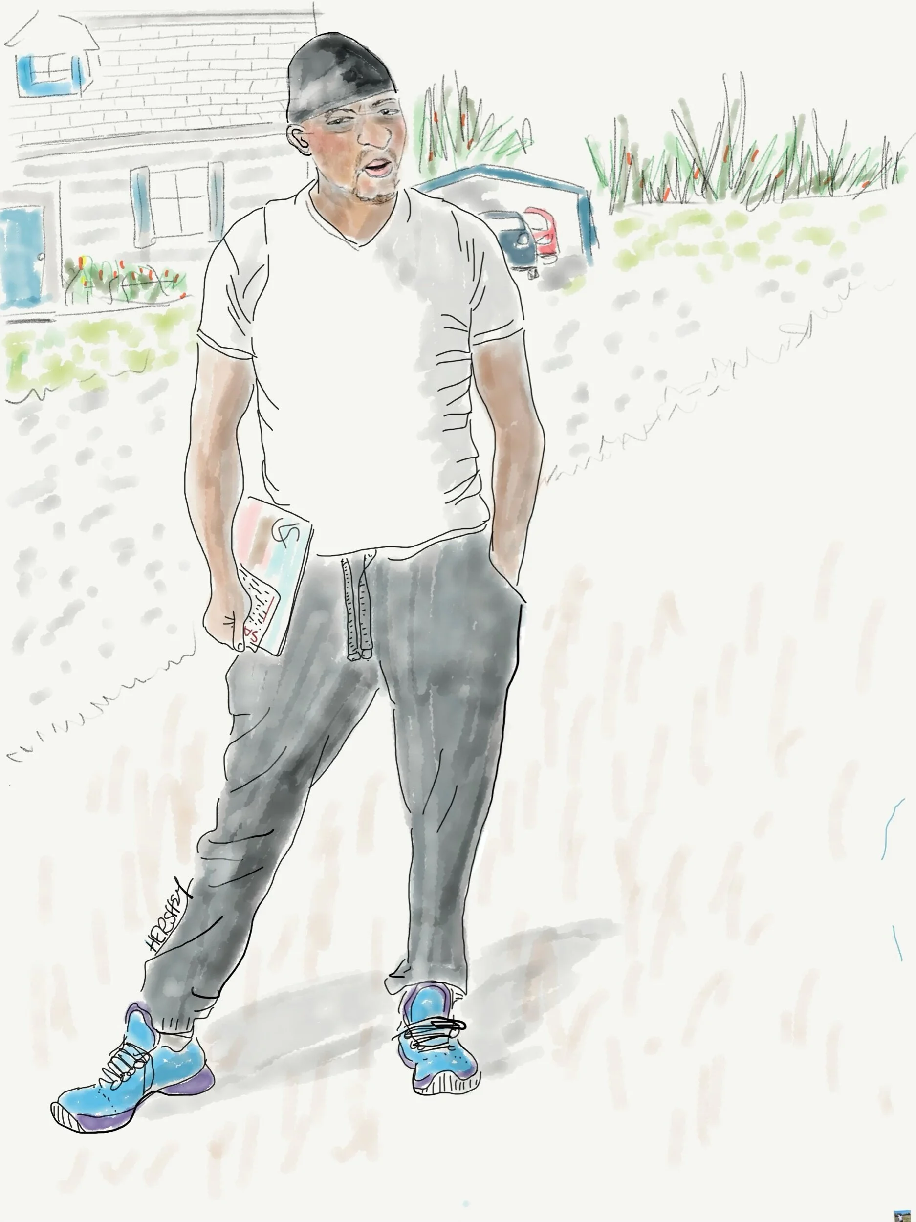
Calvin is from from Bennettsville SC. A forklift operator for Marley Engineered Products, he was given incentives and a bonus to work through the Covid pandemic. He has two kids and somehow managed to never miss a day of work, although his wife was furloughed. We met him on his way to his mailbox. He teasingly joked he was hoping for a stimulus check. …and then he said he’d been watching for it in his checking account…
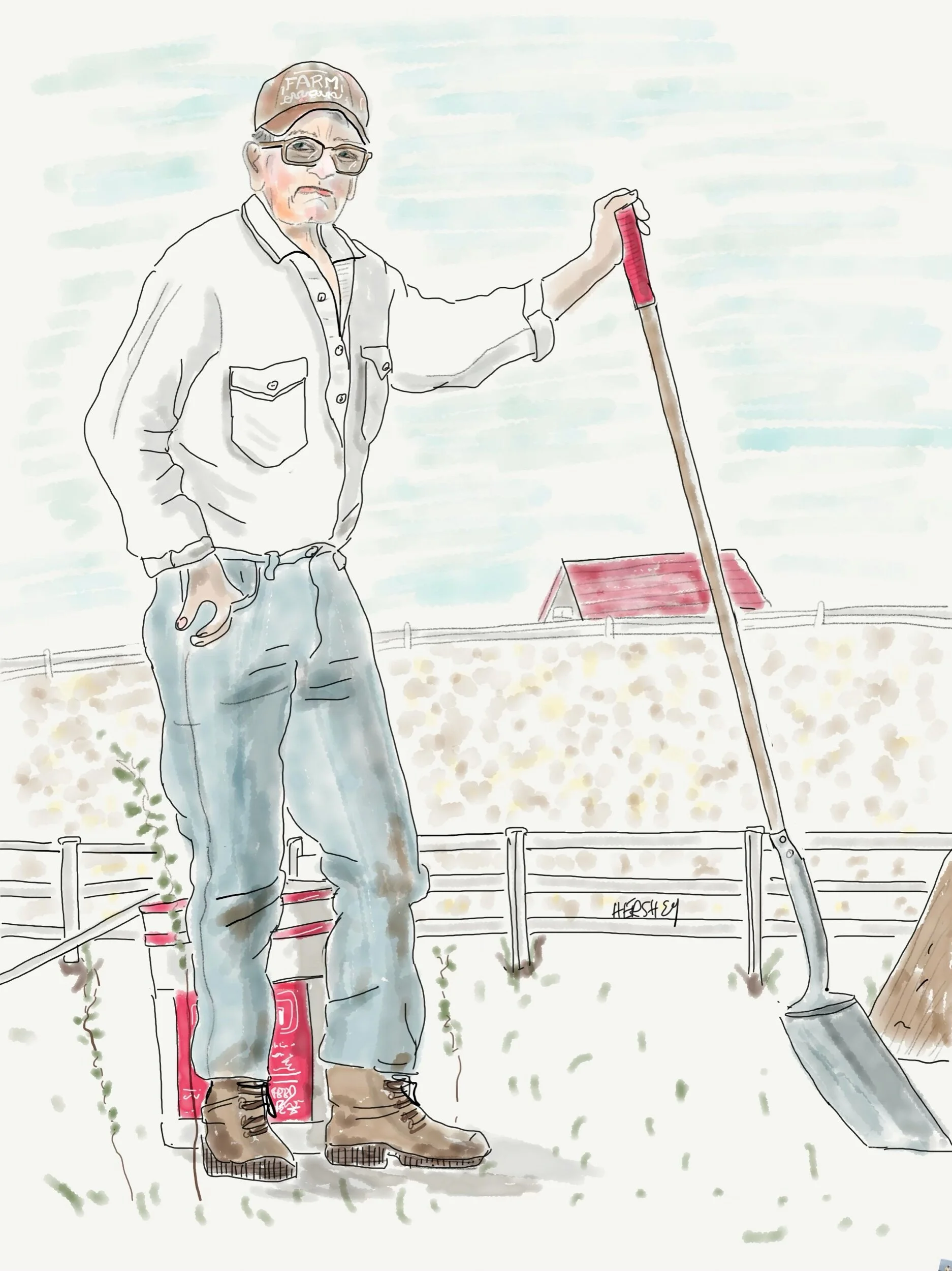
Drawing by Jennifer Hershey. Follow her work on Instagram at deeofo.
To achieve great things, two things are needed; a plan, and not quite enough time.
Leonard Bernstein
We started our latest cycling trip in Chapel Hill, where Jenny’s son Sam lives with his family. Our plan was simple enough: we would bike to Savannah and back, and then drive back to New York City in time for our second Covid vaccination shot in late March. This was our first tour since the onset of the pandemic without a car, and like many of the “best laid plans of mice and men,” it didn’t go quite as we had expected. Who would have thought that a jumble of discarded wire could work its way into a derailer and rip off a speed sensor? Yet, that’s what happened to Jenny as we turned off a rather bucolic South Carolina road onto the notorious Highway 17. Because of aging infrastructure and an abundance of coastal marshland, this is essentially the only road that connects Savannah and Charleston with the sandhills to the north. To complicate matters, route 17 is recklessly identified as a cycling route on the East Coast Greenway.
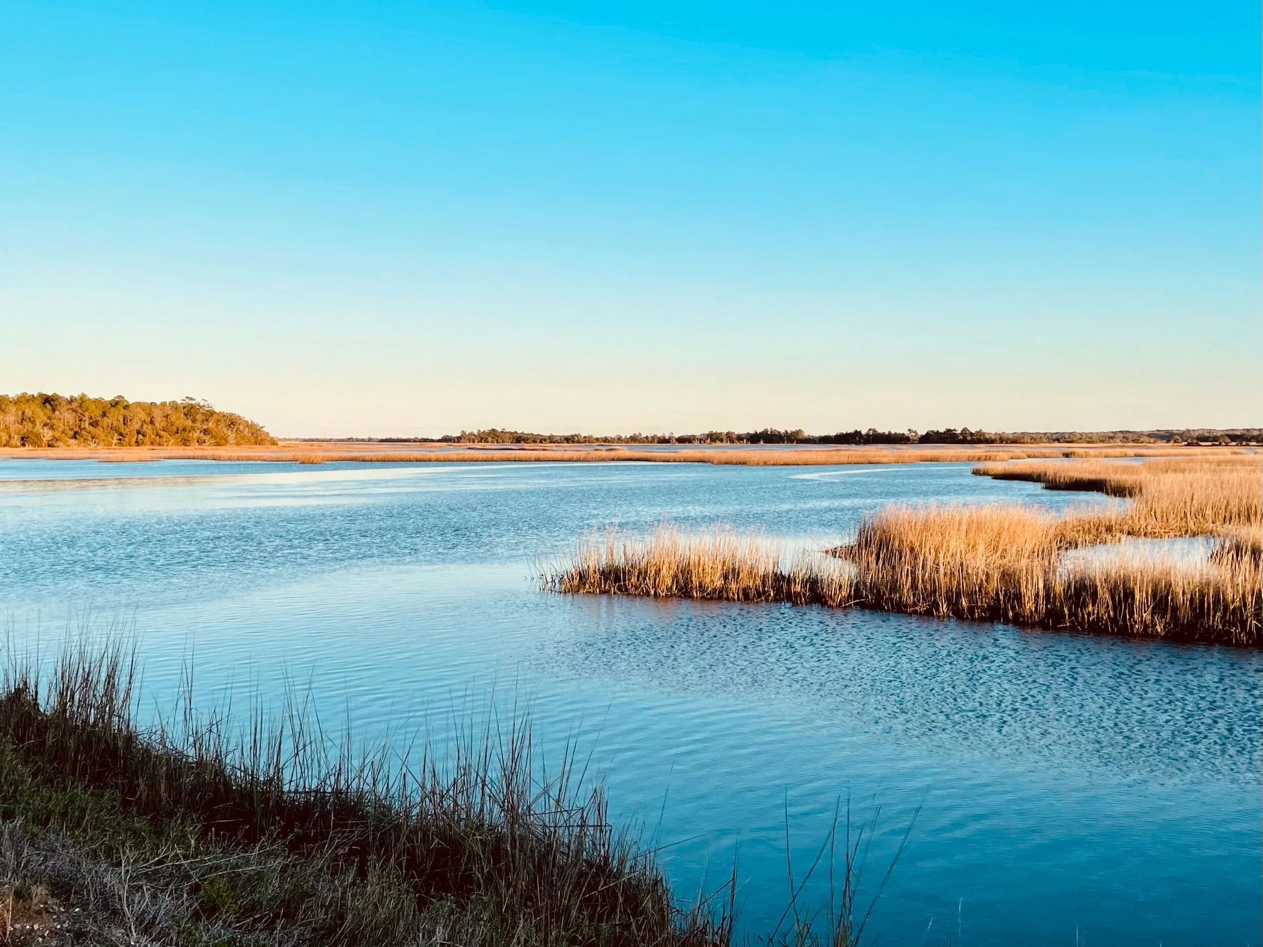
Marshland near Charleston, SC
It is also the most dangerous highway that Jenny and I have ever biked on. Where there is a shoulder (which is rare), this highly trafficked four lane highway offers cyclists lots of fast moving traffic, a customary South Carolina rumble strip, lots of loose gravel and stunningly challenging detritus. We saw the bundle of wire too late to avoid it. I went over it first, and my bike tossed the bundle into the air. Jenny swerved, but alas, it caught her rear wheel on its way down. Her bike seized immediately. Not good, but thankfully she didn’t crash.
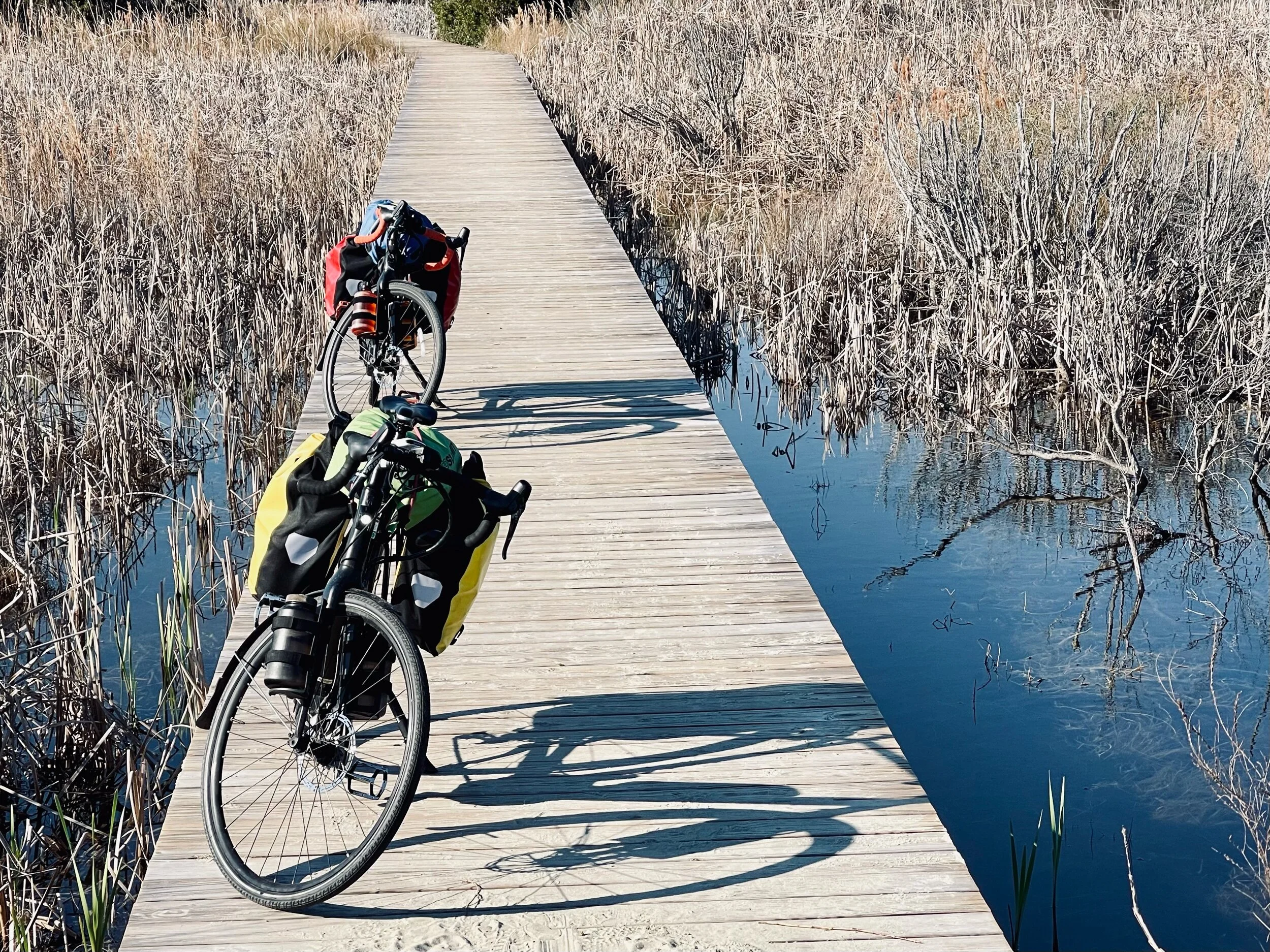
Our “fully loaded” Trek Crossrip e-bikes parked on a boardwalk near the beach on Sullivan Island in Charleston.
We both ride Trek Crossrip pedal assist e-bikes that increase our hourly touring speed by 3-5 miles/hour. This makes riding 70 miles a day on average a bit easier and faster, yet still physically challenging. But these extraordinary machines also have their downsides. After carefully disentangling and cutting out multiple strands of wire wound around the cassette, derailer, rear wheel and frame of Jenny's bike, imagine our disappointment when we discovered the wire had somehow managed to tear off the speed sensor for the small motor in her crankcase. It wasn’t the end of our trip altogether. Although we doubted we’d find a Trek dealer with such a rare part in stock, Jenny was able to nurse her bike along even though the motor would cease to work from time to time when the torque increased. This made for painful uphill cycling. We were about 400 miles from our car. Getting home on the bike would be possible, but it was going to take some fortitude.
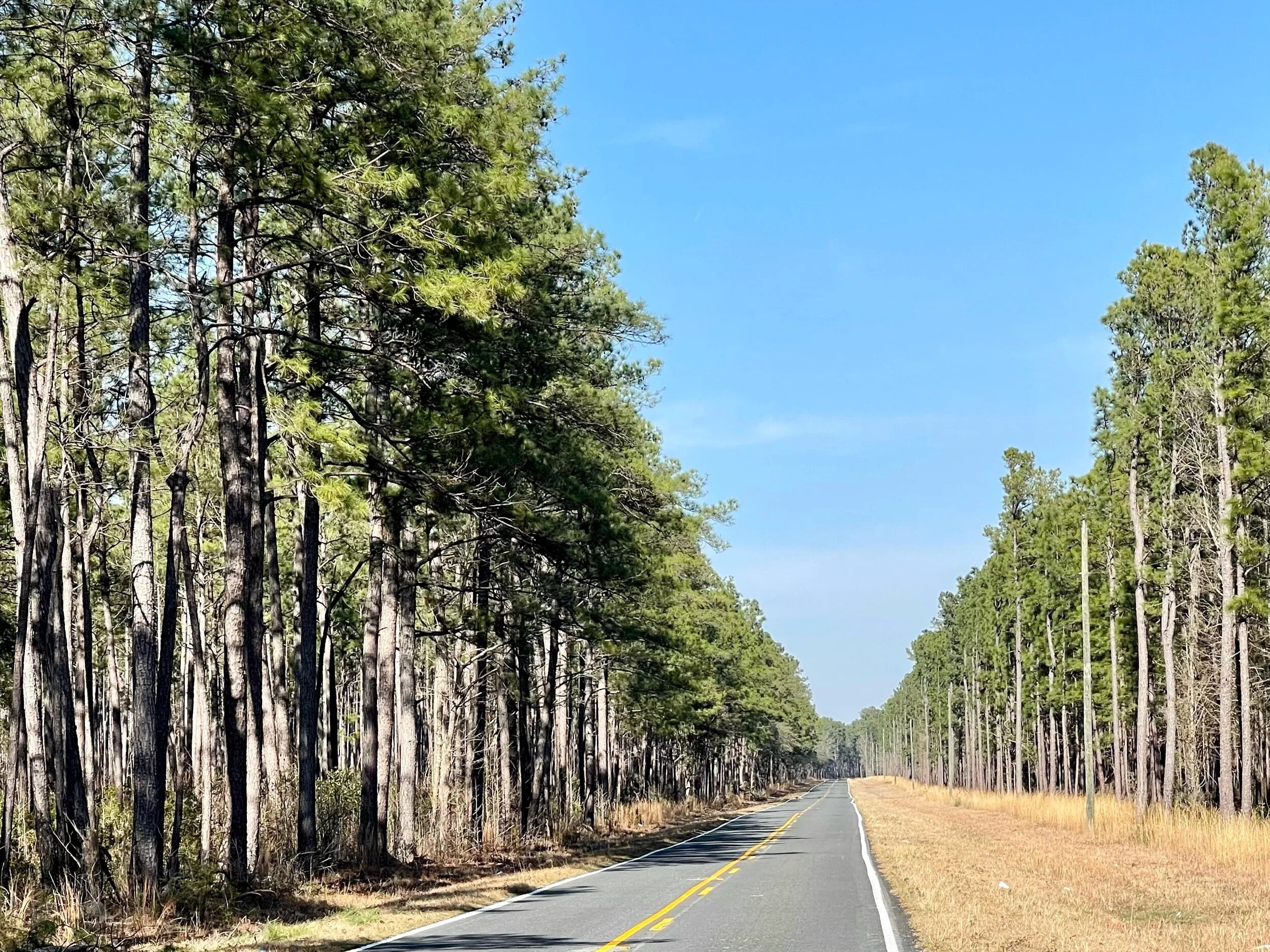
The Francis Marion National Forest on a mellow stretch of road off Route 41 north of Charleston. Formally established in the 1930’s, this forest covers approximately 259,000 acres. In 1989, the forest was nearly destroyed by Hurricane Hugo; only the young growth survived the storm and its aftermath. Today, most trees in the forest do not predate this hurricane.
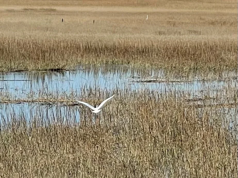
A Great Egret flying over coastal marshland on the Isle of Palm Connector near Mount Pleasant, SC, southwest of the Francis Marion National Forest.
Jenny rose to the occasion, although it took us three days to reroute ourselves through Charleston and Mount Pleasant (where we found a bike shop that, predictably, didn’t have the part we needed). Please be forewarned; if you ever visit Charleston by bike, getting into or out of that extraordinarily charming and historic city is not fun. On the upside, there is talk by state and local officials of making both Savannah and Charleston more accessible to cyclists at some point in the not too distant future through “smart growth” planning.
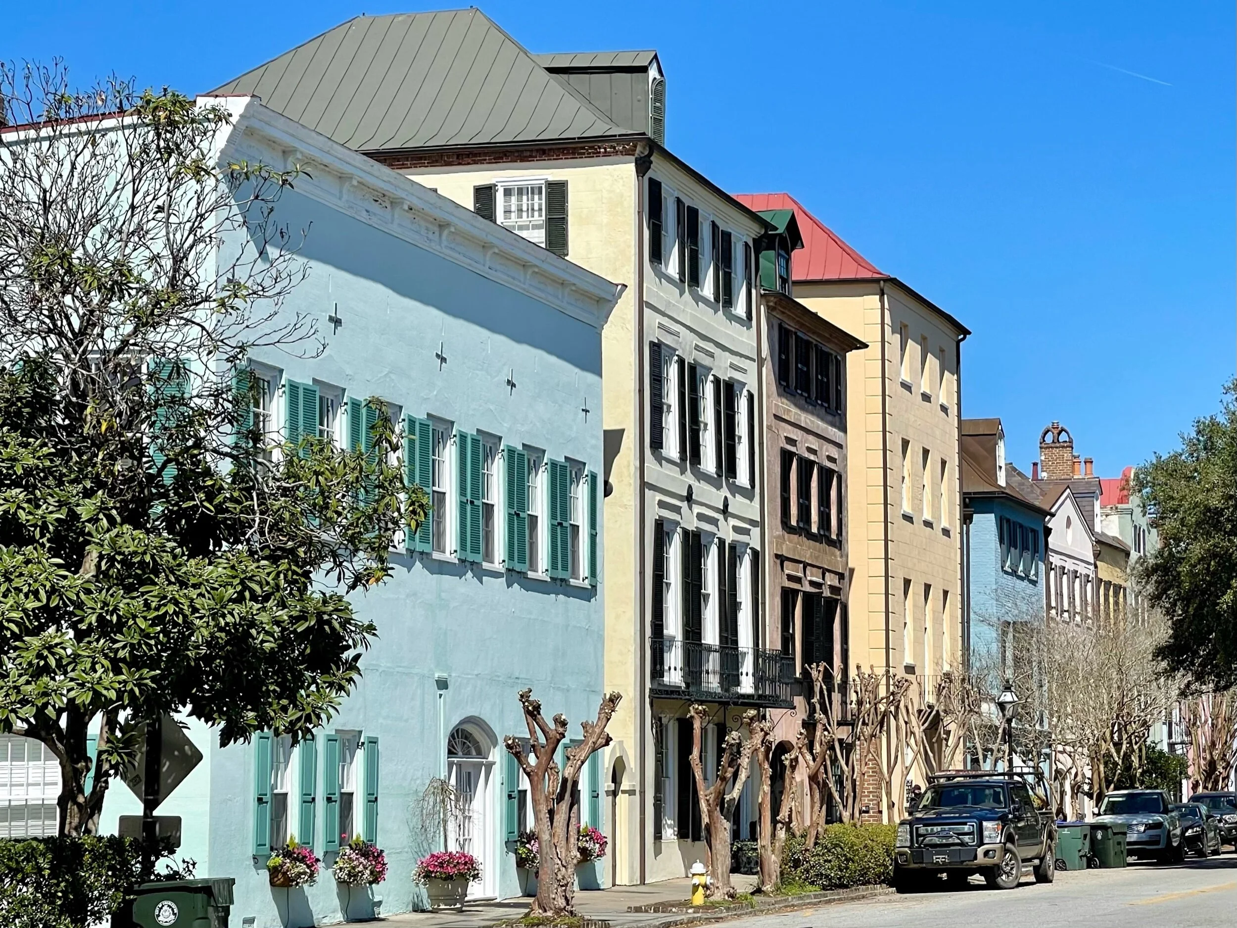
Charleston is a spectacularly attractive town, and it seemed to be gently waking from a Covid induced slumber when we passed through. There were lots of tourists wandering the streets, horse drawn carriages carrying passengers, and numerous guides talking to small groups of masked up people. We ate outside at a well known local fish restaurant, Eli Hyman’s, run by a 4th generation Jewish businessman who told us that just a few blocks away we’d find the oldest continuously used temple in the United States,
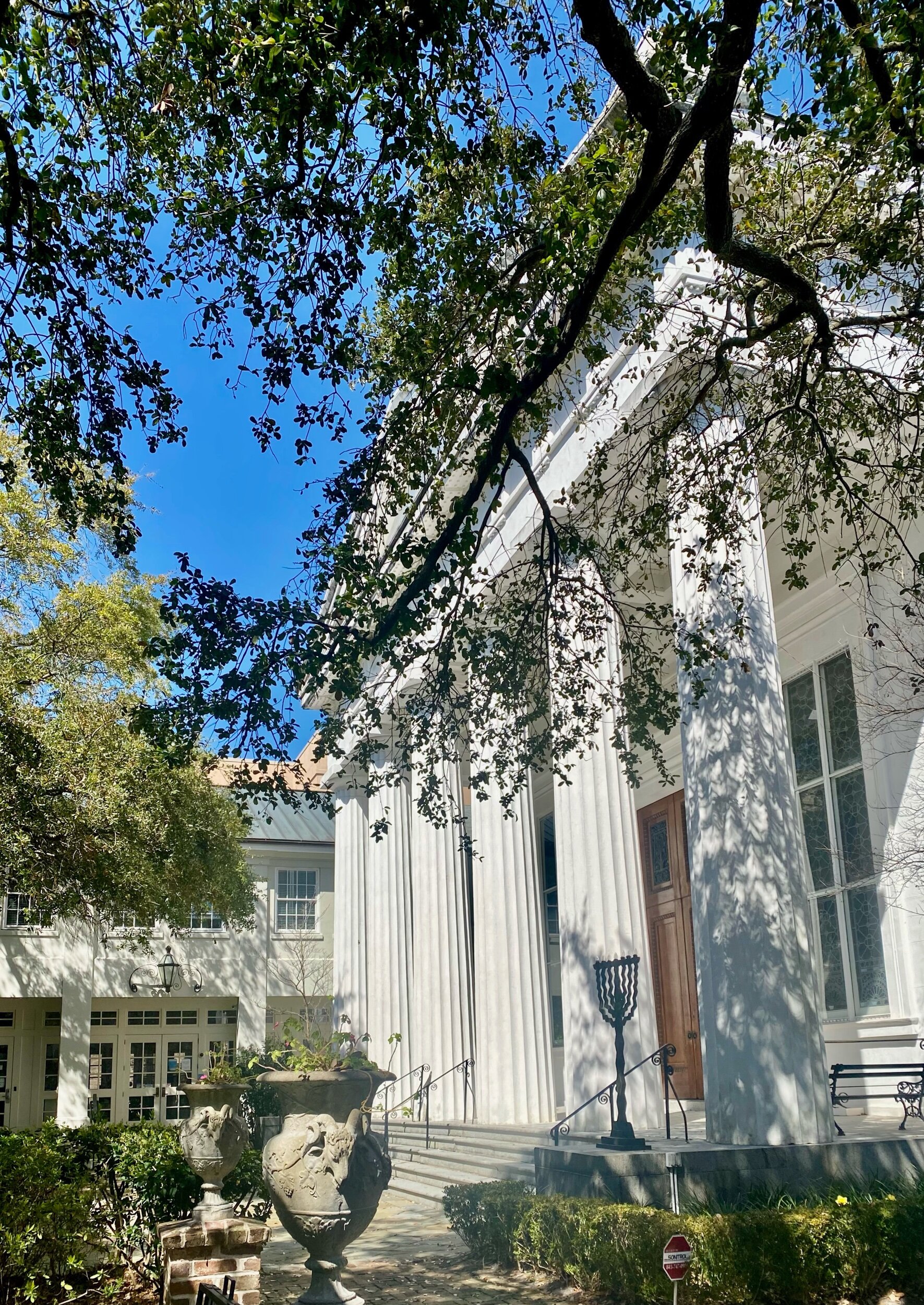
Temple Kahal Kadosh Beth Elohim in Charleston, SC. Founded in 1750, this temple is the cradle of reformed Judaism.
“Dumb growth” planning has irritated me for years. There are many roads in America where poor design fragments communities, destroys land unnecessarily, and makes walking or biking impossible. Humans have walked everywhere for thousands of years, yet in recent decades transportation planners have built many roads that can be navigated only in a functioning motorized vehicle. It's as if planners have acquired dementia about our capacity to ambulate. Where are the sidewalks or shoulders? God forbid that someone’s car should break down, and they would have to walk to the nearest gas station for help. Try ambulating by foot, in a wheelchair, or on a bike to the nearest mall next to a freeway in your community, and you’ll know what I mean. You're likely to be surprised at how terrorizing such a trip can be.
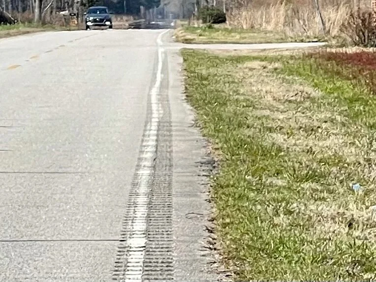
A typical road in South Carolina. While North Carolina has skinny or nonexistent shoulders, South Carolina has a terrible practice of adding rumble strips to their very narrow or nonexistent shoulders (at extra cost to taxpayers)! This might be helpful to the occasional driver, but it also forces cyclists onto very busy roads. I’d wager that for every sleepy or drunk driver whose life is saved, several cyclists are killed. This is so dangerous that the Adventure Cycling Association (ACA) runs an entire advocacy program focused solely on redesigning and/or eradicating rumble strips. You can read about it here.
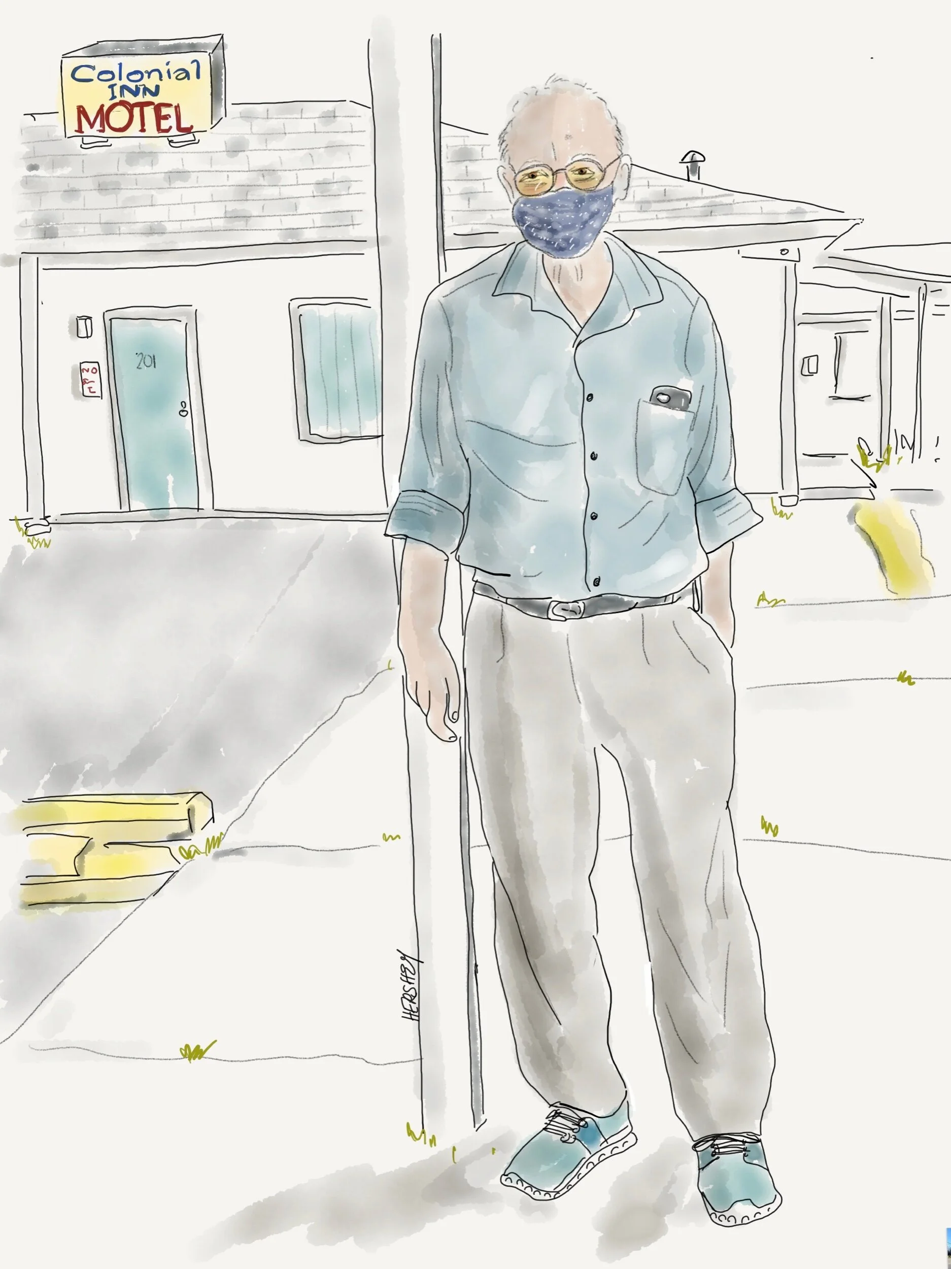
Mr Patel has owned the Colonial Inn in Andrews, SC, since he immigrated from India 41 years ago. He survived Hurricane Hugo in 1989, which devastated his town and blew off his motel sign. Mercifully, his motel was spared but his parking lot was filled with debris, including a few roofs from neighboring homes. Temporary power was restored after 4 days, and the motel prospered as it filled up with utility workers from all over the state. Currently Mr. Patel benefits when the nearby paper mill at Georgetown shuts down annually for maintenance because he houses all the workers.
Drawing by Jennifer Hershey. Follow her work on Instagram at deeofo.
In much of America, where clumps of population are mixed with cropland, pastureland and forests, it can be difficult to grasp the identity of a given “place.” That’s what Jenny and I experienced as we cycled south from Chapel Hill. After we passed a lovely (man made) reservoir on a narrow, shoulder-less, highly trafficked road and some seemingly affluent horse farms, much of the landscape became chaotic - a house here and there, a recently tilled dirt-exposed field, junked cars, abandoned appliances, a decaying shed and house, a few acres of lumpy clear-cut timber with trunks and branches strewn every which-way, a field of sod, a thin stand of trees, a gravel field of unused septic tanks, a half acre of forest, a driveway to nowhere, a parking lot, an abandoned industrial shed, a pile of tires, a Dollar General, enormous stacks of pipelines, a Family Dollar, a quaint house with a yard full of tchotchkes, a few trees, a large field revealing last year’s cotton crop.
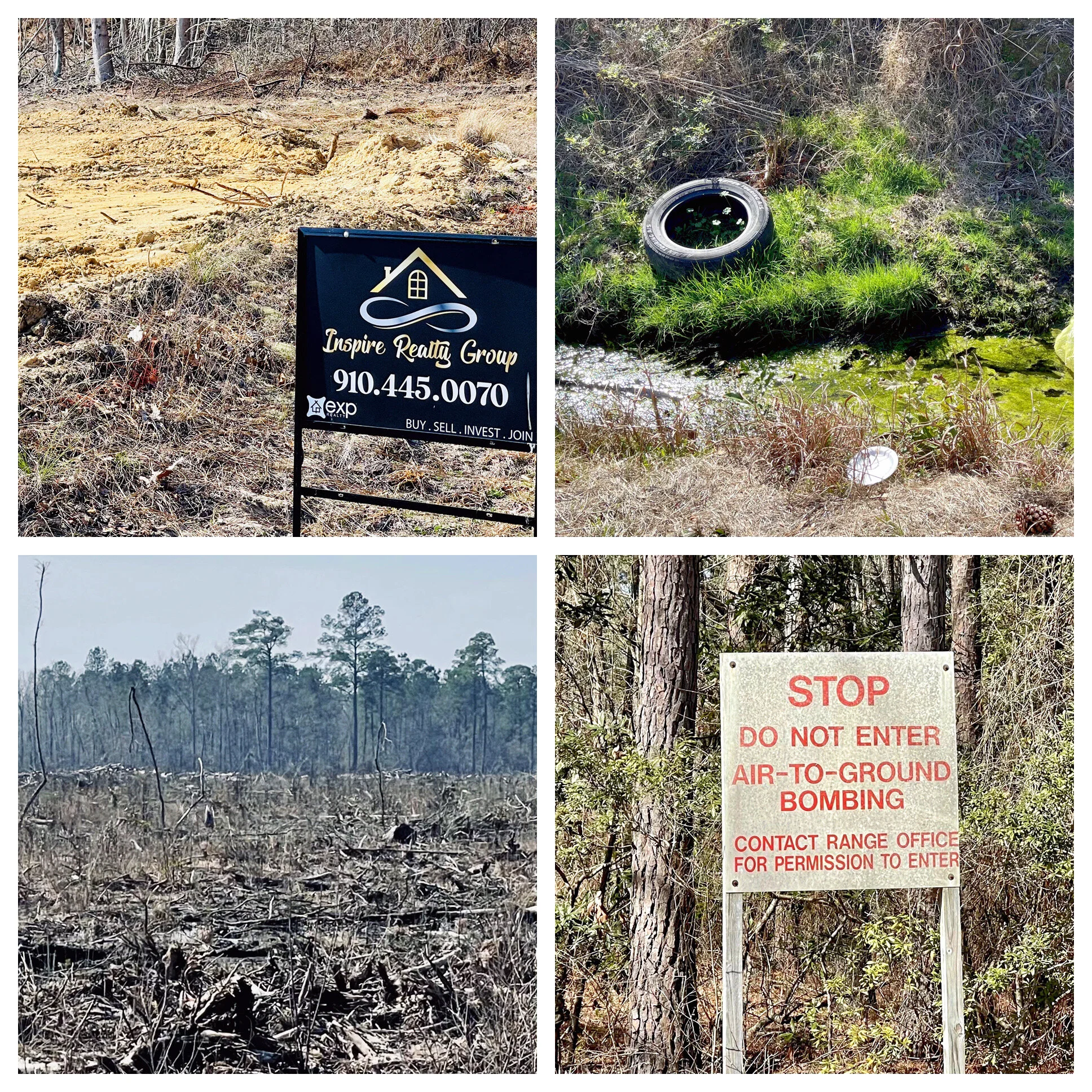
It was dizzying to take it all in, and even harder to know if there was anything at all sustainable about what we were looking at. Most likely not, we thought. And I mused on one of my obsessions - the persistent degradation of our treasured American landscape. It all seemed so ….disorganized. I really couldn’t get my mind around all that I was noticing. It was a crazy landscape, a random piecemeal (de)construction with no regard for itself. It reminded me of a frog in a slowly boiling pot who fails to notice the water is slowly heating up until it’s too late to do anything about it. There was persistent decay all around us, and no one seemed to care. But then, what do I know? As a small-city Midwesterner I can probably identify five to seven agricultural crops, and Jenny as an urbanite, even fewer. I am only now recognizing the difference between timberlands and forest. The sad fact is I know very little about rural landscapes beyond what I have come to appreciate in our magnificent national parks. But protected public land is very different from the vast stores of private land that occupies most of our landscape. And this was private land in a gentle rural landscape that had once been vast forests of Longleaf Pines nestled among swamp, marsh, bayou, streams, rivers and lakes. It is now small patches of forest, timberland, cropland and pasture, random houses and housing tracts, abandoned lots, industrial products, and an abundance of intentional and uninspired human detritus.
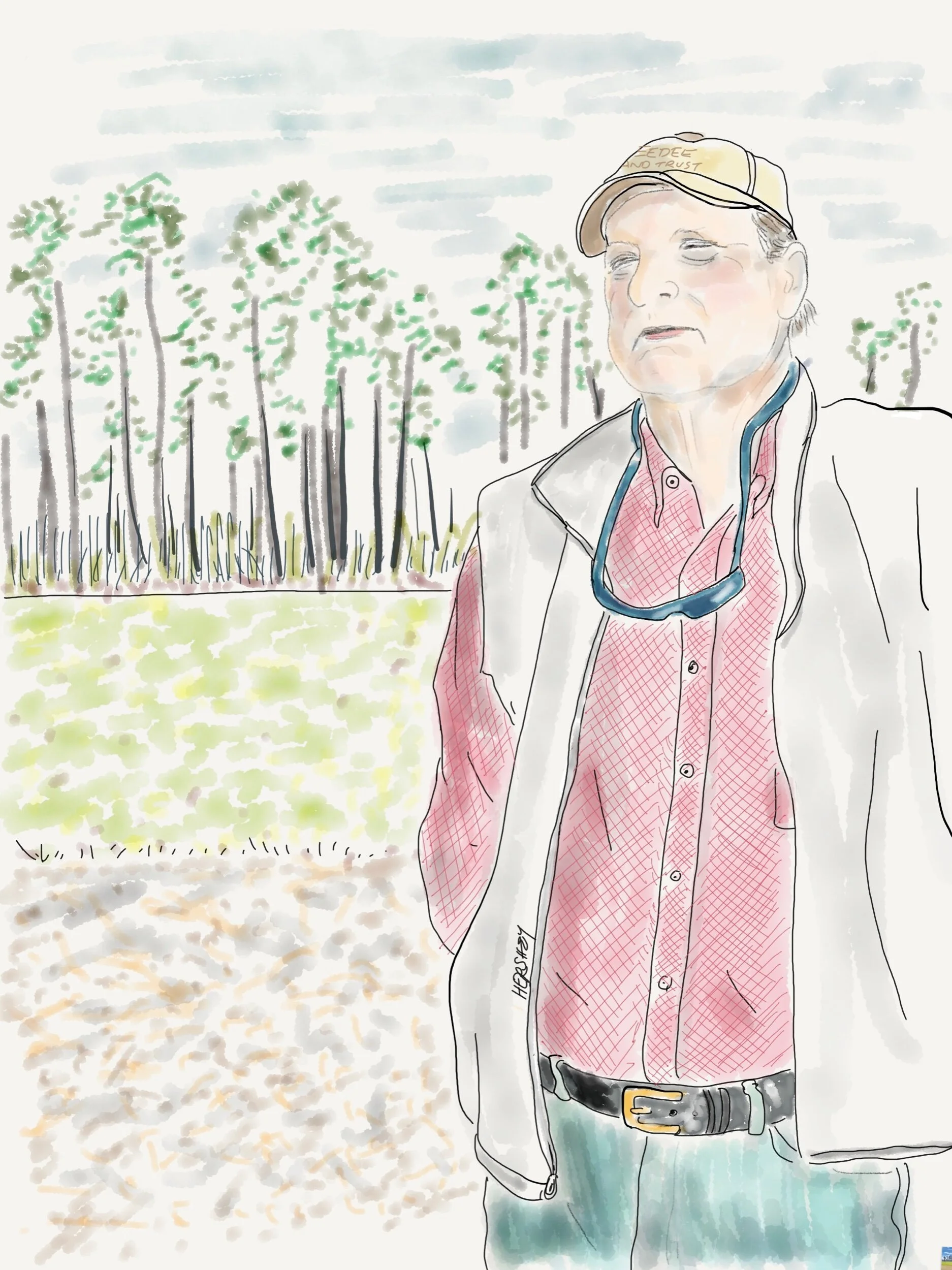
After explaining the value of winter wheat as a harvestable cover crop, the 6th generation farmer Keith Williamson tells us about the Pee Dee Land Trust (PDLT) which has partnered with private landowners throughout the Pee Dee River watershed (second in size on the eastern seaboard to the Delaware River watershed) to permanently protect over 32,000 acres of land. Over 80% of conservation easements held by PDLT are working farms and forests clustered mainly along waterways.
Did you know there are approximately 5 times more farmers over 65 years of age than there are farmers under 35?
Drawing by Jennifer Hershey. Follow her work on Instagram at deeofo.
Talking to Keith made our day. We saw him standing next to his car looking over a field that we had just been wondering about, so we pulled off on the grass (because there was no shoulder on the road) on the opposite side of the road, and yelled in our nasalized New York City and Midwest accents to get his attention. Keith didn’t seem the least bit phased by the bikes, or our car dodging as we crossed the busy road on foot all the while peppering him with questions. He patiently answered us in his gentle South Carolina drawl that we were looking at winter wheat, a cover crop on a field that would be soybeans in a few months. “It’s a complimentary process. The wheat takes up the nitrogen the soy puts down,” he explained. Legumes add nitrous oxide to the soil, which then enters the atmosphere through erosion or when the field is tilled. We learned later that nitrogen is a potent greenhouse gas, so using cover a crop like winter wheat to reduce nitrogen levels has a beneficial impact on climate change, as well as helping soil health. As we talked more, we learned about the Pee Dee Land Trust, which helped Keith and other members of his family to protect 3,000 acres of family land.
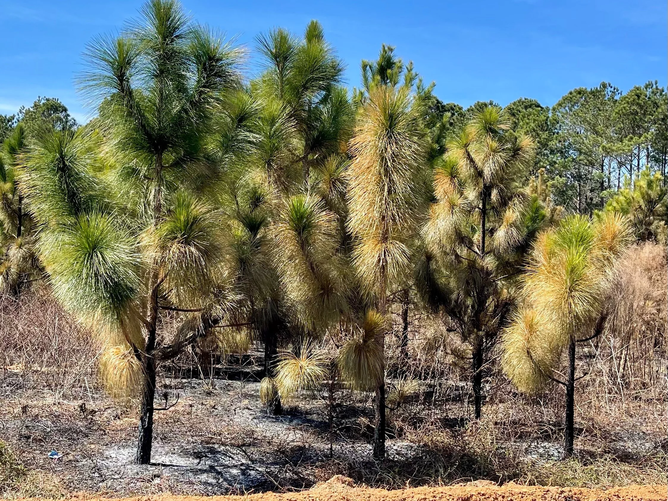
At one time most of the southeast was covered in Longleaf Pine forest. Naturally fire resistant, these superb trees would grow quite tall and create savanna-like conditions underneath, which would be routinely burned off, either by natural causes or intentionally by indigenous people. Now burning is almost always intentional. This relatively young forest was recently burned off.
Land trusts are an important tool for protecting land from development, preserving it for valuable forests, timberland and agricultural uses that encourages smart rural growth, improves water quality and ensures natural carbon storage and sequestration. For example, forests alone in the US store 59 billion metric tons of carbon in trees, roots, soils and forest products, and sequester 14% of the country's CO2 emissions. Agricultural crops are not quite as storage intensive due to their shorter life cycles, but their carbon storage and sequestration properties can be significant.
Land is typically conserved by outright purchase into a trust, or less expensively, by “conservation easement,” a deeded agreement with a Land Trust by the owner to protect a property. Conservation easements are irrevocable and apply to the present and all future owners of the land. As with other real property interests, a conservation easement is recorded in local land records and becomes a part of the chain of title for the property, permanently protecting the land from development.
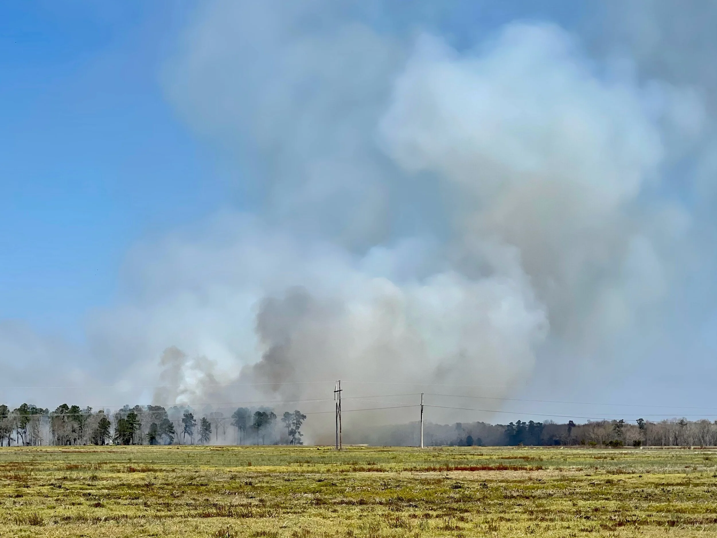
An intentional burn off seen at a distance.
Because approximately 9000 acres a day of farmland and forests in the US are lost to commercial and residential developers, land trust programs provide enormous public benefits. Conservation easements alone already protect an estimated 50 million acres of natural habitat in this country, and each year another 2 million acres are added to that total. Since 1982, the US has lost over 25 million acres of agricultural land to development, while global population and carbon emission levels have almost doubled. I couldn’t find a figure for how much farmland we have left in the US (I’m sure the USDA knows), but I did learn we currently have about 450 million acres of forestland in the US under threat of development, which is about 60% of our remaining forests. According to a study cited by the American Farmland Trust, land that is converted to other uses from its natural habitat (including agricultural land) emits greenhouse gas emissions at rates 50-70 times greater than had it remained undeveloped. Preserving our land is essential if we are going to reach net zero by 2050.
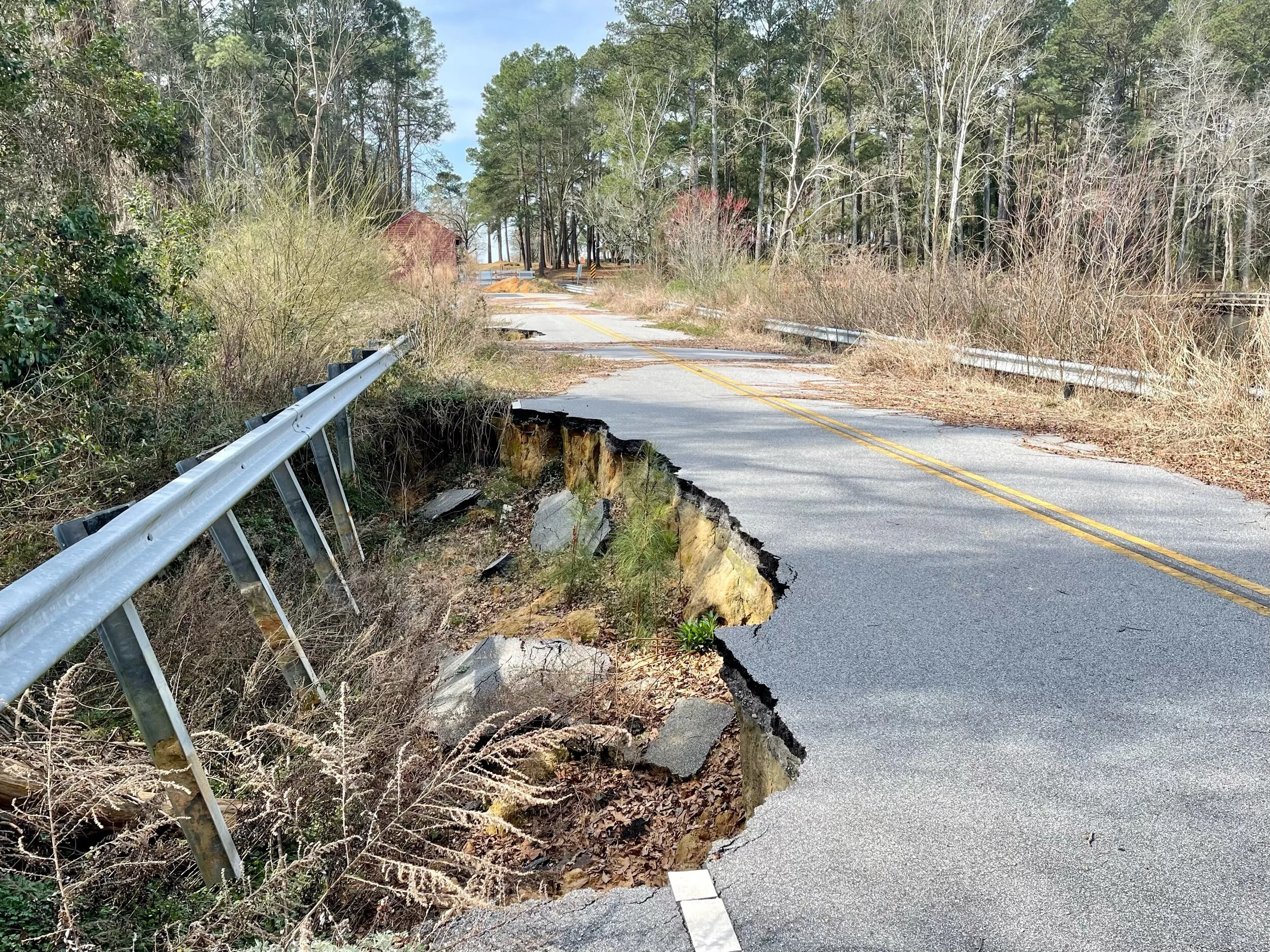
Flood damage on a road near McColl, SC
This protection doesn't come without a price tag, however. Easements are incentivized through tax credits or property tax reductions, so taxpayers effectively pay private citizens not to sell their land to developers at a higher price in order to benefit the greater good. (Frankly, that strikes me as analogous to the failure of capitalism to externalize the social costs of carbon pollution, but that’s a subject for another blog post.)
Yet, the effort is essential. Soil stores two to three times more carbon than the atmosphere and up to four times the amount of carbon stored in the vegetation on land. Since the advent of modern agriculture (till and fertilize; wash, rinse and repeat) soil health has degraded considerably and we have lost much of our topsoil to erosion, including more than half of the organic carbon originally stored in US soils. With nearly 400 million acres of cropland alone, we have an enormous opportunity to use “regenerative” farming methods to rebuild organic carbon in our soil, sequester atmospheric carbon and reduce greenhouse gas emissions. However, soils need healthy plant life on them to be able to accomplish this. How we manage carbon stocks on our land - whether it’s forest, timberland, cropland or pastureland - will have a significant impact on climate change over the coming decades. Climate activists, policy makers, and most importantly farmers, need to understand that how we use our land (and in particular, how we grow our food), are every bit as important to our collective efforts to decarbonize as transforming our energy system.
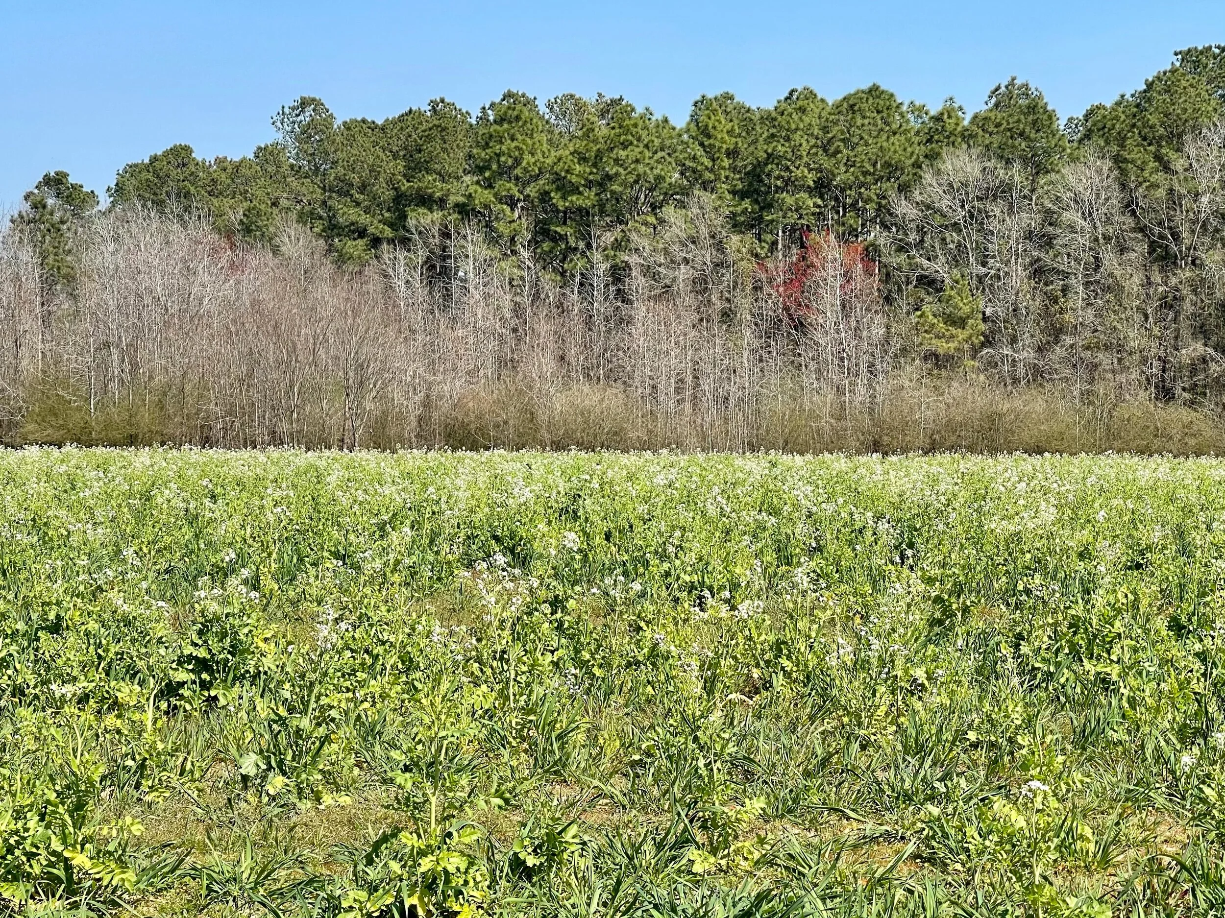
A field of turnip, another popular cover crop in regenerative agriculture.
Rural communities face a host of challenges - including changing demographics, lack of economic growth, community health and preservation, and a strong need for environmental protection. In addition, rural communities need workforce development, access to broadband, and effective transportation in their planning efforts. Smart growth strategies can help communities guide development while protecting working lands and preserving rural character. There are an increasing number of great organizations and online mapping tools for learning more about these topics. I list some of them below, especially those that I used to prepare this blog.
Lucky, a 74 year old ex jockey from Virginia, runs a 16 acre horse boarding farm in North Carolina. He believes everyone can find a job doing something even if they don't like it, and he doesn’t like the Covid stimulus package. He earned his way up “galloping” horses (Secretariat was his most famous) when he was young. He got paid $3.00 a run. He laughed as we biked away, just after we encouraged him to get a Covid vaccine. We gathered he wasn't interested.
Drawing by Jennifer Hershey. Follow her work on Instagram at deeofo.
And finally, the Biden administration’s recently-announced plan to address climate change, which includes provisions to conserve 30 percent of U.S. land and waters by the year 2030, is definitely worth attention.
Stay vigilant! Thanks for reading. More to come. Follow our next biking trip from central Wisconsin into the Dakotas this coming May, 2021.
All photos, unless credited or otherwise noted, are copyrighted property of the blog post author.