
Louisiana/Texas, Post 4
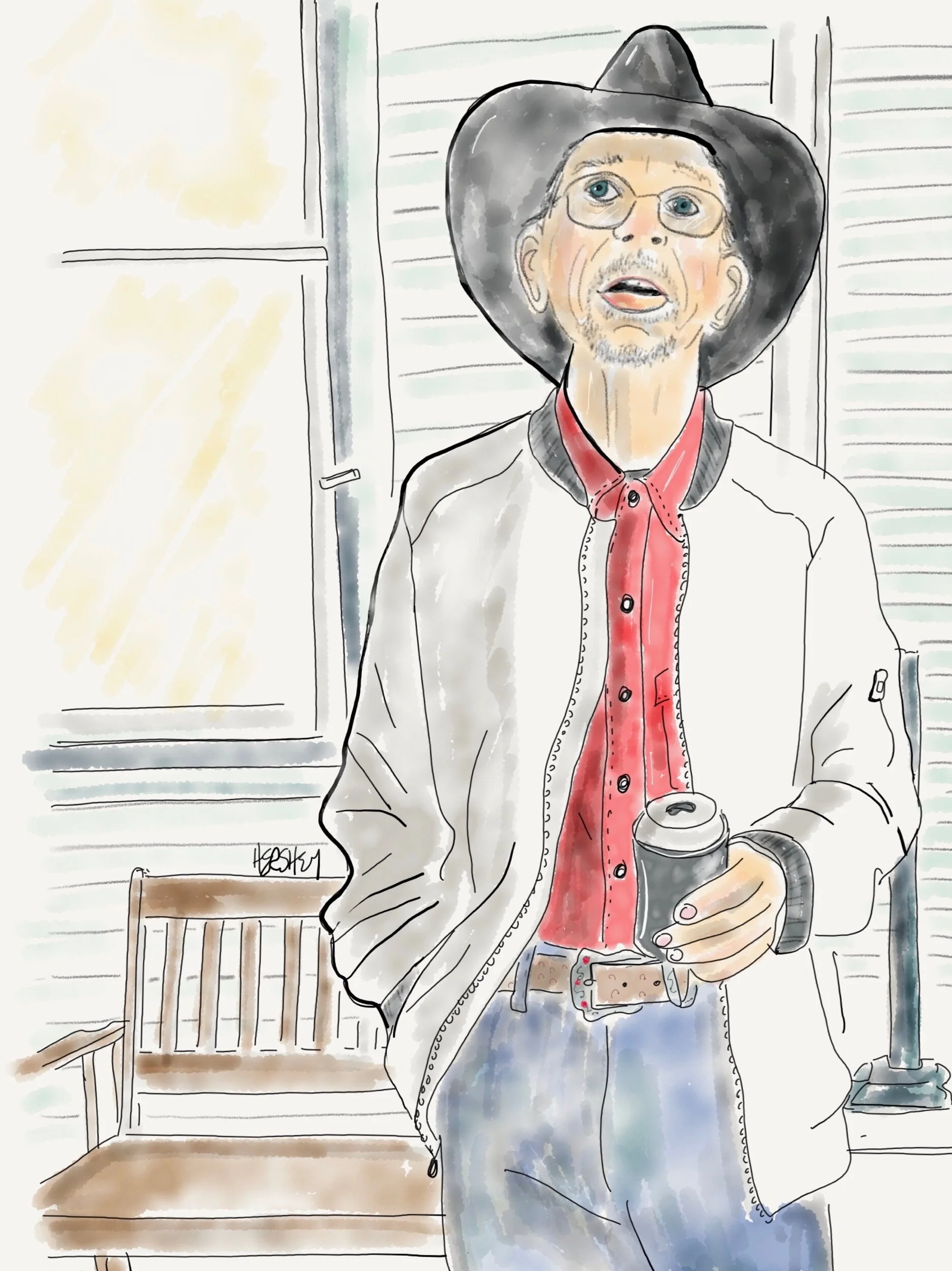
“I work up at United Ag in El Campo. I live at this hotel. Spend Sundays off in Bay City.” Drawing by Jennifer Hershey. Follow her work on Instagram at deeofo.
“Don’t go around saying the world owes you a living. The world owes you nothing. It was here first.” — Mark Twain
Most everywhere we’ve been in Louisiana and Texas, we’ve encountered people who believe deeply in the concept of hard work. I don't know if the importance of work is stronger in the south than elsewhere (it’s hard to imagine a more frenetic work environment than New York City), but its virtue came up repeatedly in our conversations with locals. Often the merits of working seem linked to another highly prized value in these parts - self-reliance - the pathway to the most exalted of American values, our freedom.
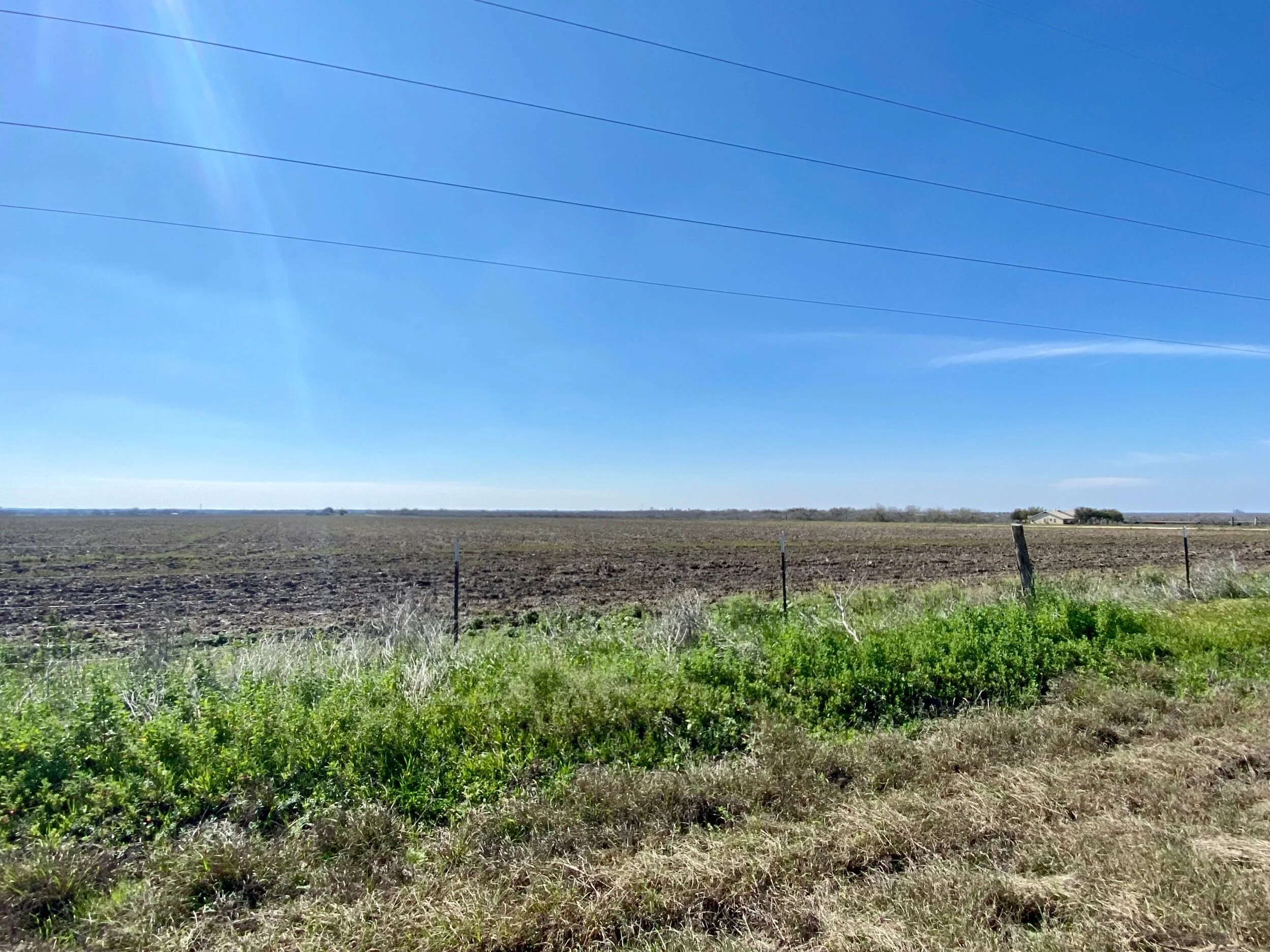
Big sky country in Texas between Corpus Christi and San Antonio.
One of our first conversations with a local in Louisiana centered around the concept of a strong “work ethic.” The man we were speaking to was a small businessman and boss of six employees. His perspective made a lot of sense. What boss wouldn't want productive workers? He went on to explain he wasn’t a fan of freeloaders - people too lazy to work, who wanted a handout from the government. I’m sure he’d fired his share of poor workers, but when it came to individuals wanting handouts, it seemed more like he was talking about an idea of what people are like than a reality. Maybe others know people who don’t seek the meaning that work brings us (even when they are unemployed or underemployed), but I do not. I can’t help but wonder if that experience is a reflection of my own cultural viewpoint, or an indication of a lack of exposure to reality seen through a cultural and political naivety.
One thing is certain to me: it is fundamentally human to seek meaningful activity. We all must live. And even in an age of extraordinary inequalities in wealth and income, the majority of us still must - and want to - work. So while there may be poor workers, are there really folks out there who think they deserve something for nothing?
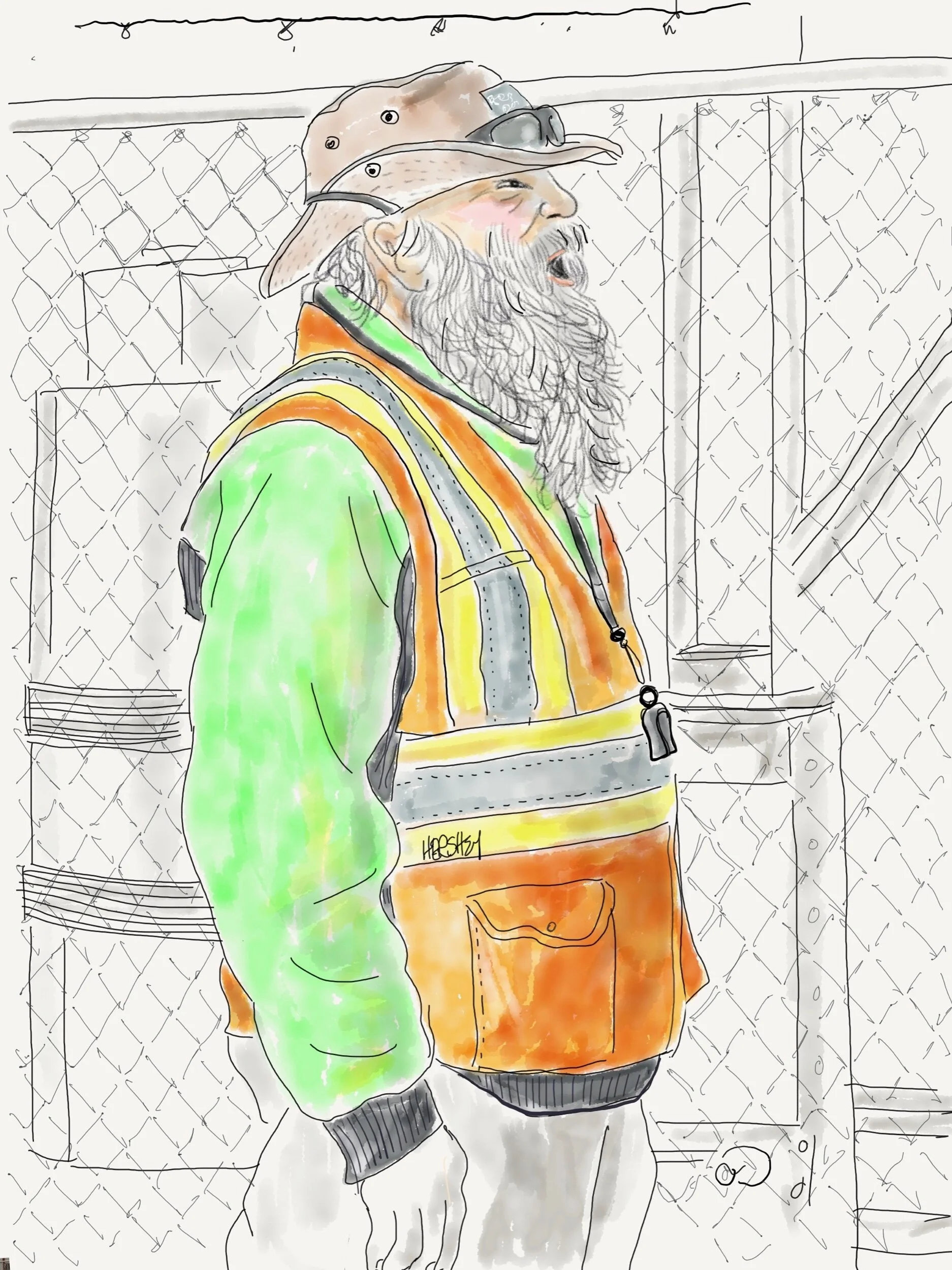
“We don’t get many bikes down here— just make sure you walk ‘em onto the ferry”! Drawing by Jennifer Hershey. Follow her work on Instagram at deeofo.
Although southwest Louisiana and southeast Texas are equally flat, the land between Corpus Christi and San Antonio seems especially vast. Perhaps it’s the steady 150 mile rise from the coast to San Antonio (which is 650 feet above sea level). Or perhaps it’s the unrelenting expanse of open, uninterrupted fields. Perhaps it’s the long, straight roads. Whatever the reason, it's BIG.
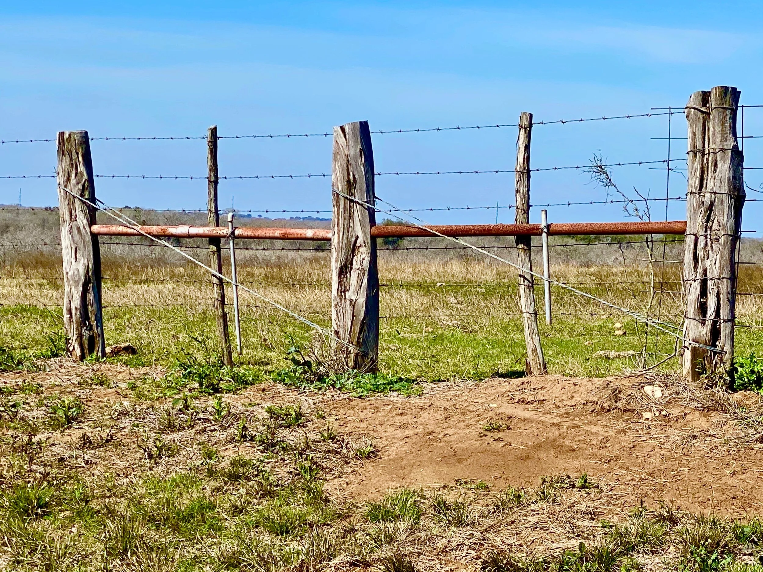
Taken on Texas State Highway 181 between Corpus Christi and San Antonio. Prior to the invention of barbed wire in the 1870’s, fences couldn't reliably contain cattle.
At the same time, both the land and people between Corpus Christi and San Antonio are hardscrabble. Pickups are normal, sedans are unusual. Regular folks are used to fishing and hunting. Although they don’t rely on their catches to stay alive, fish and animal wildlife seem to be part of the rural Texan diet, at least among the people we talked to. And the land is used in every way possible; for agriculture, farming, fishing, hunting, wind power, oil and gas extraction, compression stations, pipelines, home building, junkyards, storage sheds, telephone poles, auto graveyards, human graveyards… The Texas countryside is a hodgepodge of so many competing uses I often found it as overstimulating and confusing as a Wal-Mart Megastore.
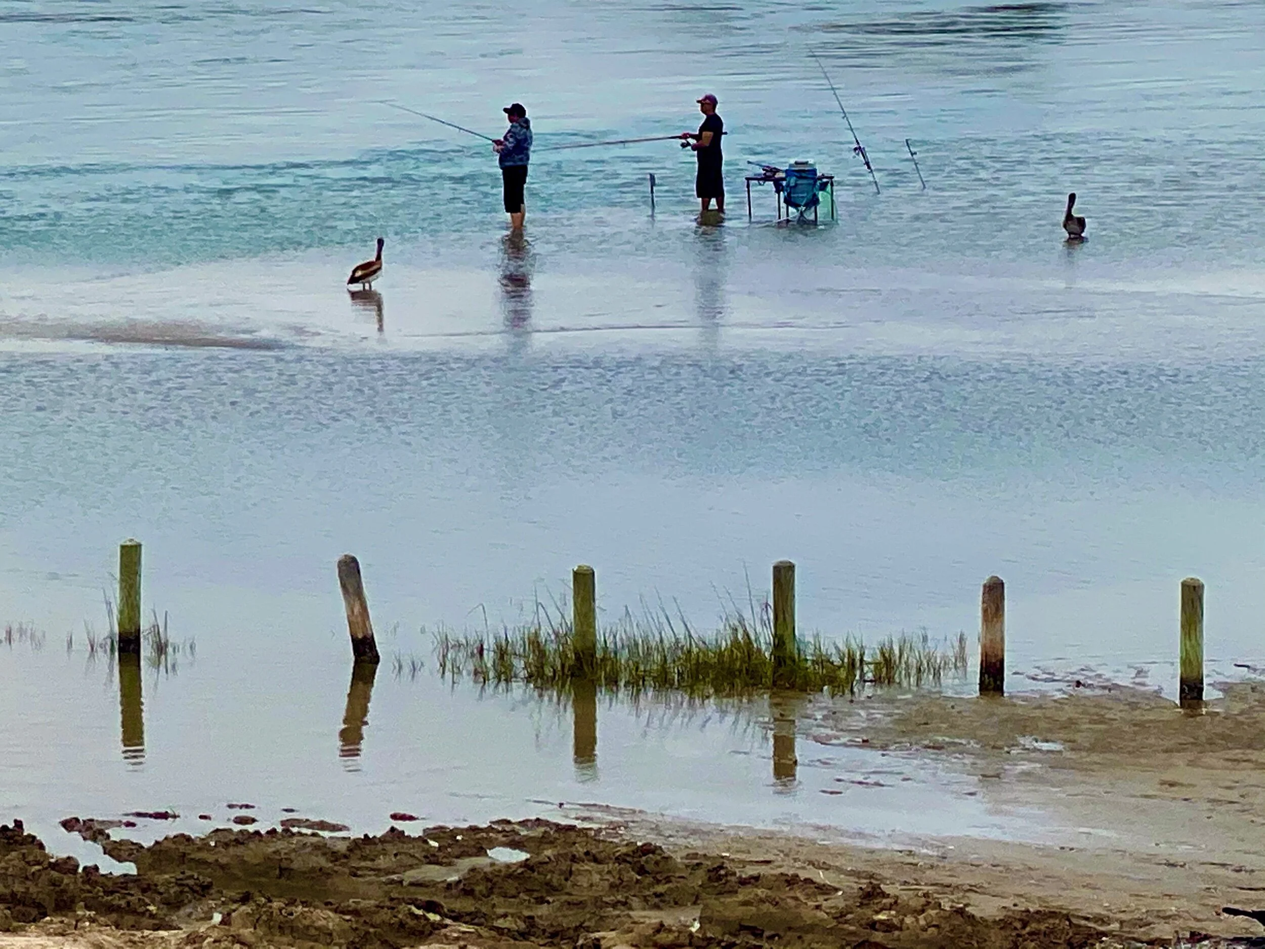
Texans fishing off the causeway between Aransas and Port Aransas, Texas. The birds nearby are Pelicans.
There's also a lot of workers. A surprising number of people work for wind farms and quite a few work in agriculture, but most of the people we met work for oil and gas or petrochemical companies. And there are a lot of companies. Thirty one new petrochemical plants have been approved for construction or reconstruction in hurricane prone areas on, or near, the Louisiana and Texas coasts since 2016. In our last post, we wrote about two large LNG exporting plants under construction in Cameron, Louisiana and nearby Port Arthur, Texas. These are among those 31 new plants.
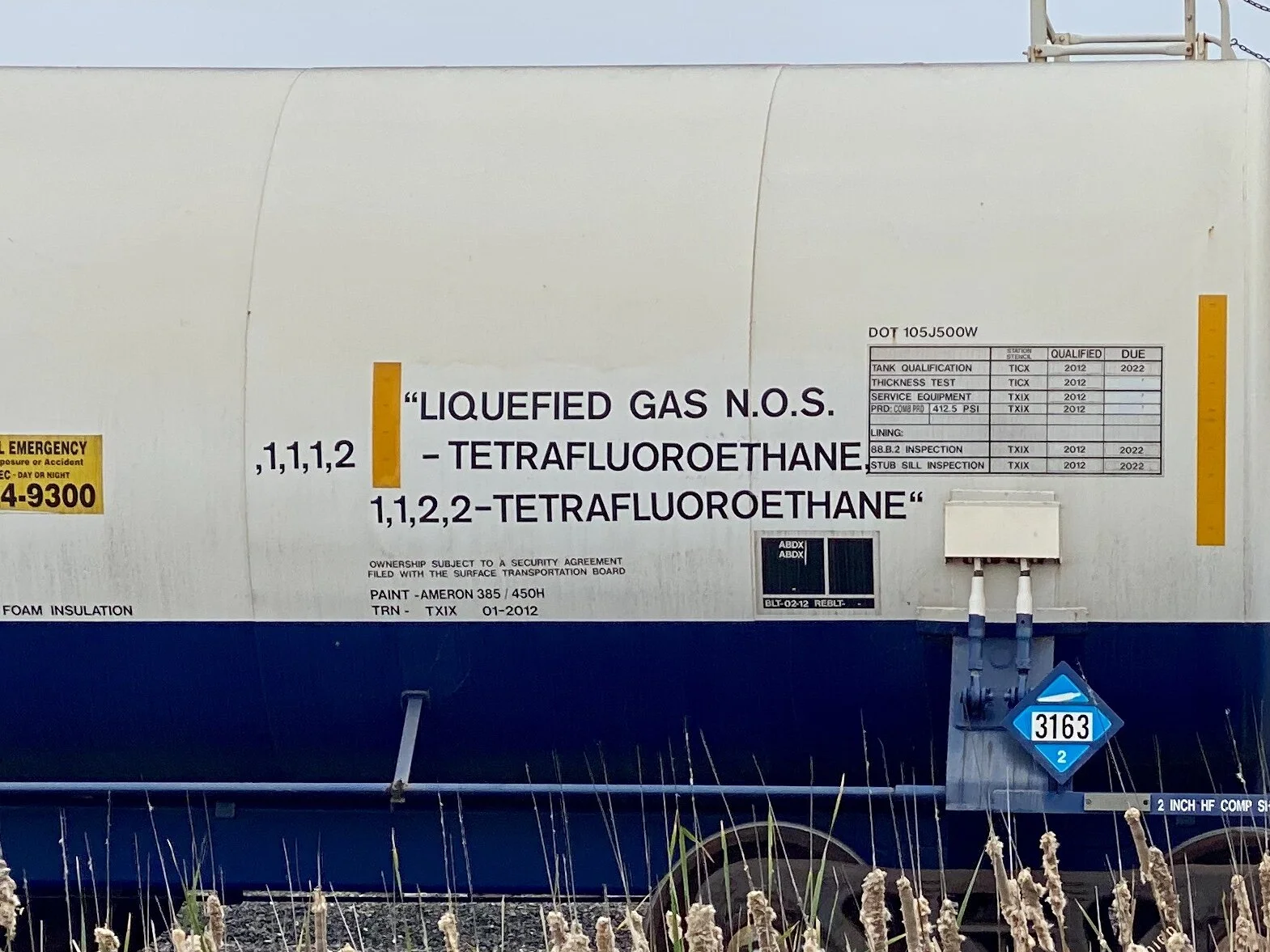
One of hundreds of refrigerant tank cars lined up near the Occidental Petroleum, Chemours, and Nashtec Plants at Gregory and Ingleside, Texas, not far from the Gulf Coast on the way inland to Beeville, Texas.
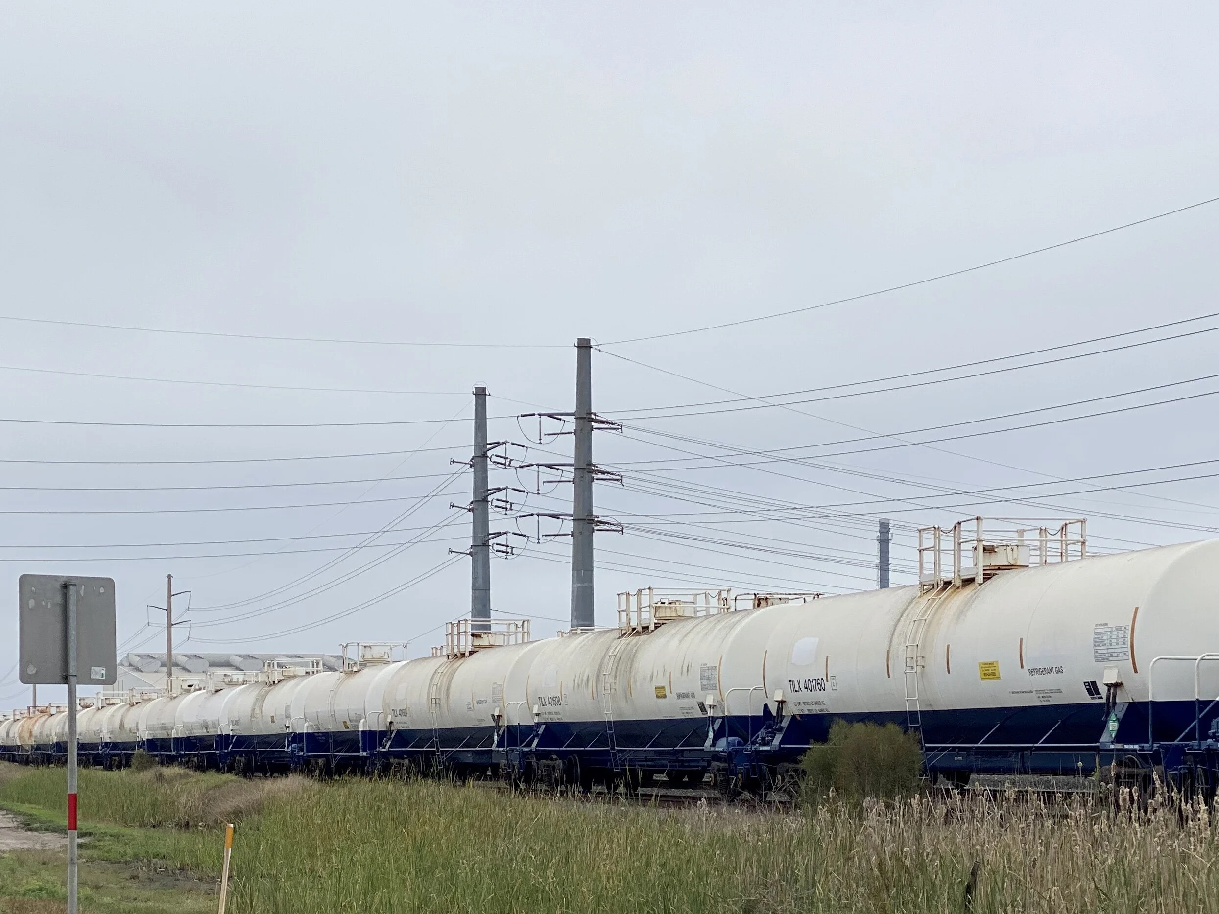
Tetrafluorethane is regarded as a “sustainable” refrigerant because it has lower carbon emissions than previous versions, and a minimal impact on ozone.
As much as we were profoundly charmed and cheered by the warmth of the people we met, the omnipresence of these facilities contributed to our uneasiness. In the face of climate change, does this boom really make sense? There’s something profoundly unsettling about the trend. I’m not so sure the locals feel any different. In Texas, even cognitive dissonance is BIG.
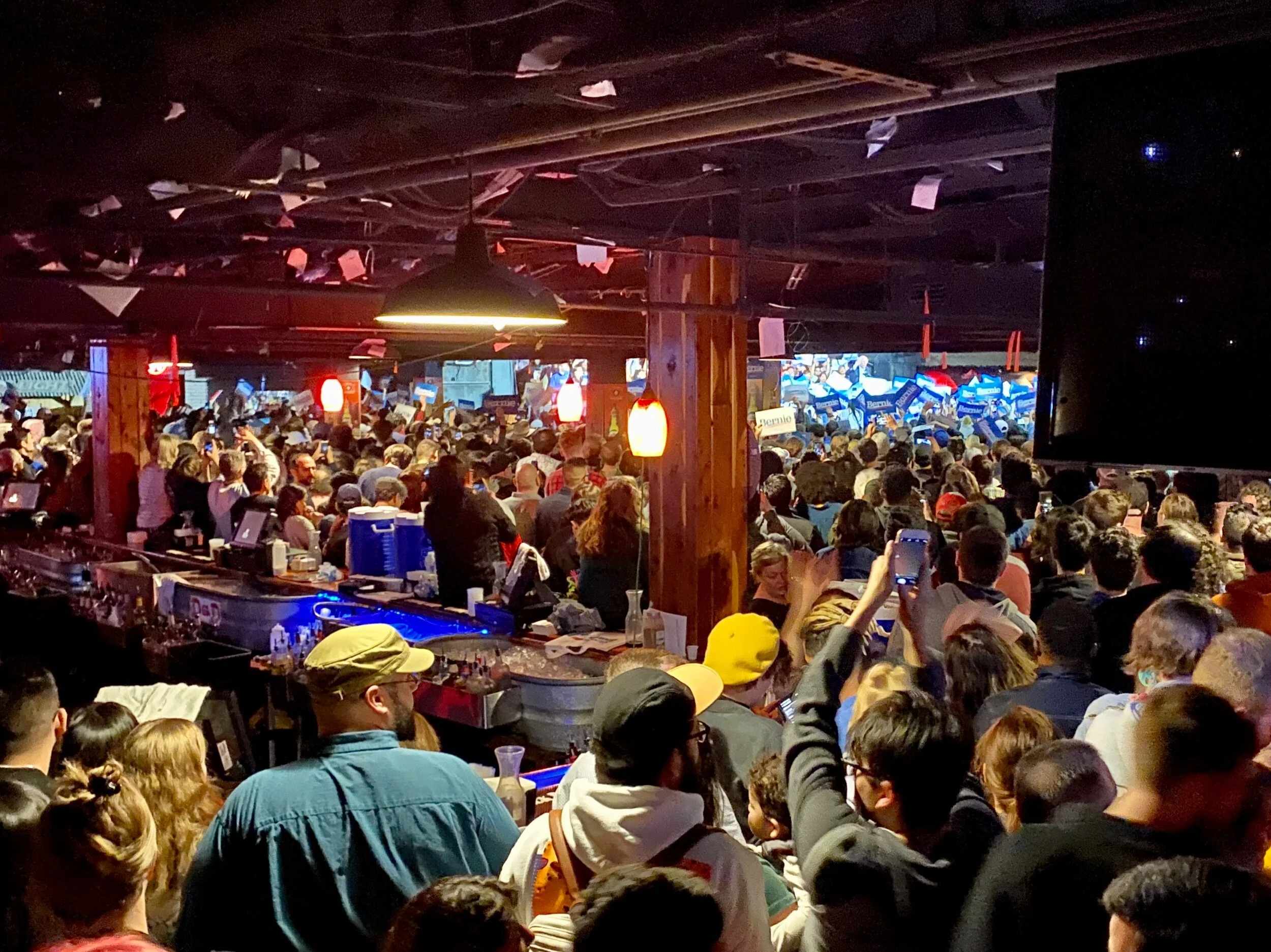
Interestingly, Jenny and I arrived in San Antonio on the night of the Nevada Democratic caucus, and we had the opportunity to drop into the famed Cowboy Dance Hall to catch a raucous, youthful and well-supported Bernie Sanders rally. Just for the record, we both appreciate Bernie’s concerns about climate change, but worry he is over-focused on what we need to achieve and under-focused on how to do it without causing a destructive backlash.
Northerners may not be aware that Texas is the leading U.S. producer of both crude oil and natural gas. In 2017, the state accounted for 37% of the nation's crude oil production and 24% of its marketed natural gas production. NPR.org reports that Texas currently supports a total of 163 natural gas production plants, and Texas has the largest processing capacity in the U.S. In addition, there are 29 petroleum refineries in Texas that process more than 5.7 million barrels of crude oil per day. These plants account for 31% of the nation's refining capacity.
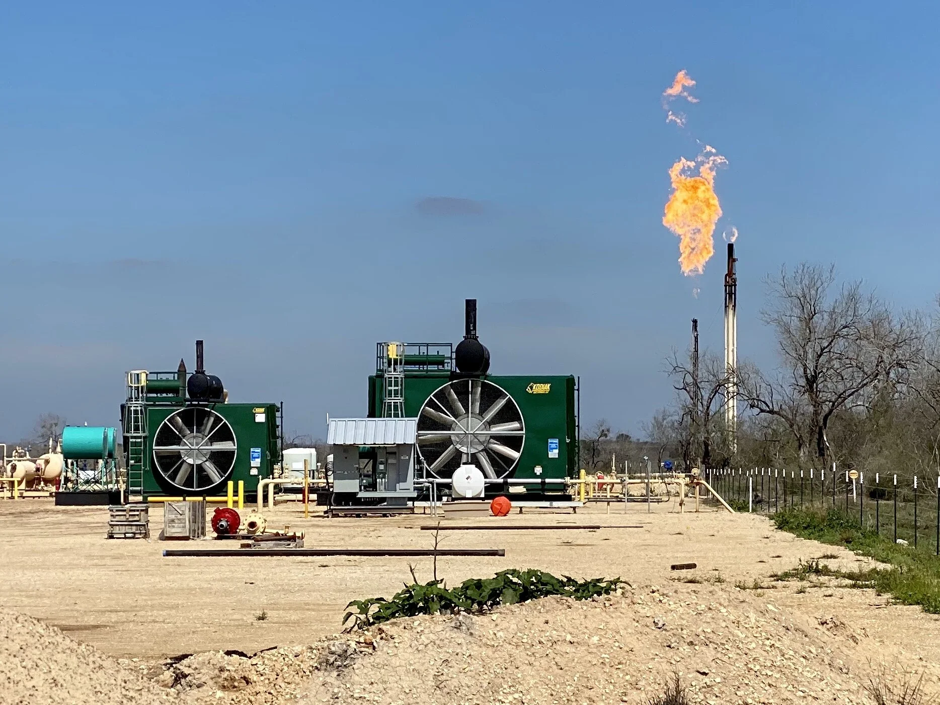
A hydrogen sulfide (H2S) flare near a gas pad. Flaring burns off gas that is deemed uneconomical to collect and sell. It is common to flare natural gas that contains hydrogen sulfide to convert the highly toxic hydrogen sulfide gas into less toxic compounds. Although the practice of flaring is decreasing as pipeline efficacy improves, the following air pollutants may be released from natural gas flares: benzene, formaldehyde, polycyclic aromatic hydrocarbons (PAHs, including naphthalene), acetaldehyde, acrolein, propylene, toluene, xylenes, ethyl benzene and hexane. Taken from this source.
On our next trip to the southwest, we hope to visit the fast growing, second most productive oil field in the world (as of 2018), located in the Permian Basin in western Texas and New Mexico.
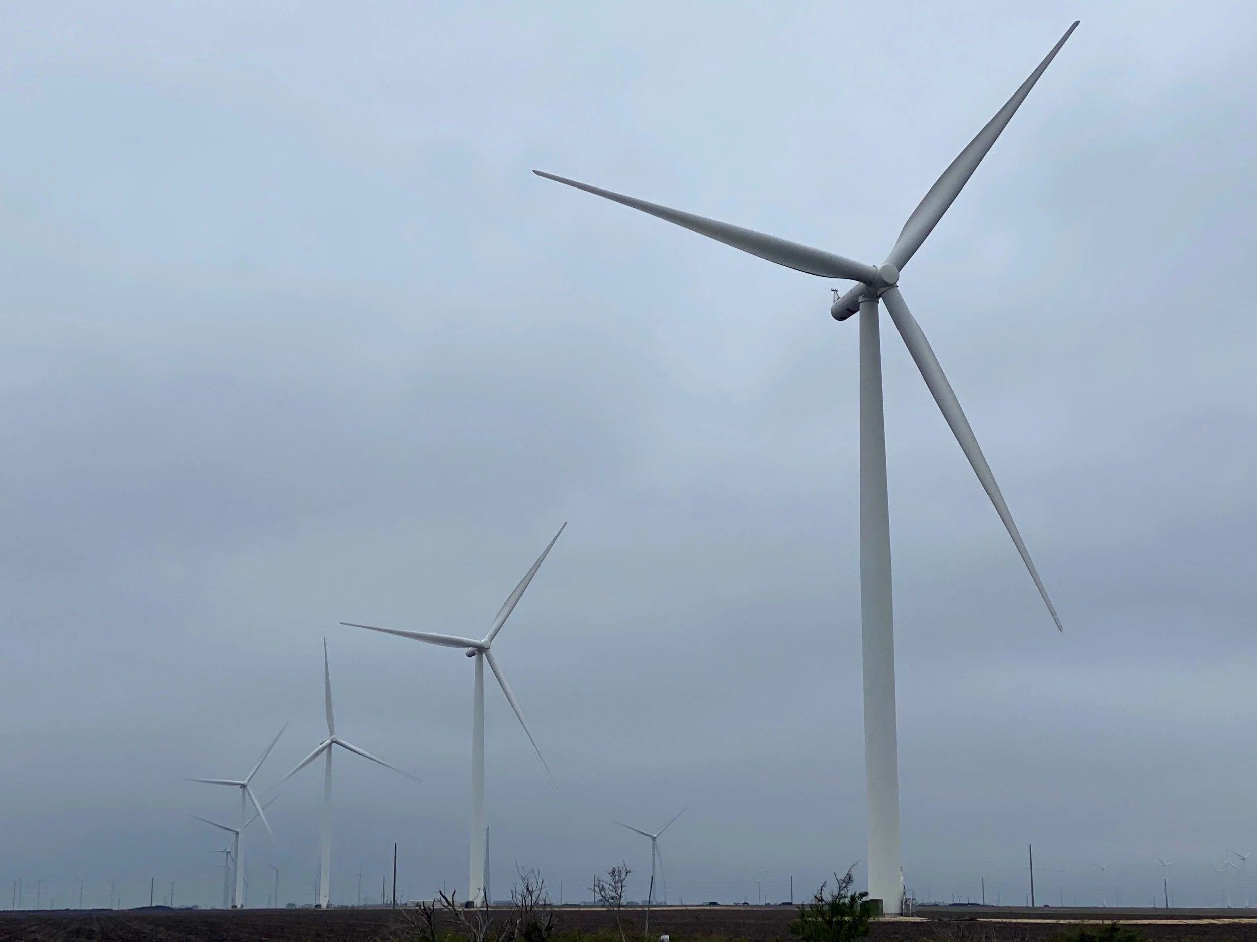
Just above Gregory we encountered a large wind farm on agricultural fields that spanned to the horizon on both sides of the road for almost 8 miles. Later we learned it is run by E.ON Climate and Renewables North America, one of the worlds largest developers, owners, and operators of renewable energy projects. EON owns and operates over 1,900 MW of wind farms in the United States. The wind on these flat plains are intense (we learned that the hard way), and there are quite a few more wind power companies in the area.
Perhaps more surprisingly, Texas leads the nation in wind-powered generation. The state produced one-fourth of all the U.S. wind powered electricity in 2017. Texas wind turbines have produced more electricity than both of the state's nuclear power plants since 2014. And equally interesting, Texas produces more electricity than any other state, generating almost twice as much as Florida, the second-highest electricity-producing state. All combined, Texas is the largest energy-producing state in the country. It’s also the largest energy-consuming state in the nation. In fact, the industrial sector, including its refineries and petrochemical plants, accounts for half of the energy consumed in the state.
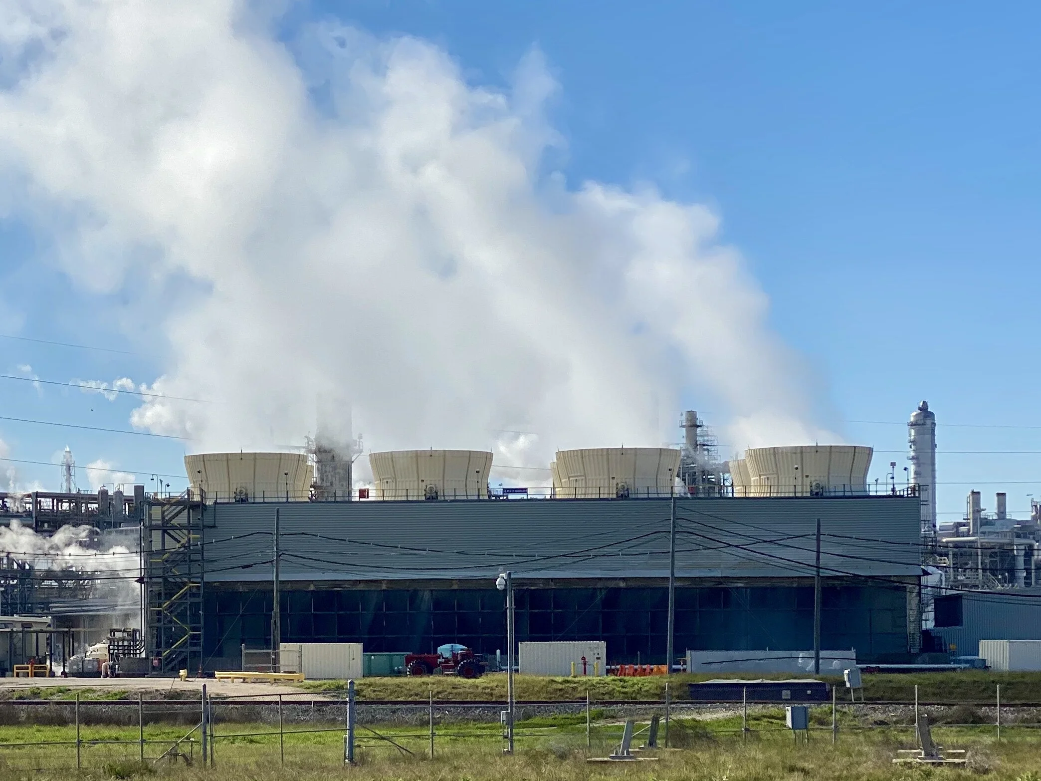
Cooling Towers on the Dow Chemical Plant in Freeport, Texas.
Given our lowbrow method of bicycle travel to offbeat roads and towns, we had lots of opportunities to speak with locals. We didn’t meet one person who spoke of his or her job in disparaging terms. We were often met with gratitude for the opportunities that seemed to be available. Truth is, Texas is humming. The unemployment rate is 3.4%, while the national average is 3.6%. Louisiana’s rate is slightly higher at 4.5%, although it was 6% in November of 2016. By most measures in both states, employment is looking up.
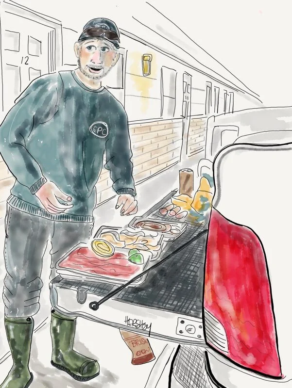
“Me?- I’m Norberto. Me an’ my brothers, Ivan and Freddy cook our meals for the week out here. We take our lunches to the plant.” Drawing by Jennifer Hershey. Follow her work on Instagram at deeofo.
Norberto and his brothers had traveled from their home near Brownsville to work at a plant near Kenedy, Texas. There’s a lot of available jobs there. We counted 9 oil and gas plants in this town of 3500 people.
The evening we hung out with Norberto and his brothers, I fell into a conversation with one of their friends, an oil worker named Jose. An Hispanic transplant from Indiana, Jose was happy to be finding so much work in a part of the country that he preferred. He educated me for awhile about H2S flaring and modern pipeline construction methods, which I appreciated. It was comforting to hear the industry was actually trying to lower methane emissions. After a while, I asked him about his politics. Jose was unabashedly straightforward about supporting Trump because Trump supported his industry. I turned the conversation to climate change. He hesitated a bit as I gently expressed my concern about carbon emissions and what might happen to the world my grandchildren will be inheriting. He didn’t have children, so I kept the conversation a few generations out. I could also tell Jose was aware lots of folks felt like I did, and I could feel him becoming defensive. So I changed tack. I told him I didn’t begrudge anyone working in any industry who was trying to achieve his or her fair share of the American Dream.
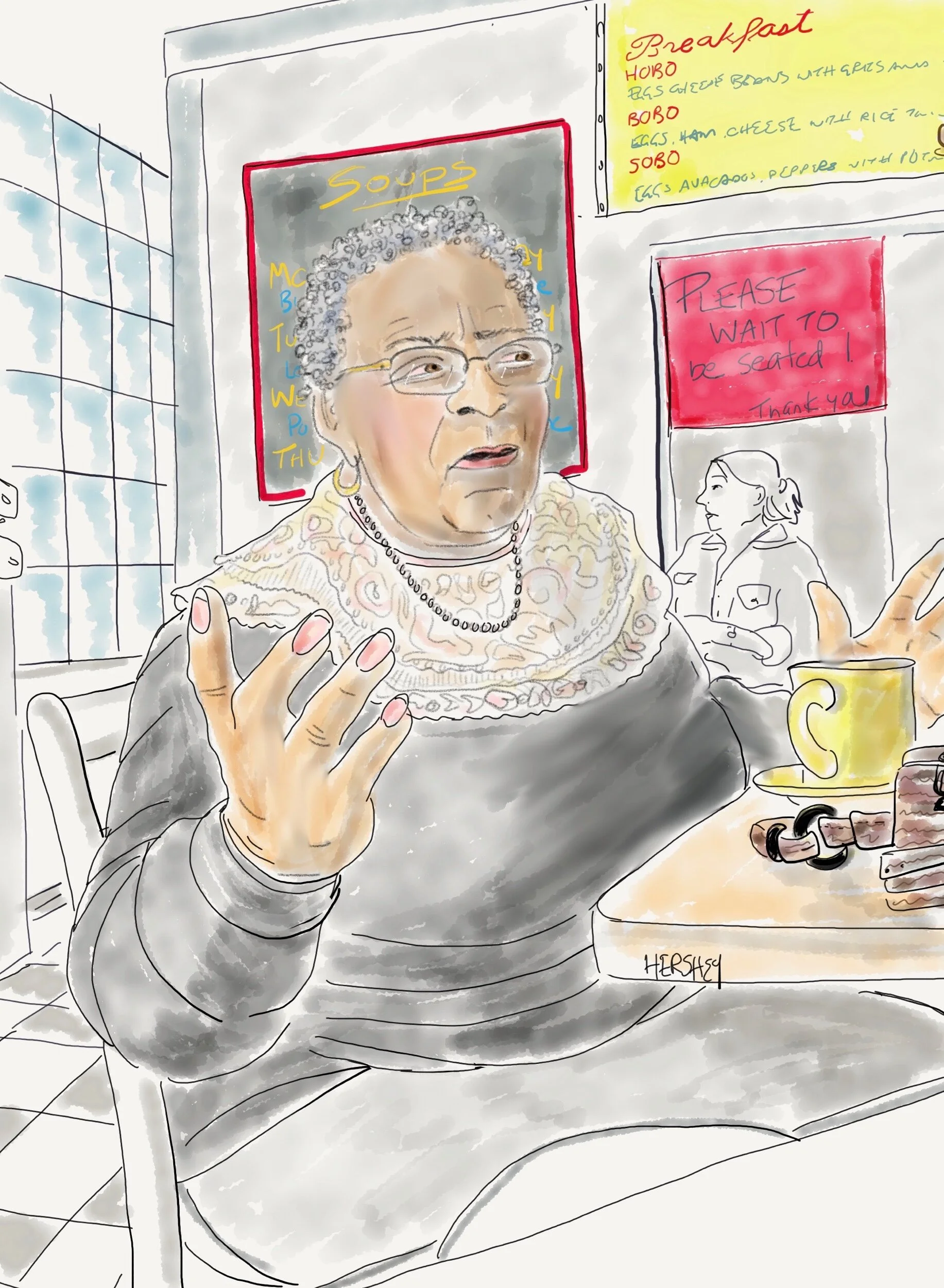
“I used to be an intelligence analyst for the army in Germany. I moved back here to be close to my military family. I pray everywhere and anywhere because God is always where I’m praying”. Drawing by Jennifer Hershey. Follow her on Instagram at deeofo.
I remember how isolated veterans felt when they returned from the Vietnam war many years ago. Coming back to a divided country after having served in an unpopular war was a miserable experience for so many veterans, and their shame and degradation cloyed deeply at those of us who opposed the war. Consequently, it was a relief when Americans did not do the same thing to vets when they returned from the second Gulf War - a war equally as unpopular as Vietnam. It seemed that Americans understood had that our vets were not the perpetrators of an unpopular and ill-advised conflict, but were instead brave men and women who had been asked to do something unpopular and counterproductive by their superior officers. In that case, the right people were held accountable for poor choices.
Just as those of us who are deeply worried about the growing climate emergency are realizing that meaningful change has little relevance to the consumer-based choices of the average middle class, we also need to avoid blaming our brothers and sisters who work at low and mid-level technical jobs in an industry that has brought us so much, but is also causing us great damage.
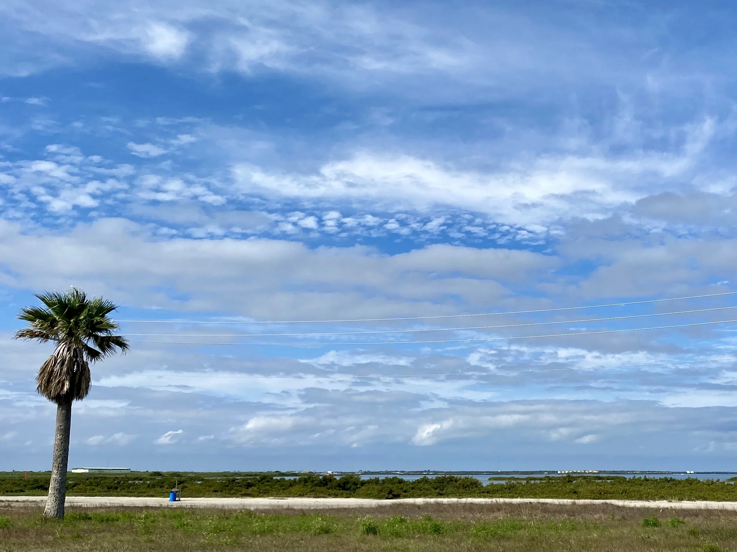
Looking south from the causeway between Aransas and Port Aransas, Texas.
Jobs matter. They are a necessity. At the same time, we need policies that will aggressively curb and eliminate carbon emissions. I've heard conservative Republicans say that it’s not fossil fuels that are the problem, it's emissions. In response, I say …. great! If one really trusts the free market, then put a price on those emissions (and return the proceeds as a dividend to taxpayers to mitigate additional costs), and trust the market to work its magic. And if that intervention doesn’t do the work fast enough (at the rate that science tells us we need) then let’s put our money where our mouth is and trust the market enough to increase the price of carbon until it’s enough. Let’s bring the emissions down! If we can use the market to stimulate innovation that will help us save a lot of our oil and gas jobs, that’s terrific! If not, then let’s accept the truth of our situation and create a different kind of economy.
As one of the people we met kept saying, “I'll tell you what” …Using the ridiculous excuse that the science isn’t settled isn’t acceptable. The science of climate change is as verified and verifiable as the concept of gravity (about 98% of scientists agree both are happening). Climate change isn’t convenient, that’s for sure. But just because we don’t like that it’s happening isn’t a reason for denial. Let’s deal with it.
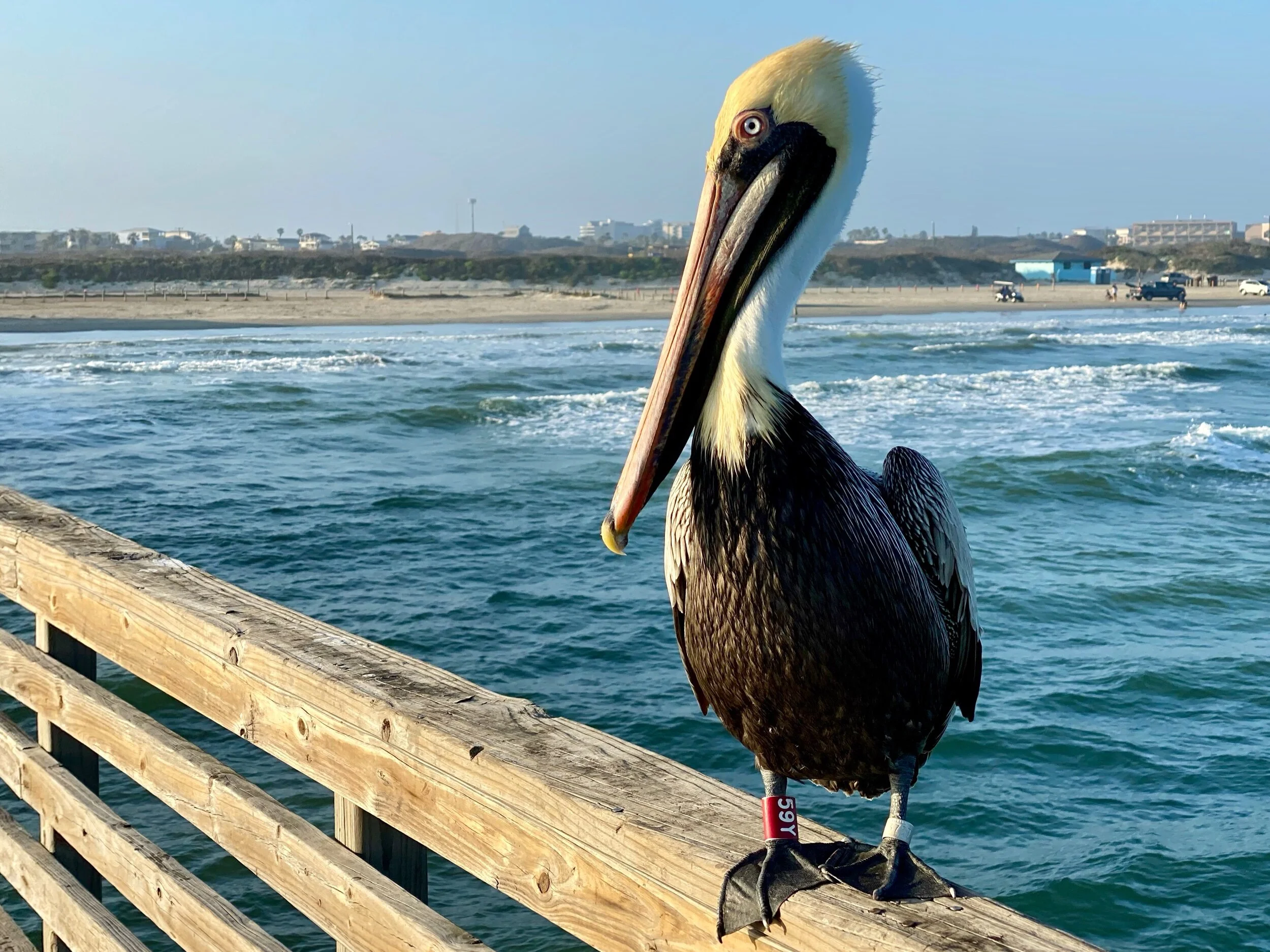
Yet another Pelican poses for us near Corpus Christi.
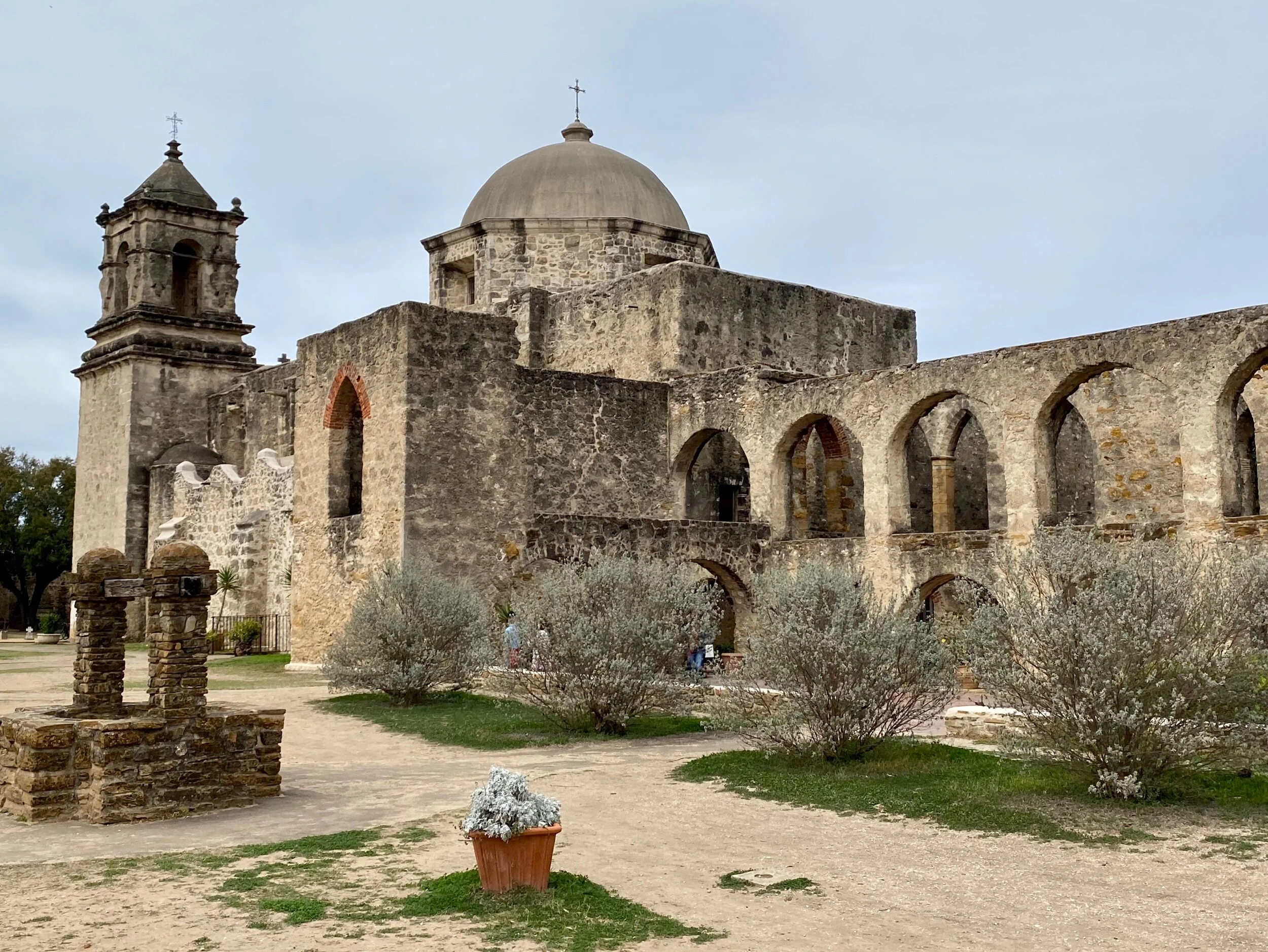
This blog post concludes our latest trip from New Orleans to San Antonio. I am writing this on an Amtrak train, with our bikes safely stowed in the baggage car. It’s been an extraordinary trip. If you haven’t visited the 4 missions on the San Antonio River, we enthusiastically recommend them, especially Mission San Juan. A few key pictures from there are posted below.


Below are links to this entire trip. If you don’t have a Garmin account you will have to create one to see them (it's worth it if you're a biking geek or map lover).
1) New Orleans Road Cycling, 2) New Orleans Road Cycling, 3) Donaldsonville Road Cycling, 4) Morgan City Road Cycling, 5) St Mary Parish Road Cycling, 6) Abbeville Road Cycling, 7) Lake Arthur Road Cycling, 8) Cameron Parish Road Cycling, 9) Port Arthur Road Cycling, 10) Galveston Road Cycling, 11) Freeport Road Cycling, 12) Matagorda County Road Cycling, 13) Refugio Road Cycling, 14) Port Aransas Road Cycling, 15) Bee County Road Cycling, 16) Kenedy Road Cycling, 17) Floresville Road Cycling, 18) San Antonio Road Cycling, 19) San Antonio Road Cycling, 20) San Antonio Road Cycling.
Thanks for reading! There’s always more to come, but this particular trip is complete.
All photos, unless credited or otherwise noted, are copyrighted property of the blog post author.
Louisiana/Texas, Post 2
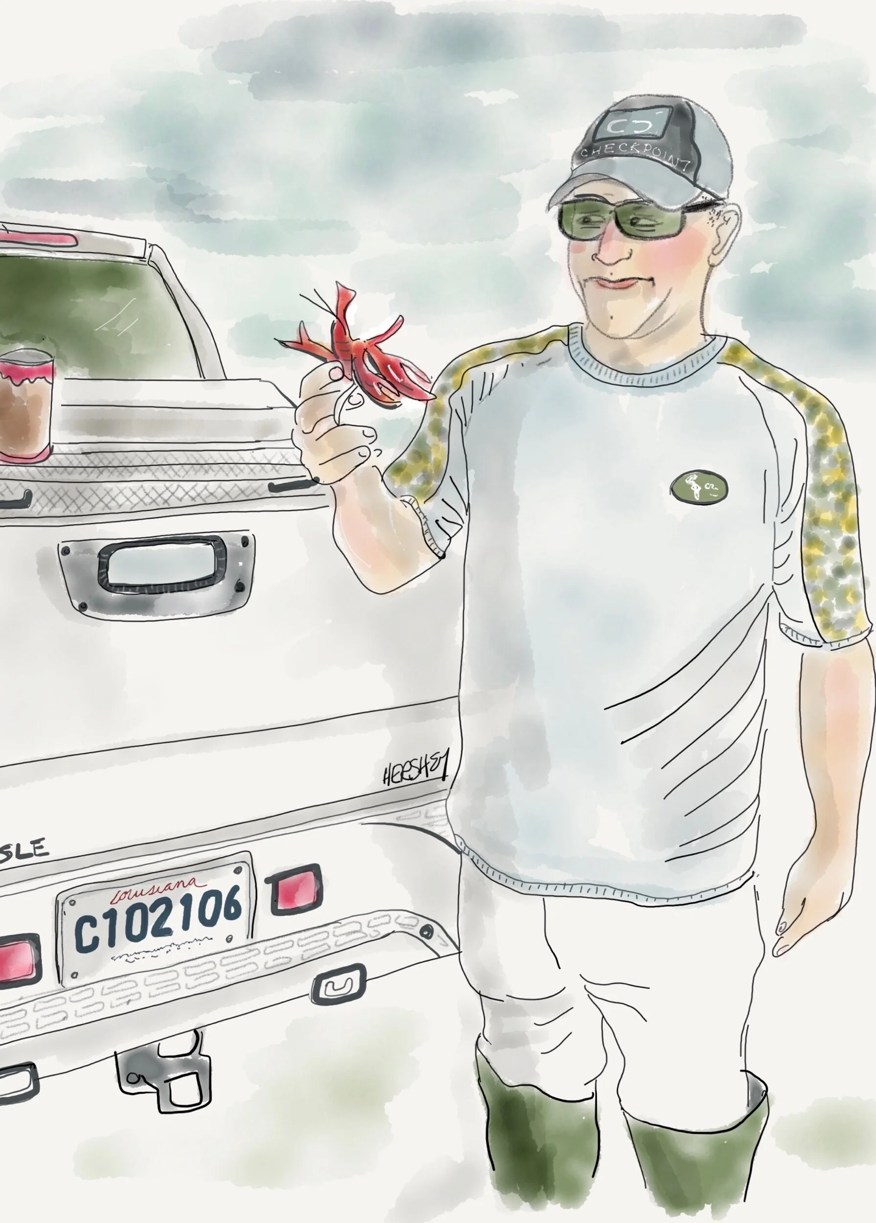
“Yes Ma’am...it’s alive. They be millions of them in pots out there in them rice fields”. Drawing by Jennifer Hershey. Follow her on Instagram at deeofo.
Welcome from Galveston, Texas, where we arrived from Louisiana by way of the coastal towns Cameron, Louisiana, and Port Arthur, Texas. Most of south central and southwestern Louisiana below the I-10 corridor from Houston to New Orleans is less than 20 feet above sea level. On both sides of the Intercoastal Waterway this land of marshy prairies, bayous, forests and intense wetlands supports many wildlife sanctuaries, cattle ranches, sugarcane and rice farms, and crawfish trapping. It was a pleasure to cycle through. People are friendly, and the inland towns are small and attractive.
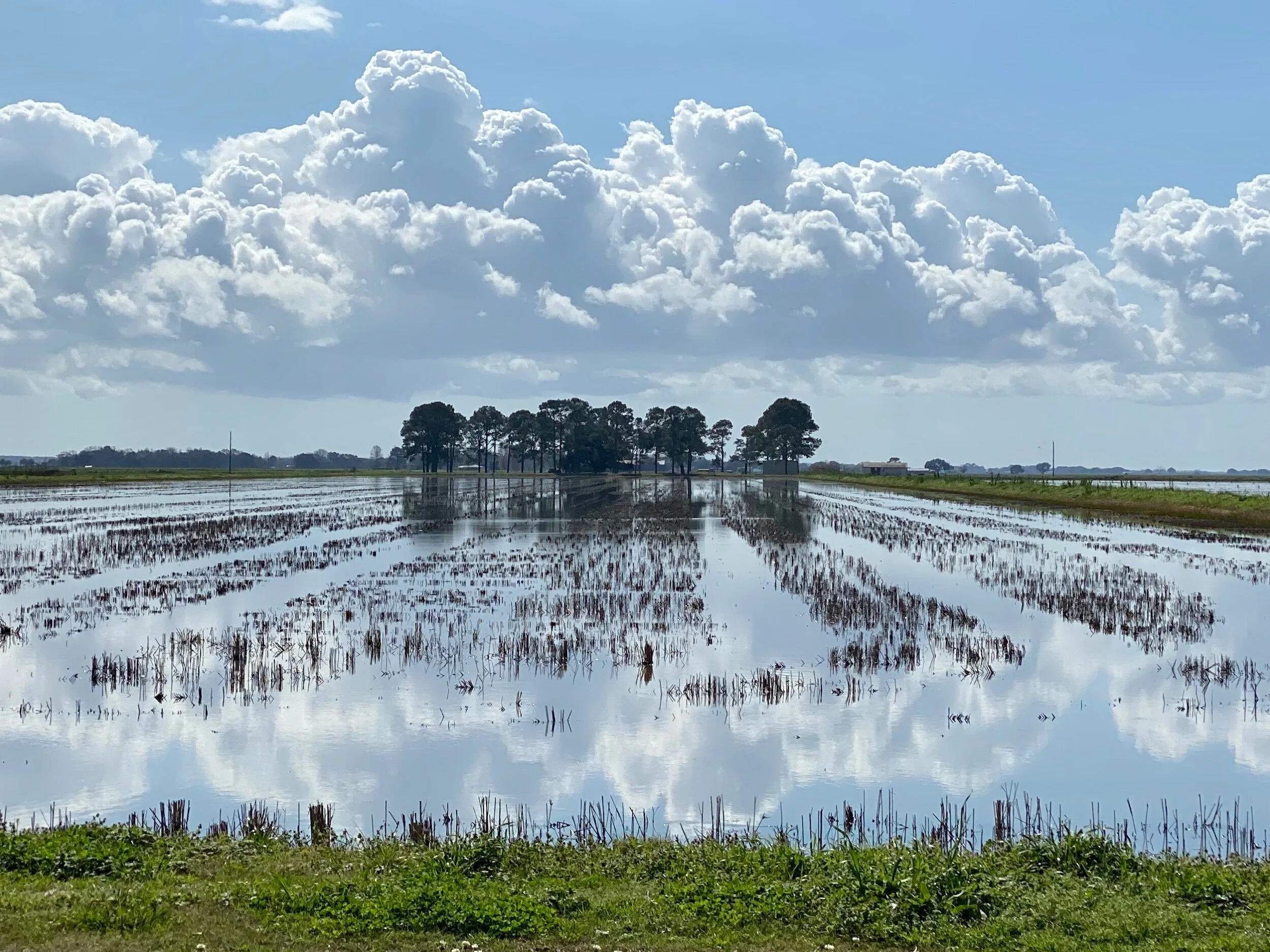
A rice field east of Lake Arthur, LA.
We had an interesting encounter with a very busy and successful woodworker named Mark near New Iberia, Louisiana, who showed us his shop, and introduced us to some of his workers. After we got settled into a motel in nearby Abbeville, he and his wife Dona picked us up and took us out for a sensational seafood dinner. We enjoyed Louisiana hospitality at its best, with good food and plenty of libation and conversation. Although we could sense we weren’t all likely to be on the same page politically (even though we shared a concern for rising sea level and the fate of the lowlands), a strong and jovial spirit of acceptance and friendship remained intact. Interestingly, the next day Mark read my recent blog post, and texted me “Great post. Observe more, judge less. Good way to live. Just remember, sometimes you have to step up to the plate”. Jenny drew his picture, and I thought about what exactly he meant.
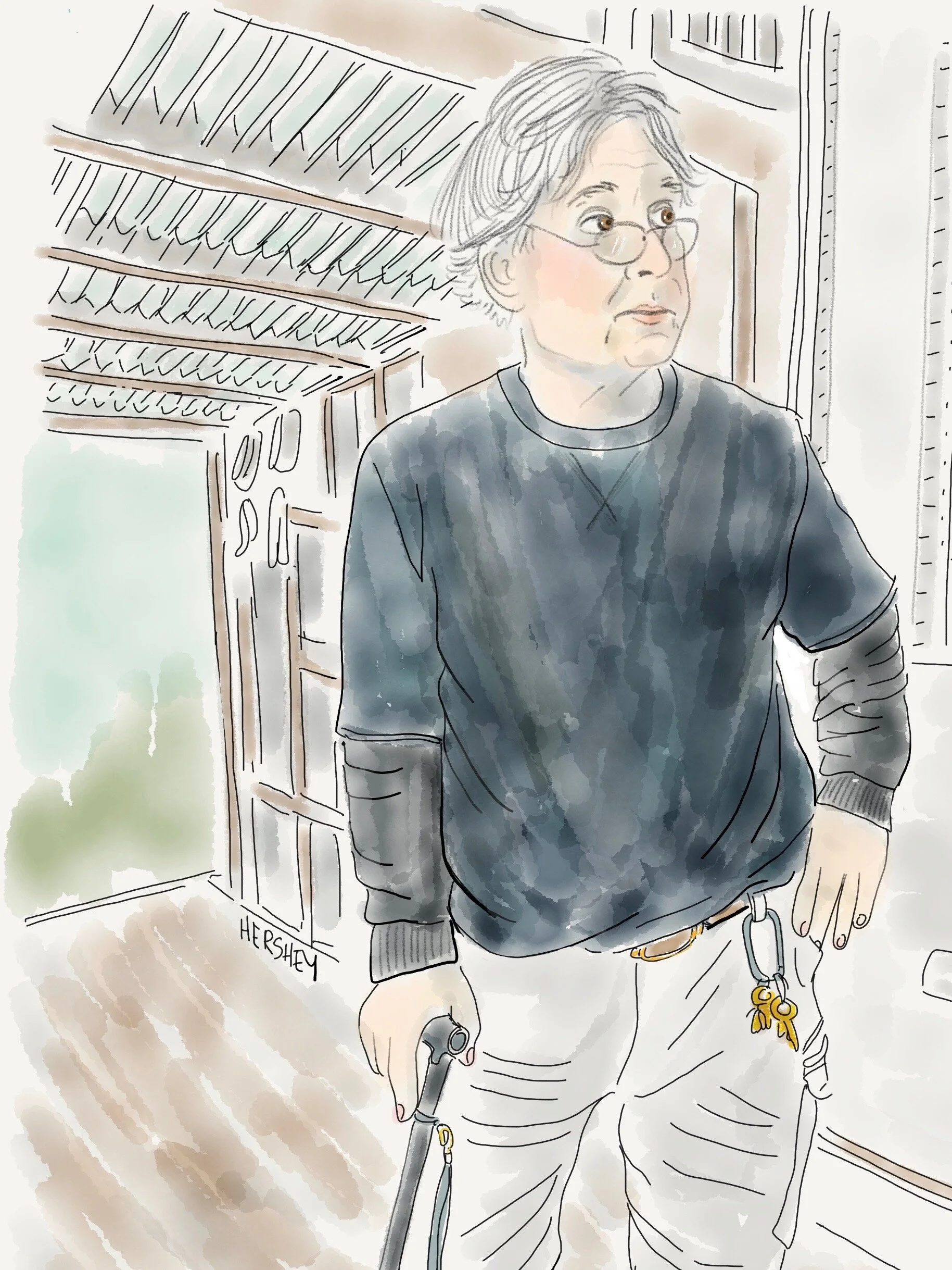
“I got three good sons in laws. I want my family to be healthy. But I worry that the land to the south of here is going to be under water”. Drawing by Jennifer Hershey. Follow her on Instagram at deeofo.
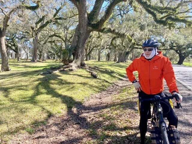
Michael biking through historic Jeanerette, LA.
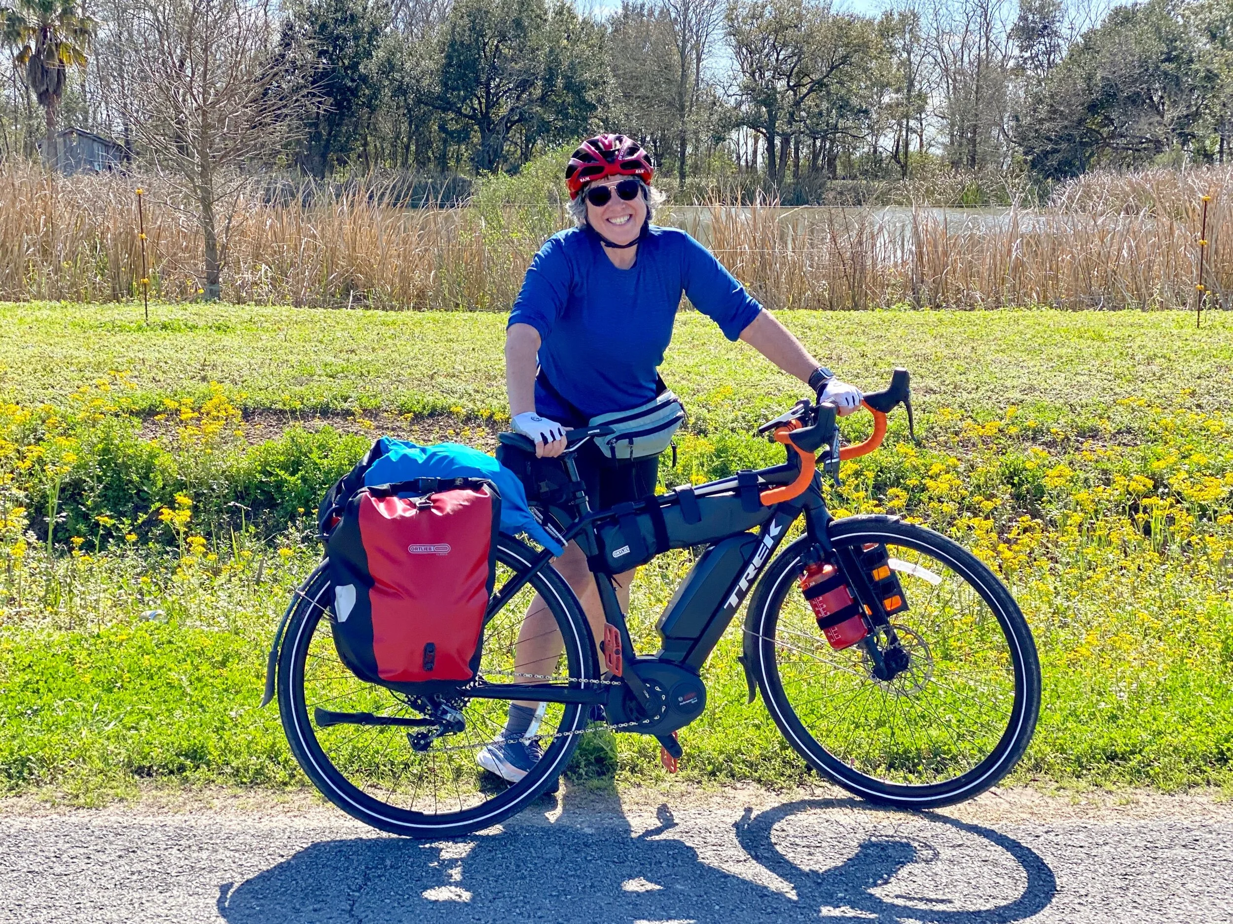
Jenny with her bike on the way to Lake Arthur, LA.
In addition to their beauty and the warmth of their inhabitants, southern Louisiana and Texas can also be disturbing places to bike through. This bucolic landscape is riddled with debris, machinery, abandoned oil wells and new fracked gas compressor stations. It’s crisscrossed by pipelines carrying oil and gas from conventional wells found underneath the marsh, and an abundance of fracked gas piped in from the north. Much of the fracked gas in western Louisiana originates from the nearby 9000 square mile Haynesville Shale, a large shale play in northwestern Louisiana.
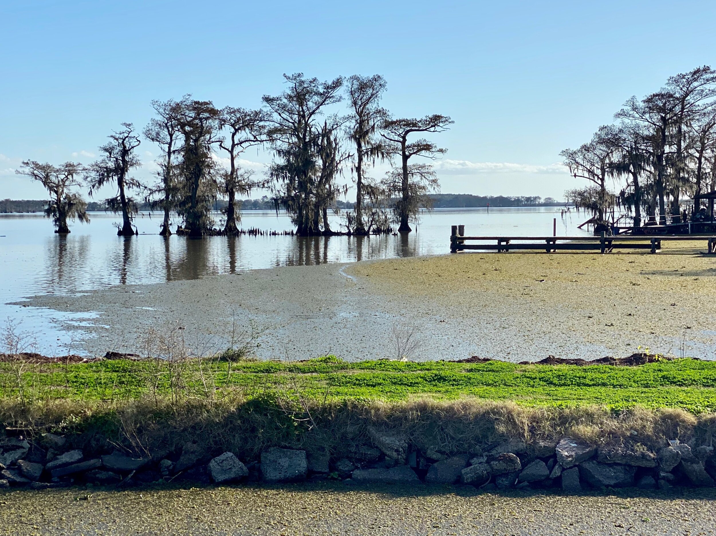
A view of Lake Arthur, LA.
Given the low elevation and the marshy characteristics of the land, it’s obvious that this area is very prone to coastal erosion, storm surges, tidal flooding, and extreme weather events such as hurricanes. A few days earlier, just west of New Orleans, we had contended with tornado warnings, which are quite unusual for the area. Locals agreed, although no one we spoke to suggested a changing climate as a possible cause.
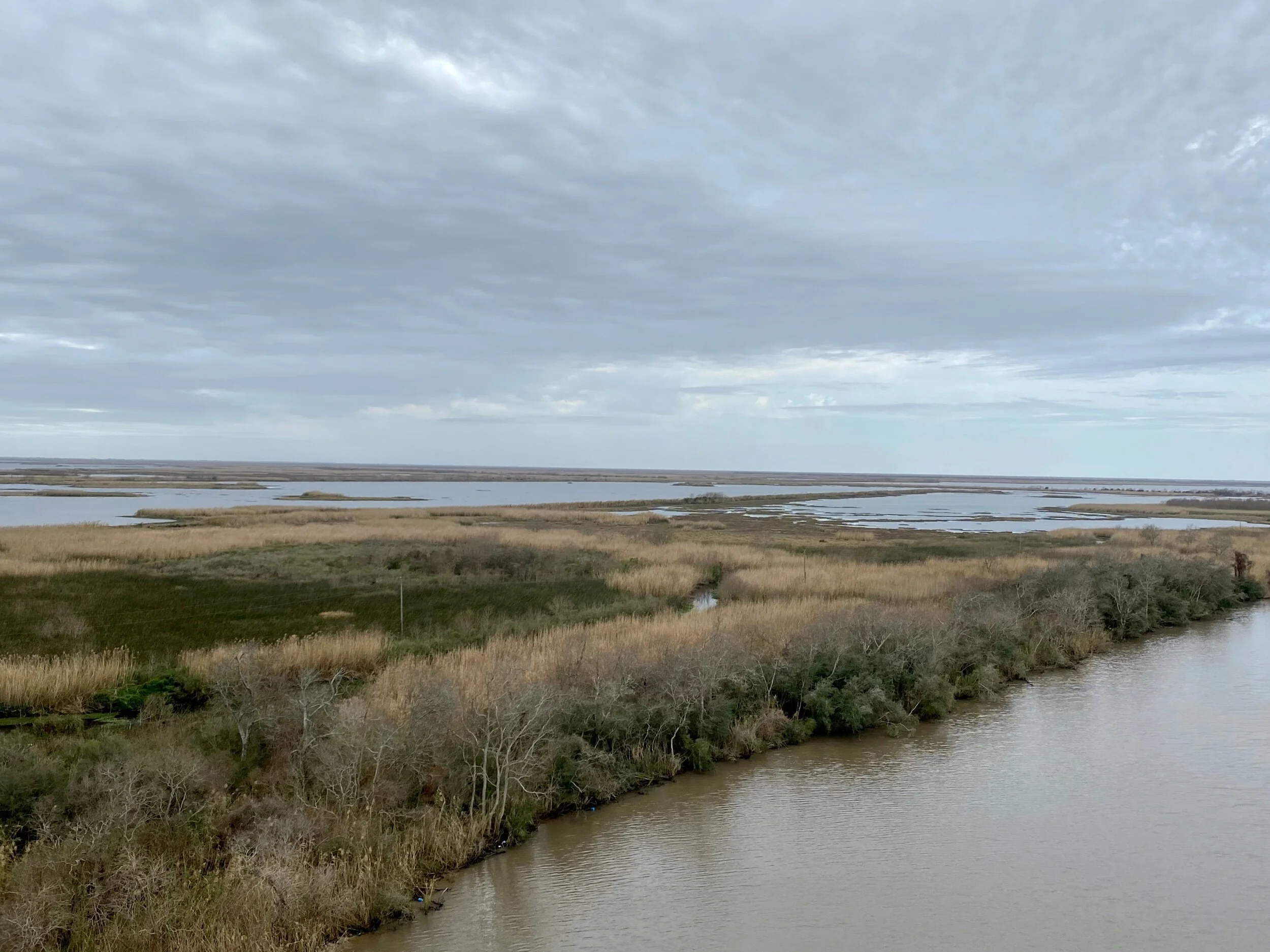
Just south of the Intercoastal Waterway on Highway 24 in southwestern Louisiana. Under these marshes lie a maze of pipelines carrying oil and gas from local deposits and the shale play in northwestern Louisiana.
The sheer vulnerability of the lowland coastal areas of the Gulf Coast seems hauntingly palpable. It’s clear to any thoughtful observer that Louisiana is deeply and complexly affected by our changing climate.
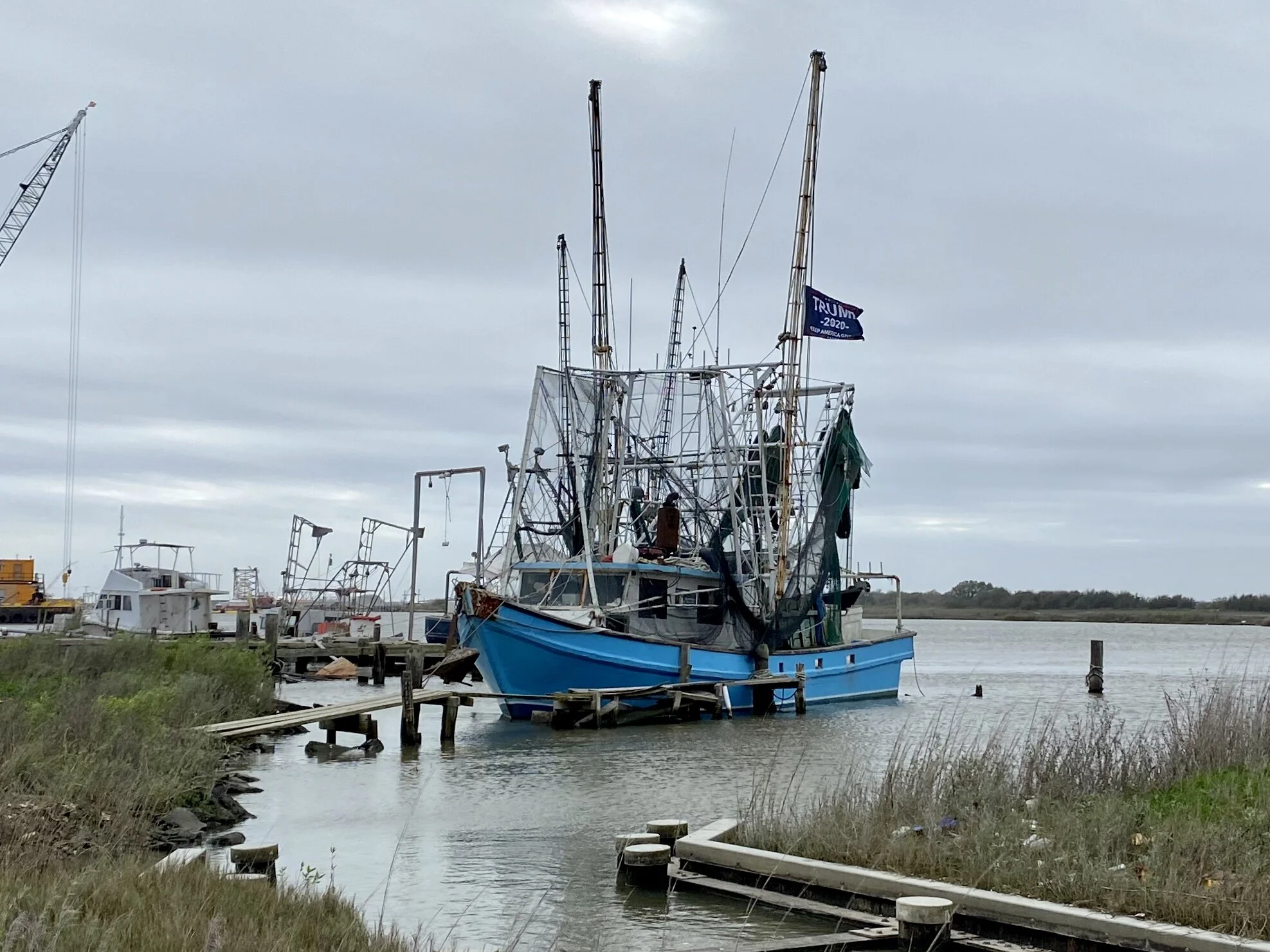
A fishing boat moored near the site of the new LNG global exporting plant at Cameron, LA. The flag on the boat says Trump/Pence 2020 . The entire port area just south of this boat (which used to be public land) is now privately owned by the company building the incoming plant. We weren’t allowed to see it.
The town of Cameron, LA, (once a bustling resort town of 3000 people that was devastated by Category 3 Hurricane Audrey about 60 years ago, and slammed again by Ike in 2008) now only has a few hundred permanent citizens. However, it is now a site for a large liquified natural gas (LNG) global exploring plant that will compete with an equally large LNG global exporting plant under construction in nearby Port Arthur, Texas. This much larger blue collar town lies just across Louisiana's southwestern border, where the Spindletop gusher was struck in 1901, setting off an oil rush that resulted in nearby Houston eclipsing Galveston as the primary port for southeastern Texas.
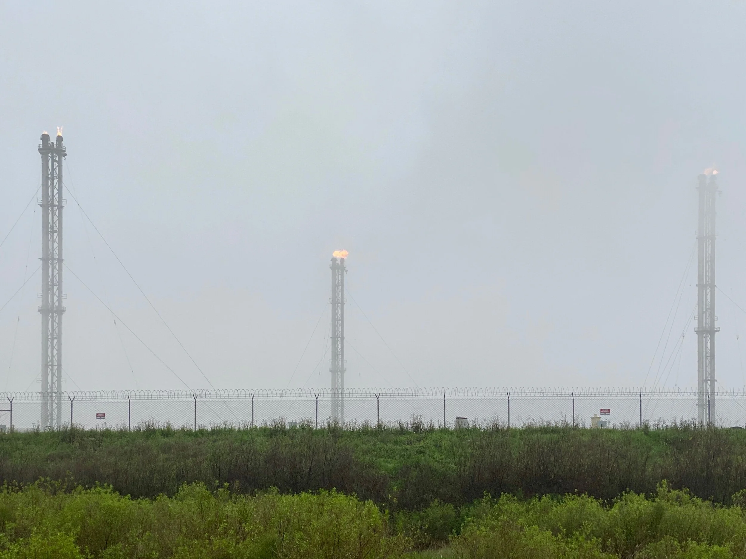
Gas flares in the marsh about a mile from the Liousiana Coast.
Each new plant currently employs about 3000 construction workers. When complete, the Cameron plant will support 160 permanent jobs, and the Port Arthur plant will support about 200 permanent jobs. That is, of course, unless a major hurricane hits this part of the Gulf Coast, in which case operations will either be temporarily or permanently interrupted.
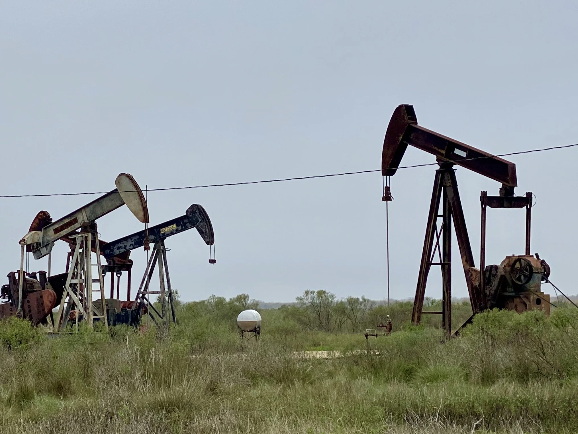
Abandoned oil wells in High Island, Texas, about a half mile from the Gulf Coast.
The reasons for this activity make economic sense in the short term. Cameron has been quite poor since Hurricane Audrey hit, and jobs are scarce. Consequently, the new plant is very popular among locals. Port Arthur is also poor, although it has more economic diversity than Cameron. However, the proximity of its site for a new receiving terminal will have additional benefit to Houston, so it’s popularity is even greater. Interestingly, in Houston, there is tacit, if not public, recognition among local officials that climate change is real. Based on a conversation we had with a local in Port Arthur, it seems there is hope that new sea walls east of Port Arthur across the Sabine River and further west across the Houston ship channel will mitigate storm surge issues for awhile, at least for southeastern Texas. …For how long, we wondered?
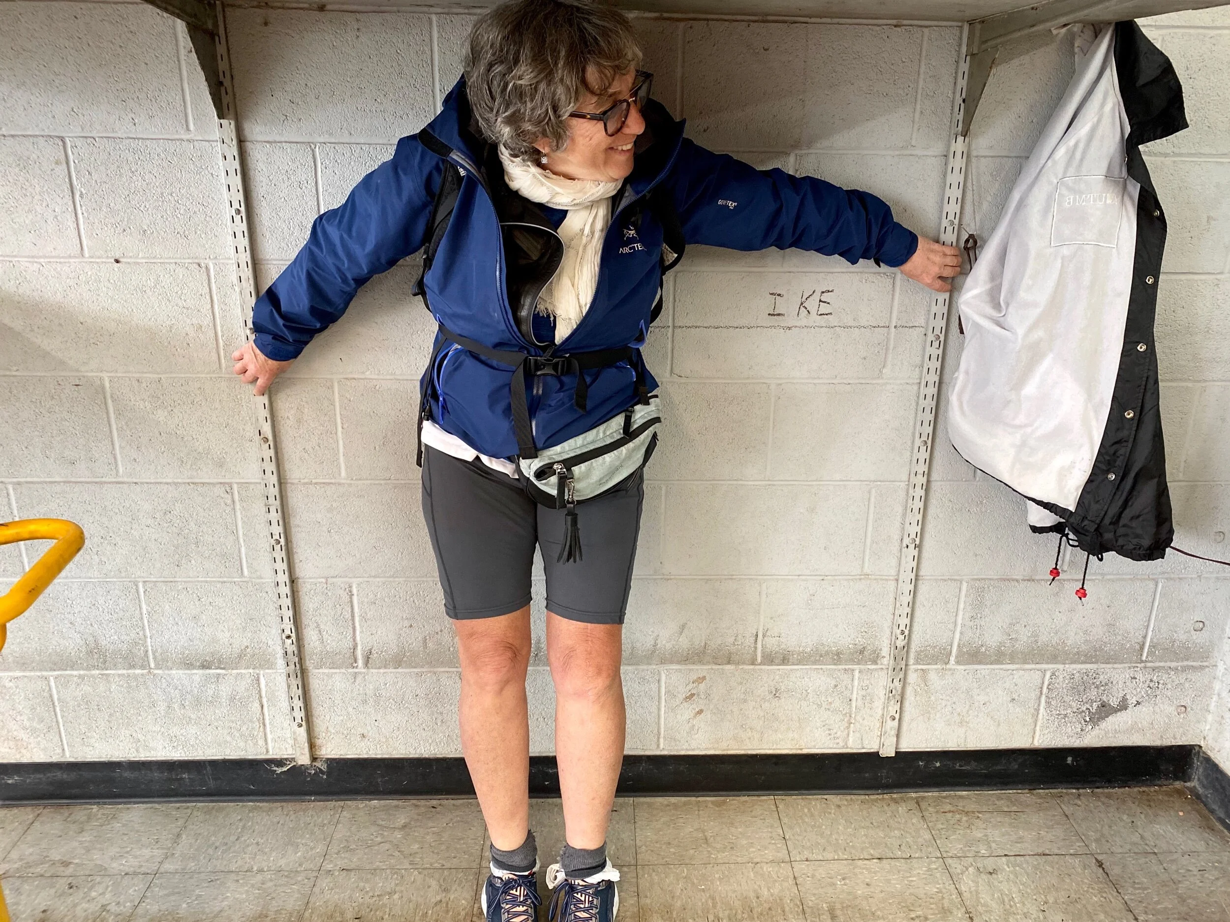
Jenny’s left arm marks the water line for Hurricane Ike in a bicycle shop we went to in Galveston. This 2008 hurricane holds the record for storm surge in Port Arthur, cresting at 22 feet.
So why do so many people in Louisiana and Texas embrace the very industry that may ultimately do them in? Isn't one definition of insanity, “doing the same thing over and over again and expecting different results?”
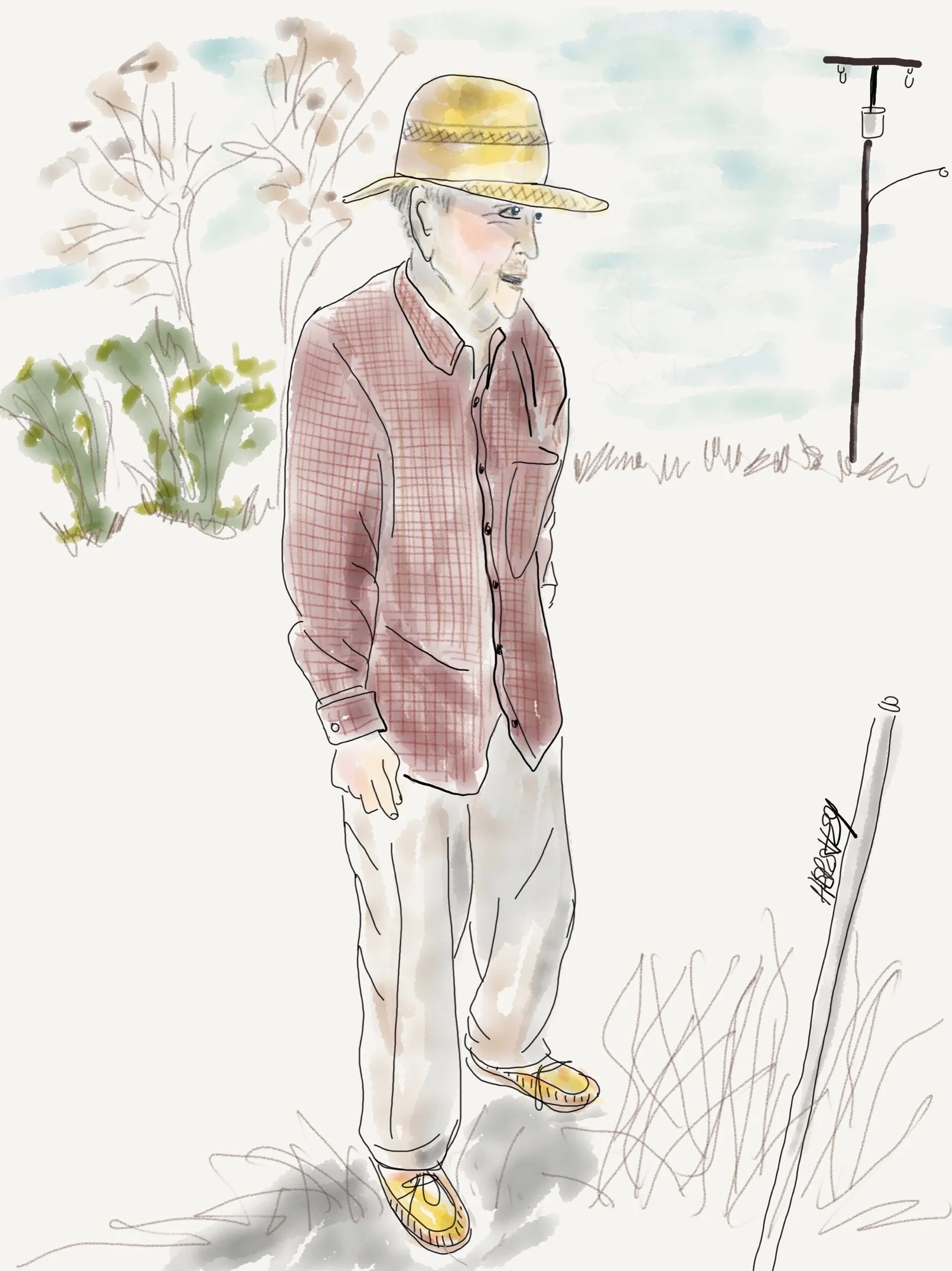
“I moved one time..in 1954...from next door to here.” Drawing by Jennifer Hershey. Follow her on Instagram at deeofo.
Jobs are important, and 460 permanent jobs might have lasting value for your communities. But at what cost? When your home is losing land to coastal erosion at alarming rates, when scientist are warning us that sea level rise is occurring faster than their previous conservative estimates indicated, when extreme weather events such as hurricanes and tornadoes are becoming more frequent with every passing year, when scientists are looking at establishing a Category 6 for hurricanes because they are growing so much more intense, …..when does that community cut its losses, and change its economic base?
Yes, life will be harder in the short term, but potentially much more livable and rewarding in the long term. Maybe that’s a plate that’s worth stepping up to…
For those of you who geek out on map routes, please email me and I will happily include links to the Garmin maps in this blog post. Frankly, I simply don’t know if they are very important to my readers. If I’m wrong, I’d love to know.
Thanks for reading! More to come…
All photos, unless credited or otherwise noted, are copyrighted property of the blog post author.
Getting Real About Global CO2 Emissions

“The fear is real”. Drawing by Jenny Hershey, on Instagram at deeofo.
Greetings from New York City. For those of you who wonder what happened to me and Jenny Hershey along the GAP Trail as we left Pittsburgh last October, you can find a short blog post about that ride in the Archived Cycling Tours for 2019 in the drop down menu. And please look forward to following our next ride beginning in New Orleans and heading across southern Texas in early February, 2020. It’s an interesting time in the U.S. for blue state urban northerners to mix with red state rural southerners. We are certainly curious as to what our fellow Americans are thinking about climate change (and many other subjects), and we hope to see and learn some things worth sharing.
But let's attend to a present concern. Previous readers of these blog posts may have wondered about the CO2 icon in the upper left hand corner of this page above the carbonstories.org logo. That is a widget from the CO2.earth website, and is a reference to the latest annual average of parts per million (ppm) of carbon dioxide in the atmosphere as measured at the Scripps CO2 research project at the Mauna Loa Observatory in Hawaii.
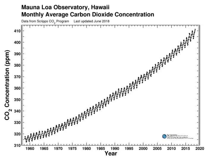
This is the famous Keeling curve, which demonstrates a 25 percent rise in carbon levels in our atmosphere since 1960.
This research project was initiated in 1956 by Charles Keeling, and operated under his direction until he died in 2005, when his son Ralph took direction of the project. The iconic “Keeling Curve” chart shown above is a result of their work, and is a well known and accurate record of the rise in CO2 levels since the 1950’s.
As of this writing, the most recently reported measurements of carbon dioxide at the Manua Loa Observatory are:
It is a widely understood, and easily verifiable physics experiment to demonstrate how increasing CO2 levels causes air temperature to rise; in fact this was proven well over 100 years ago by both the Irish physicist John Tyndall and Swedish physicist Svente Arrhenius. Tyndall is widely credited with discovering the greenhouse effect that underpins the science of climate change by publishing a series of studies on the way greenhouse gases, including carbon dioxide, trap heat in the Earth's atmosphere.
Following their leads, other scientists established a clear link at least 30 years ago between the accumulation of greenhouse gases in the atmosphere and increases in surface air temperatures. Scientists have established that temperatures increase 1.8 degrees C for each 3.7 trillion metric tons of additional CO2 in the atmosphere. (Emissions are expressed in metric tons, each of which is equal to about 2,205 pounds). Today's CO2 concentrations and global average temperatures are typically measured against levels that prevailed before the Industrial Revolution, when humans began to have a meaningful impact on the planet's natural chemistry.
That influence has been extraordinary. As you can see in the graph below, current parts per million (PPM’s) are above 400, even though CO2 levels have consistently hovered around 280 ppm for the last 800,000 years until quite recently. The upward explosion in the line graph below begins in the late nineteenth century, corresponding to a rapid rise in the production and use of oil and natural gas in addition to coal. Where the graph ends in real time is anyone’s guess; it depends entirely on what we humans decide to do.
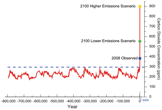
Sourced here from NASA. Note that although current parts per million (PPM’s) are currently over 400, CO2 levels have hovered around 280 ppm for the last 800,000 years until the late 1800’s.
Over the past few decades, scientists have come to understand that carbon dioxide emissions must be reduced to hold human caused global warming below levels that may cause dangerous changes in our climate. As a result, carbon budgets have become a staple of climate change analysis. One excellent source for immediate ongoing tracking is the Global Carbon Project.
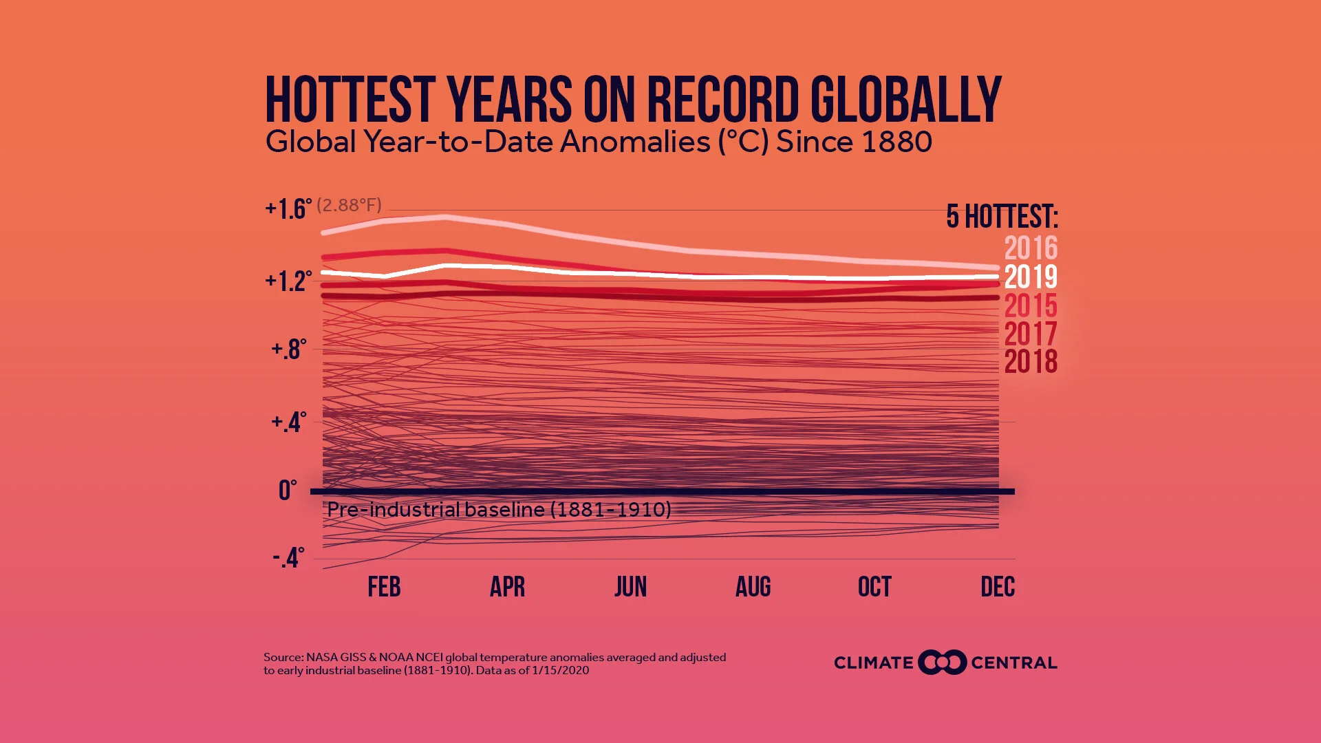
Sourced from Climate Central, this chart shows the increasing impact CO2 levels are having on global average temperatures.
Clearly, we are running out of time. Here’s a simple countdown clock from the Guardian that has been in use since the Paris Accord goals were established. It is as specific (and accurate) as the current science will allow. When it comes to global CO2 emissions and greenhouse gases in general, well …it’s time to get real.
Continuing our steady rise in fossil fuel use without capturing emissions is essentially a march toward oblivion. Not only will we experience life-threatening escalating temperatures, sea level rise, increasing diseases, and widespread crop failures, we’ll most likely experience a breakdown of civilization as we know it. For a current and quite sober assessment, see the most recent report by the World Economic Forum, Global Risk Report for 2020.
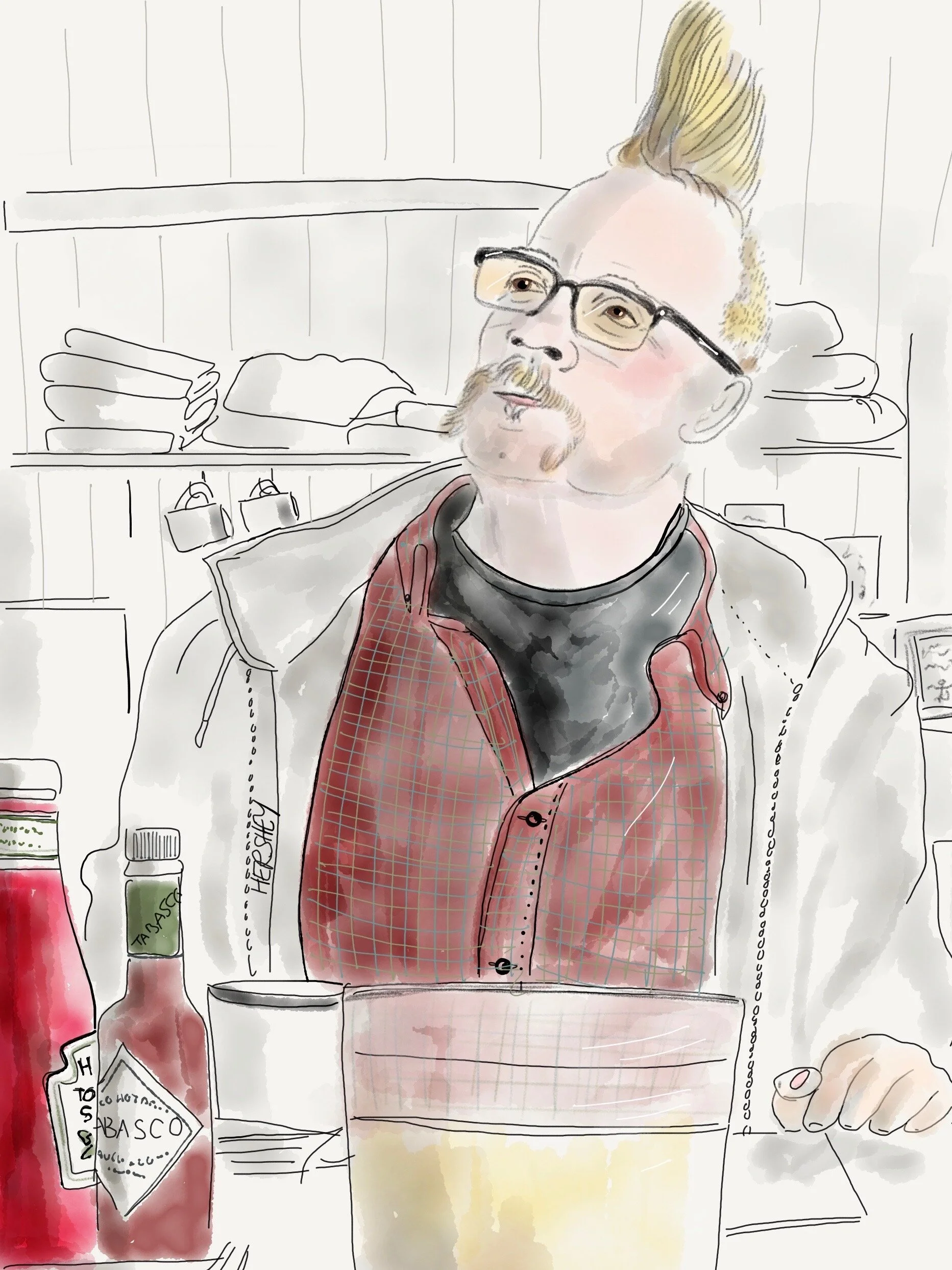
“Sure, they’re rebuilding in Ocracoke because of Hurricane Dorian. So what? It’s always been like that here”. Drawing from the Outer Banks, North Carolina, by Jenny Hershey. On Instagram at deeofo.
So what do we do? Talking to others is a start, especially policy makers. As you may know, I am active with the Citizens Climate Lobby (CCL), a global organization of over 100,000 volunteer citizen lobbyists who advocate for specific legislation (HR 763) to establish a price on carbon in the form of a fee that returns dividends directly to citizens to mitigate increases in energy costs. This group works hard to convince conservatives that climate change can still be addressed through aggressive market mechanisms. However, the need to act is a nonstarter for those who historically deny climate change science. CCL has been active for over 11 years, and while this ambitious and hardworking citizen lobbying organization has changed many minds in Congress, their legislative agenda remains unmet. If we are lucky enough to get a Democrat in the White House in 2020, CCL’s legislation will most likely prevail, and a decade of effort will finally pay off.
However, the current science tells us that global carbon emissions MUST be cut in half over the next ten years for us to maintain a climate anywhere close to what we humans have enjoyed in our comparatively short time on earth. If we end up with four more years of Trump plus a Republican Senate, we will lose 40% of the time we have to create aggressive changes in national (and global) policies to effectuate change. Considering the stakes, avoiding that outcome is essential.
Anyone who understands climate science agrees that Trump's policies are dangerous, and that his willfully ignorant characterization of those faniliar with the science as “prophets of doom” is patently ridiculous and beyond pernicious. As a result, many environmentalists argue that trying to convince his Republican supporters (especially in Congress) to think effectively about climate change is a complete waste of time and energy. Among them are activists in the interesting and global new group “Extinction Rebellion”. I think this group deserves credit for articulating an approach to the climate emergency that might push policy makers toward meaningful action. They focus on mobilizing people who are already passionate about climate change, and then work to consolidate progressive support for drastic action. Their approach is explained more fully in the following PBS article.
Their philosophy is summed up as follows: “We have finite energy, and spending energy trying to win over the people who are absolutely not going to be won over to your side is peanuts compared to mobilizing the people who would be active or passive supporters,” said Leah Francis, an organizer with the Extinction Rebellion U.S. national team. “We really want to shift people’s perspective on what constitutes normal, socially acceptable behavior around responding to climate change.”
Maybe that's exactly what we need. Maybe, just maybe, those of us who are alarmed by the existential issues of climate change are being just too damn nice.
I’m curious to know what you think…
Thanks for reading! More to come…
All photos, unless credited or otherwise noted, are copyrighted property of the blog post author.
Phoenix to El Paso, ...no, Tucson, Post 3
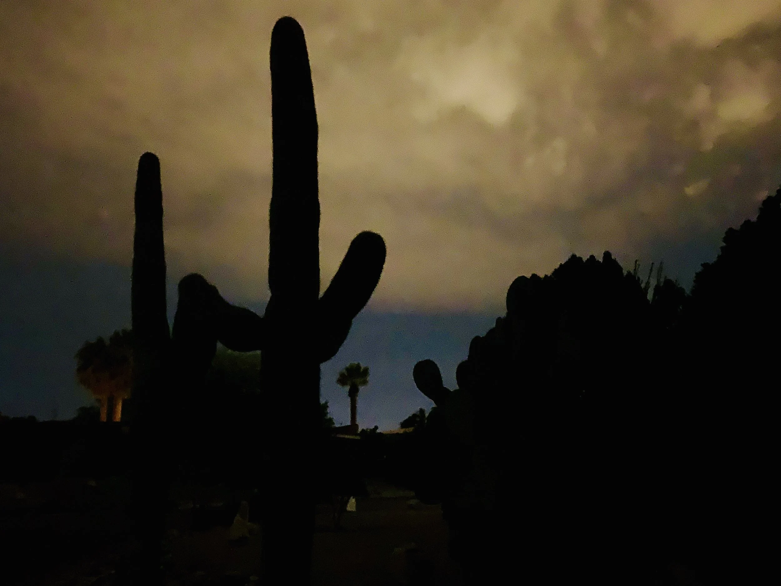
Twilight behind a sugaro cactus in Tucson.
After a one day layover in Portal, AZ, where I hiked near Cave Creek Canyon, I woke to a very cold day. The wind was clocking about 24 miles an hour out of the southeast, so I decided to head northeast to Silver City, NM, thinking that I would then zag southeast the next day to Columbus NM, and then make my way eastward into El Paso.
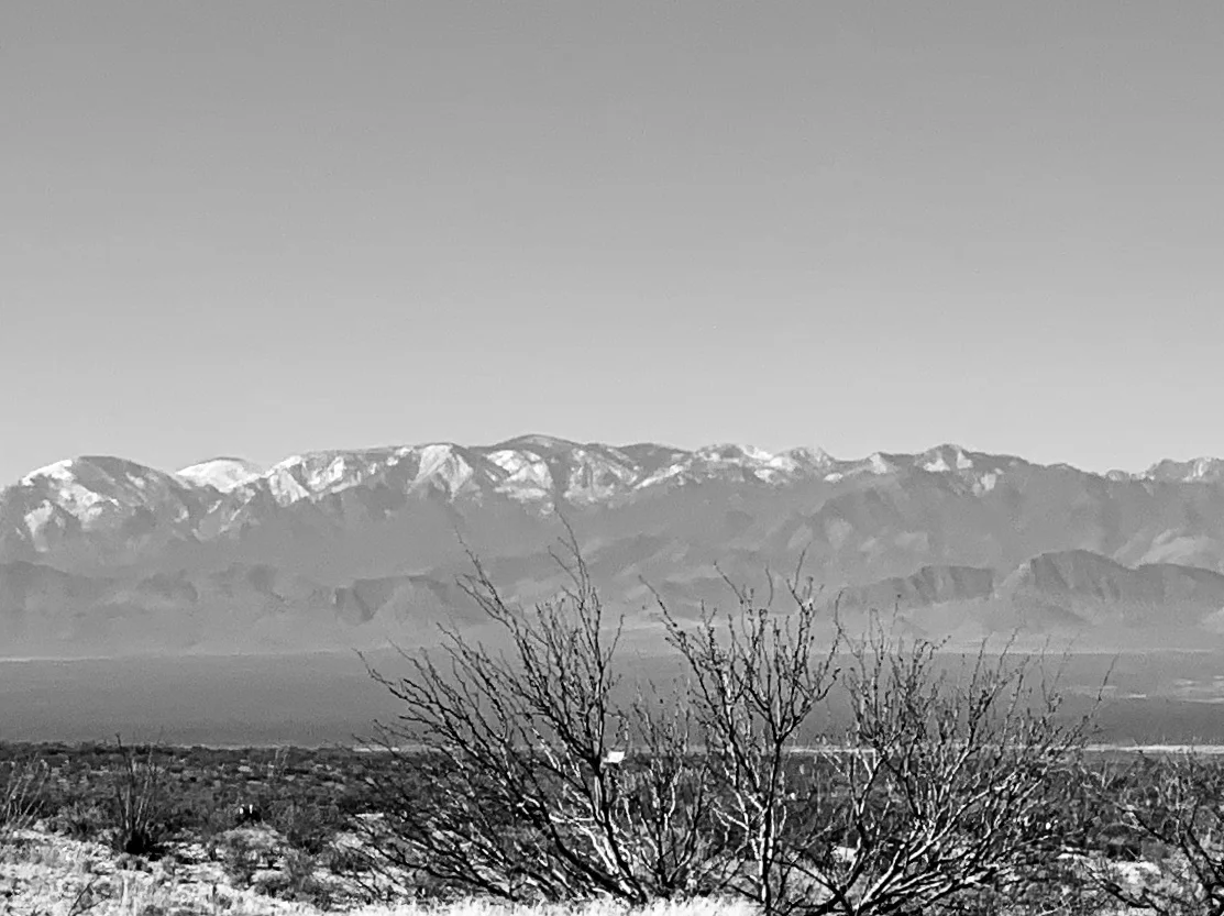
The Chiricahua Mountains on the way to Lordsburg.
Life has a funny way of making us change our plans. The wind shifted to the east. Rain clouds gathered. The temperature dropped. After a very difficult slog of a ride directly into a punishing wind, I arrived in Lordsburg about 45 miles away from Silver City. I wasn't sure what the weather was up to, but I was worried. I found an inexpensive motel and downloaded another wind app for my cell phone, hoping it would give me better capacity to analyze and predict what the next few days were going to be like. I knew there was a raging storm in the Midwest (the Nebraska bomb cyclone) and I assumed its outer edges were the cause of the wind and cold weather coming out of Texas. So I sat in my motel room, finally warm again, thinking about what to do. Near as I could determine the winds were going to remain out of the east/southeast at approximately 15 mph for the next 4-5 days. Additionally, rain and some snow were forecast for the entire region for the next few days. I knew I could make it to El Paso one way or the other as planned, and I also knew the trip was likely to be difficult and miserable.
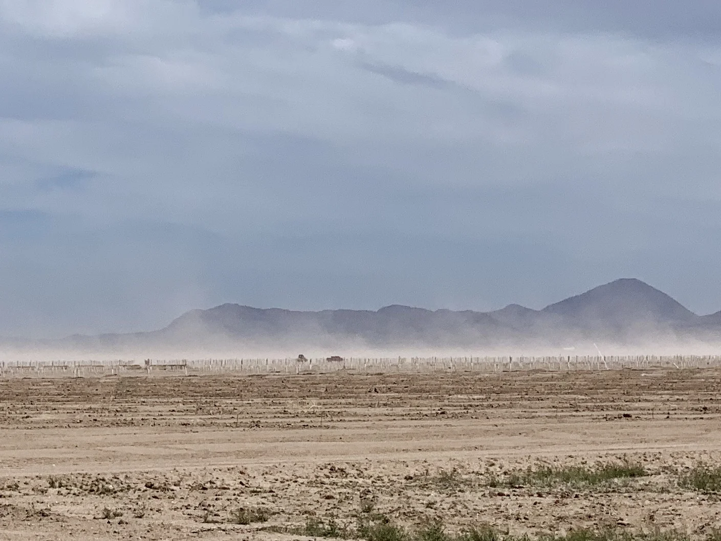
The wind stirs up dust on the way to Lordsburg.
I called my Dad in California, and my Mom in Illinois. I also called my kids. That might seem like a strange comment coming from a grown man in his 60's, But for those of you tracking older parents and grandkids, you'll recognize the behavior. I wanted to be certain my eastward direction under such conditions didn't make it difficult to get to either parent should the need arise. And I wanted to know if changing my itinerary and visiting my kids and grandkids a month or so later than previously planned would be ok.
I was improvising based on weather, just as humans have done for thousands of years. That is, before we insulated ourselves from it through our technology. Yet, our very attempts to tame it have only made it more foreboding. As the recent bomb cyclone in Nebraska - and the even more devastating cyclone in southeastern Africa - remind us, the weather will always humble us. We can't defy physics.
After discussions with various family members, I decided to return to Tucson where the weather was milder, and catch a train up to San Jose to my Dad's place. Right now I'm sitting in a lovely Landmarked train station in Tucson. I travel tonight on the Sunset Limited and will arrive into LA the morning in time to catch the Coast Starlight up to San Jose tomorrow. As usual, I will roll my bike up to the baggage car. For only $20 more a ticket there's no better way to get a bicycle somewhere (other than riding it, of course).
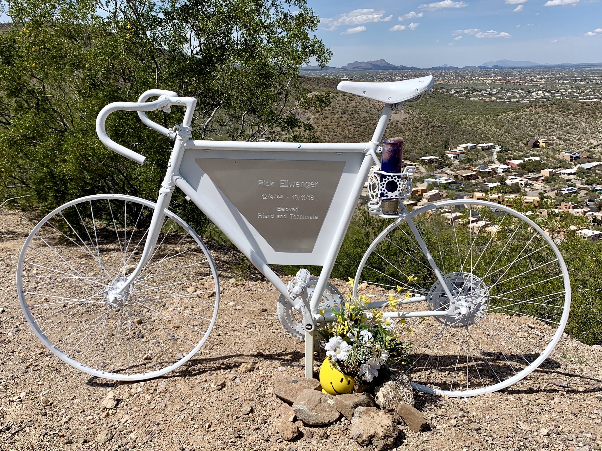
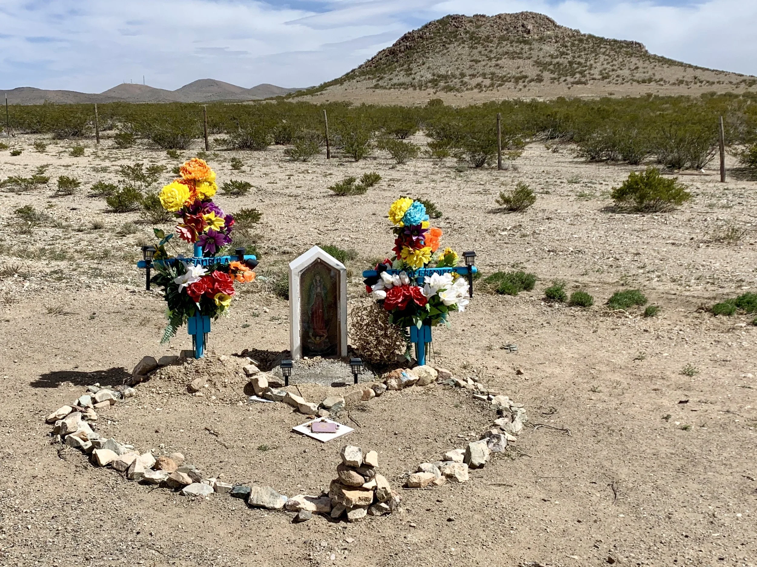
One of my intentions, for now, is to avoid an effigy in my honor. I came across this one on "A" Mountain east of Tucson.
Seen in western NM.
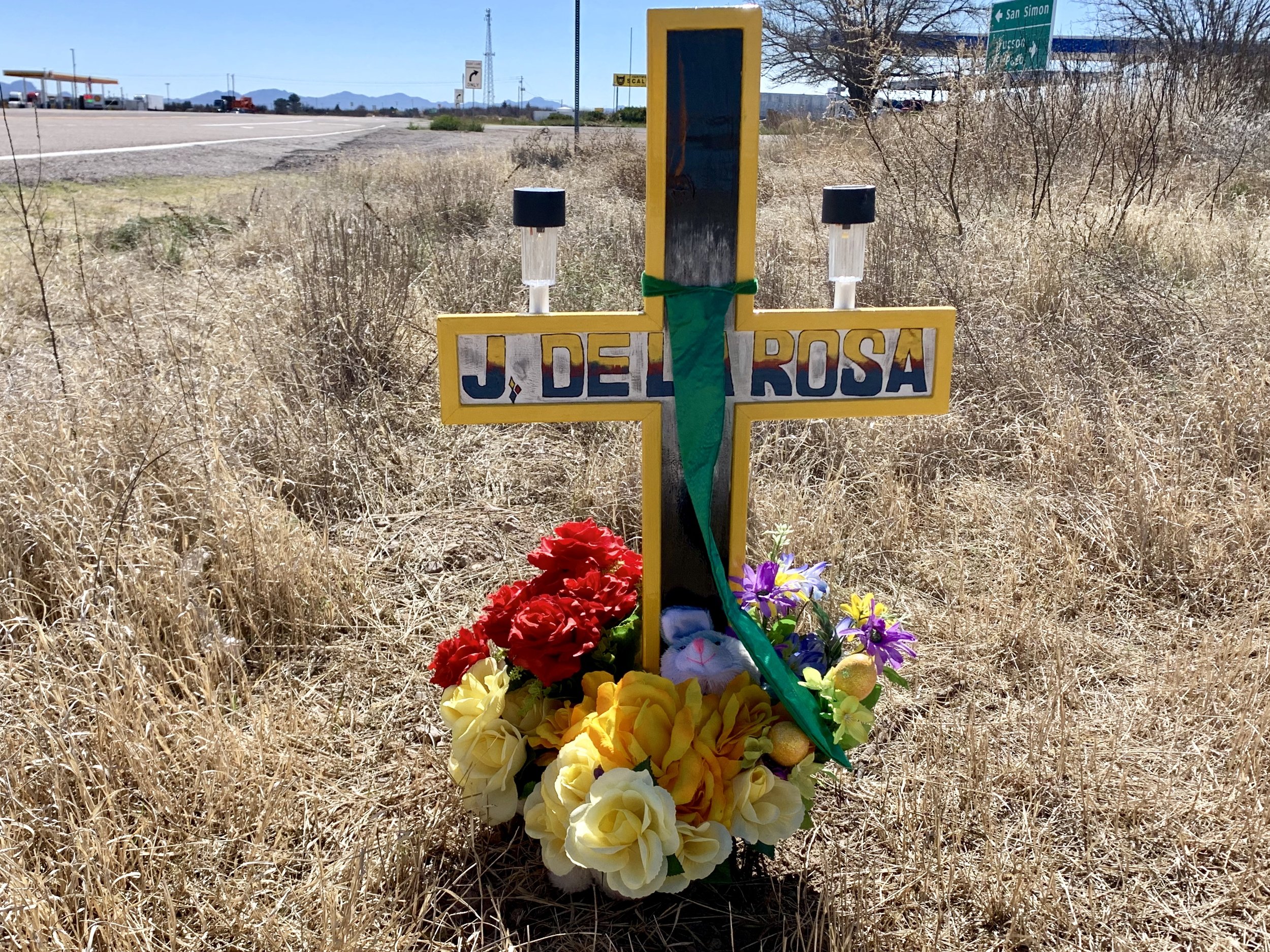
Seen in eastern Arizona.
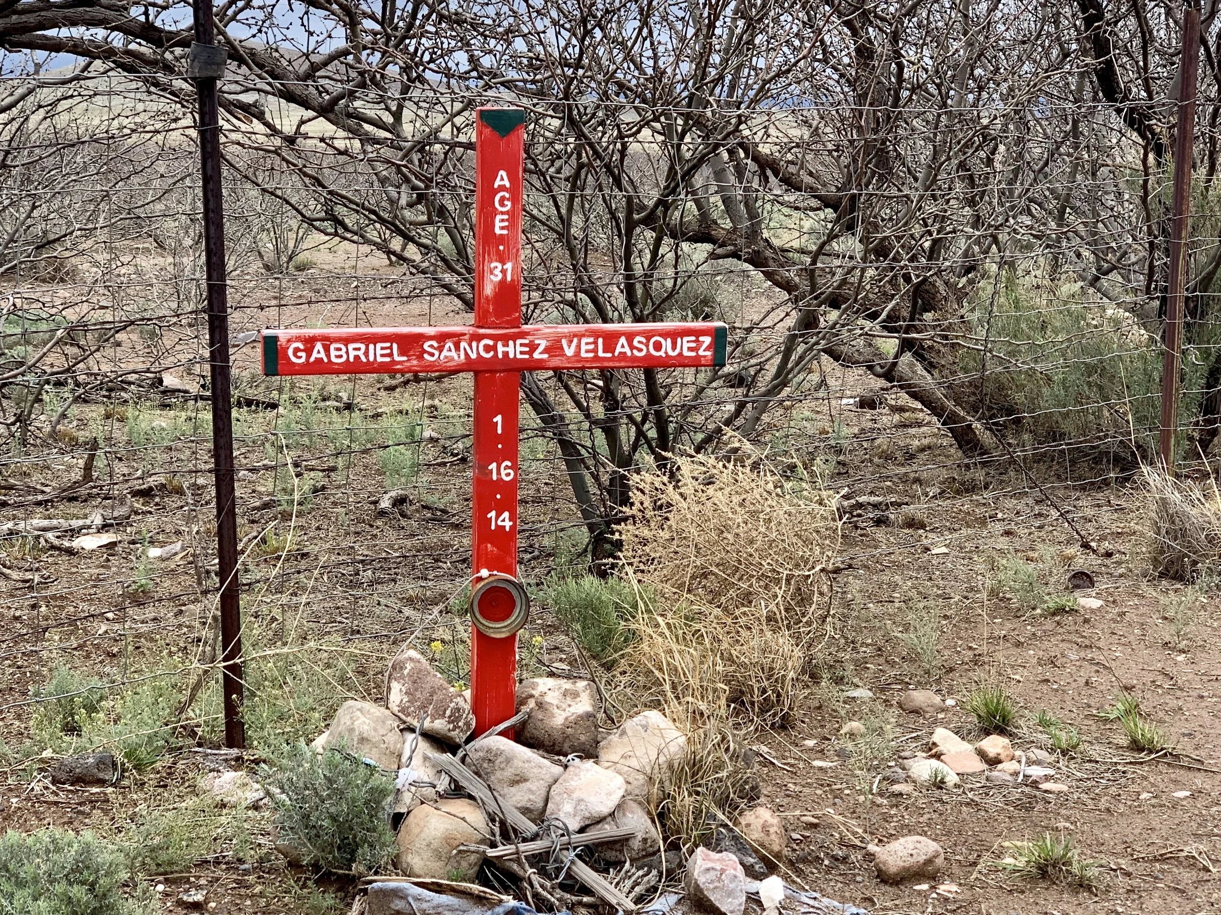
Seen near Douglas, AZ
The new plan made me breathe easier, and sleep a bit more deeply. That said, I'm sorry to have missed exploring route 9 and the towns of Columbus, NM, where Pancho Via "invaded" the US at the battle of Columbus in 1917, and Antelope Wells, NM - which I am told is a hot spot for Border Patrol action. I'll be back.
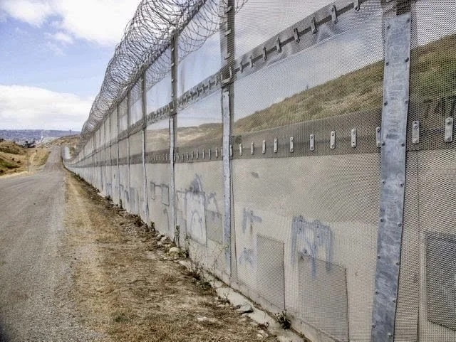
The border near Nogales, AZ. Photo credited to USA Today.
I can't say that I've seen much near the border that suggests we have a crisis of "invasion". Where I've been it seems quiet, "normal" and only subtly militarized. As per the pictures I've already posted, the fences are ugly and the concertina wire is threatening. I've been reading an interesting book titled "Storming the Wall; Climate Change, Migration and Homeland Security" by Todd Martin. If the numbers of illegal immigrants on our southern border are actually increasing (recent reports suggest that is true) they are mostly immigrants from Guatemala, El Salvadore and Honduras. And, according to Todd Martin, these countries are experiencing devastating drought, and are climate refugee "canaries in the mine" for what lies ahead.
Apparently, migrants from these countries turn themselves into Border Patrol at their soonest opportunity with the intention of applying for asylum. Most are farmers who are no longer able to survive on their land. If they flee to nearby cities, they and their families are subject to horrific gang violence. So they come north, hoping they can gain asylum in the United States. If there is a crisis, it's a humanitarian one, and one that a wall might even exacerbate. Here's an article in "Scientific American" that explains the underlying issue more deeply.
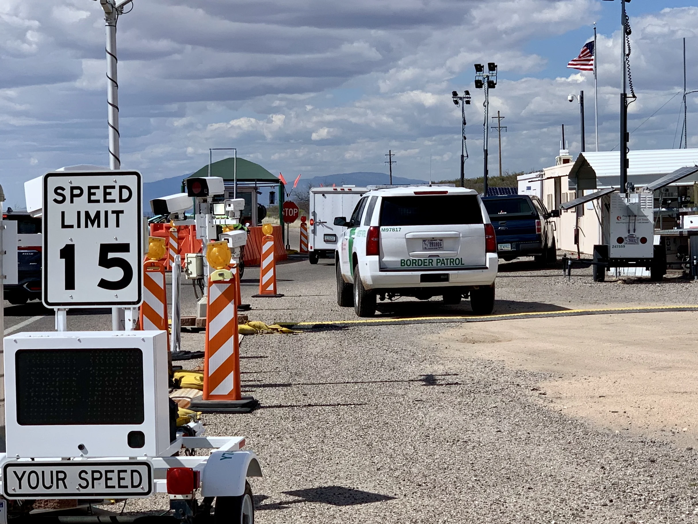
One of hundreds of checkpoints on a north/south road just south of Interstate 10. They are intended to keep migrants from gaining access to our interstate system. I've passed through several. Each time I've asked the agents if it was busy that day, and each time the answer was no.
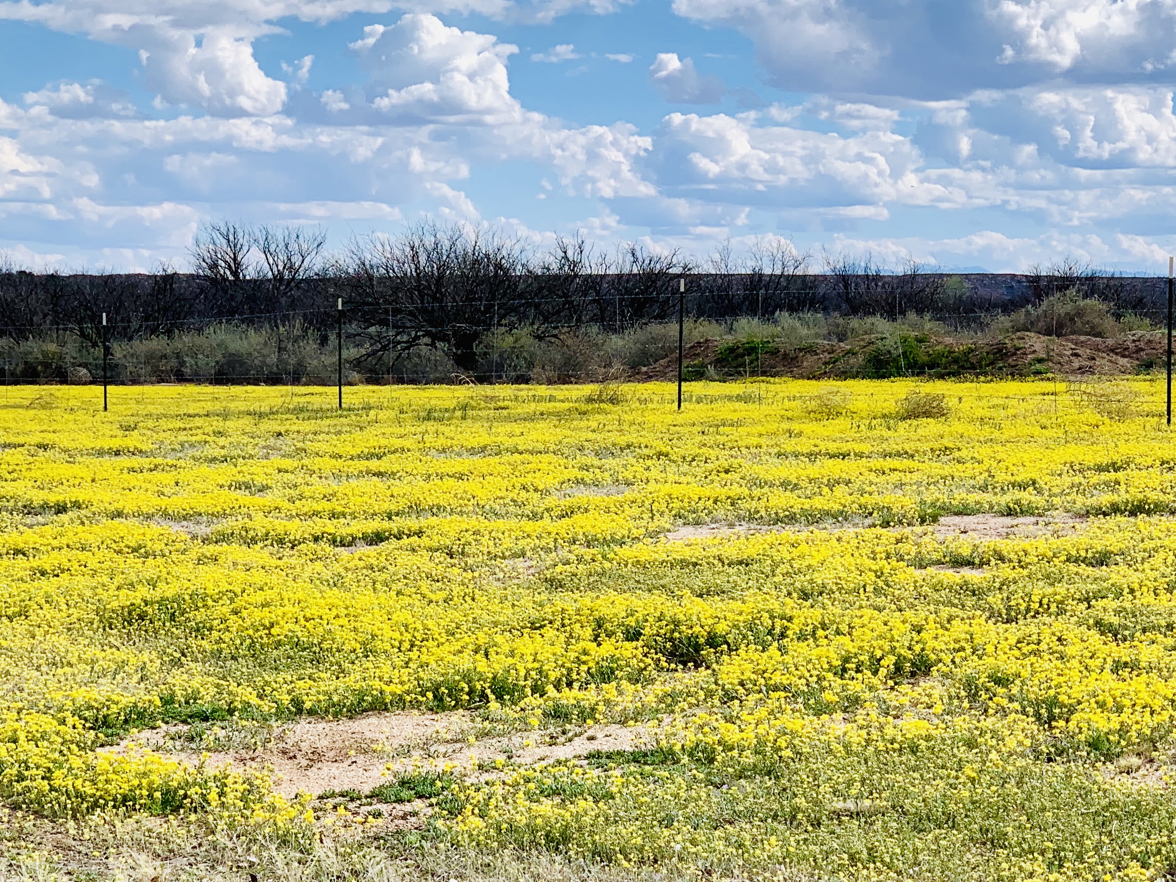
Fields of daisies are common here this time of year.
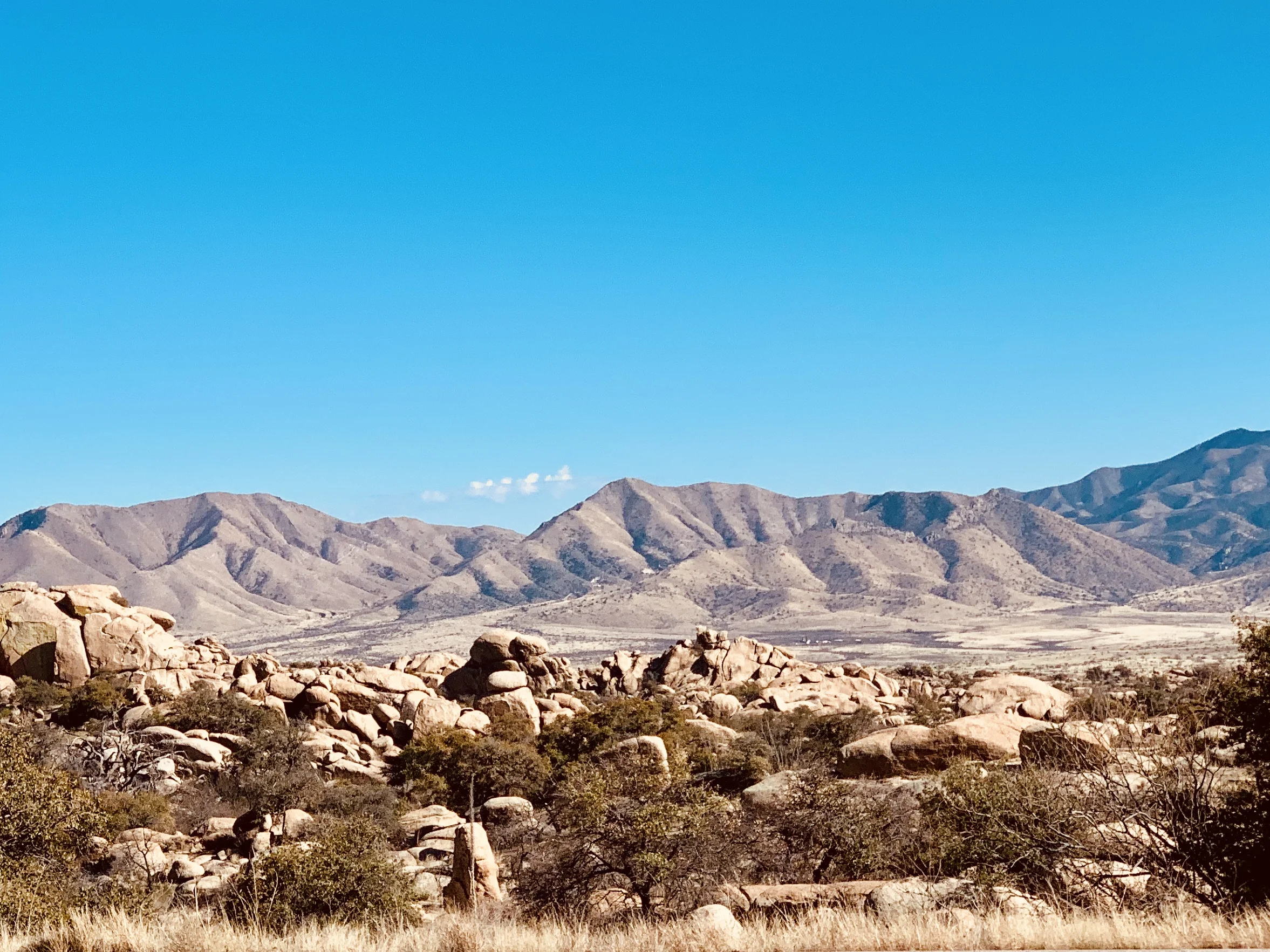
A view to the south about 50 miles east of Tucson.
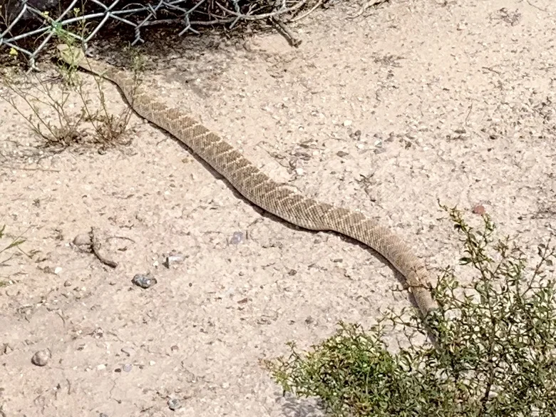
A rattlesnake seen on a bike trail near Tucson. As it gets hotter, they get more active.
Next week I fly back to New York. It will be another month or so before I start my next cycling adventure, so you'll notice a lag in my blog posts. But, as always, there's more to come.
All photos, unless credited or otherwise noted, are copyrighted property of the blog post author.
Palo Alto to Tucson, Post 2
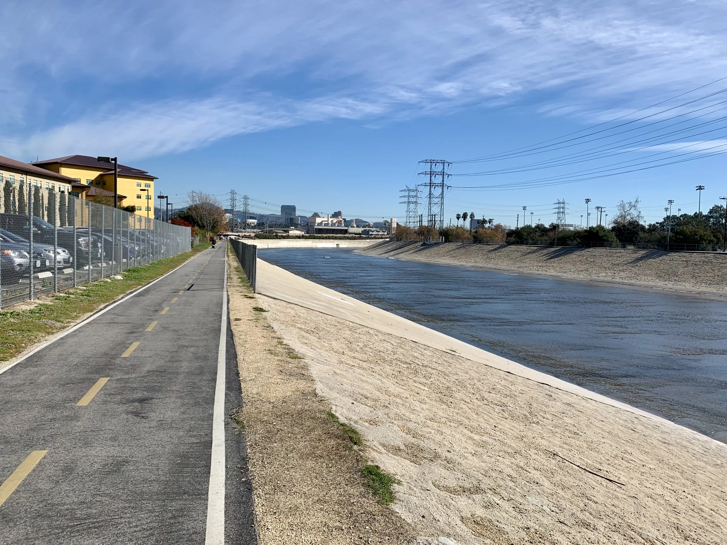
The Los Angeles River Cycleway.
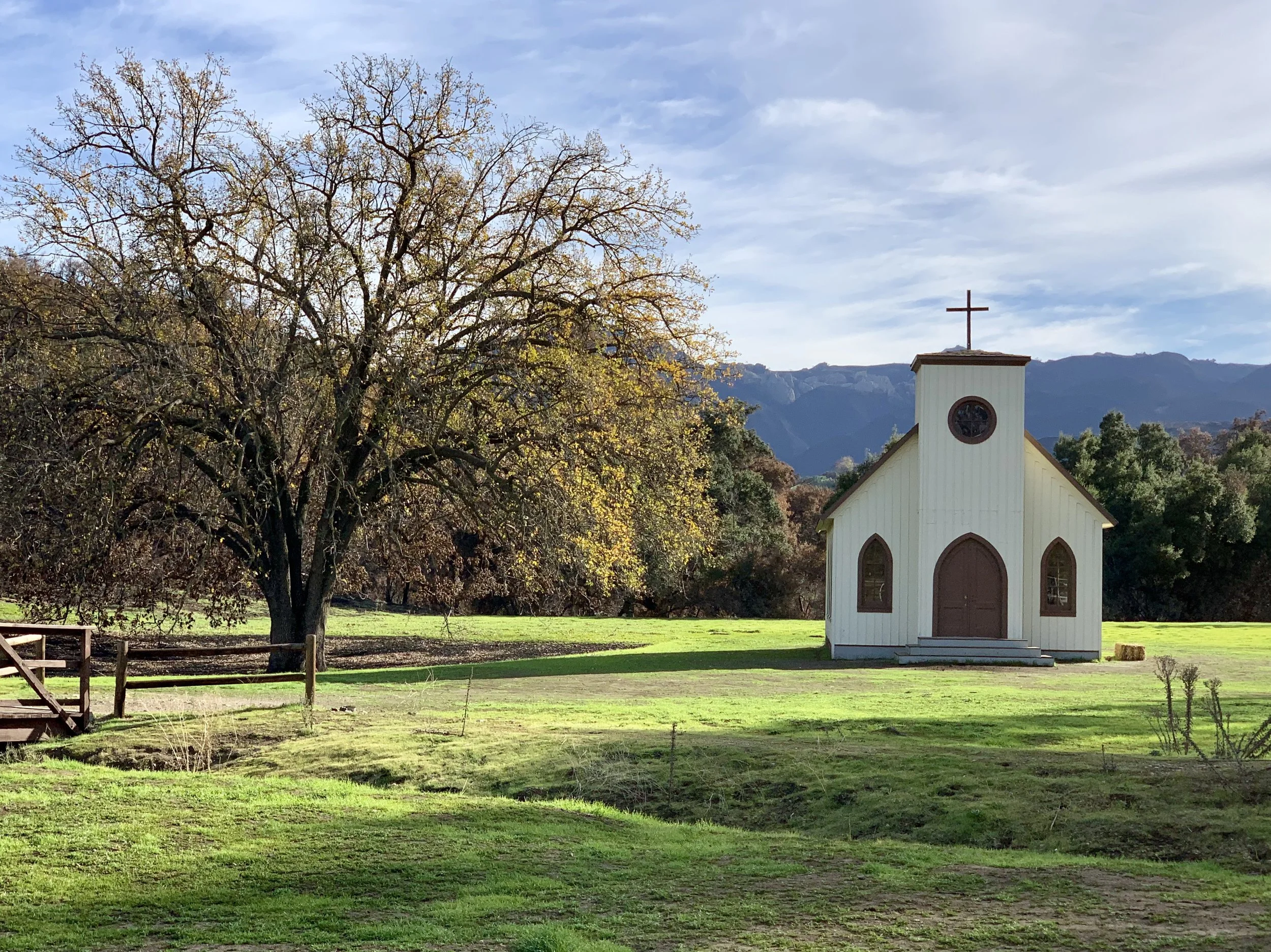
Once I got to Ventura from Santa Barbara, I called my old childhood friend Debra Dralle in Woodland Hills in north LA. I was in luck. I had stayed with Debra on my GRID trip two years back, so she and her husband Richard weren't surprised to see me arrive the next day on a fully loaded bike. Getting to Woodland Hills from Ventura presented a small challenge - such as the Santa Monica Mountains. It was raining, and I was challenged by the climbing, so I didn't notice the clues I was passing through the Woolsey Fire area. Fast moving and capricious, that fire was one of many that has turned life on its head. Much has been written about the intensifying and record breaking fire seasons in the American and Canadians wests. Here's one example. Of course, climate scientists tell us this is only the beginning. Record droughts, warmer temperatures, longer fire seasons, and encroaching development are the new normal, which isn't going to be normal at all. There's no normalizing the future when it comes to climate.
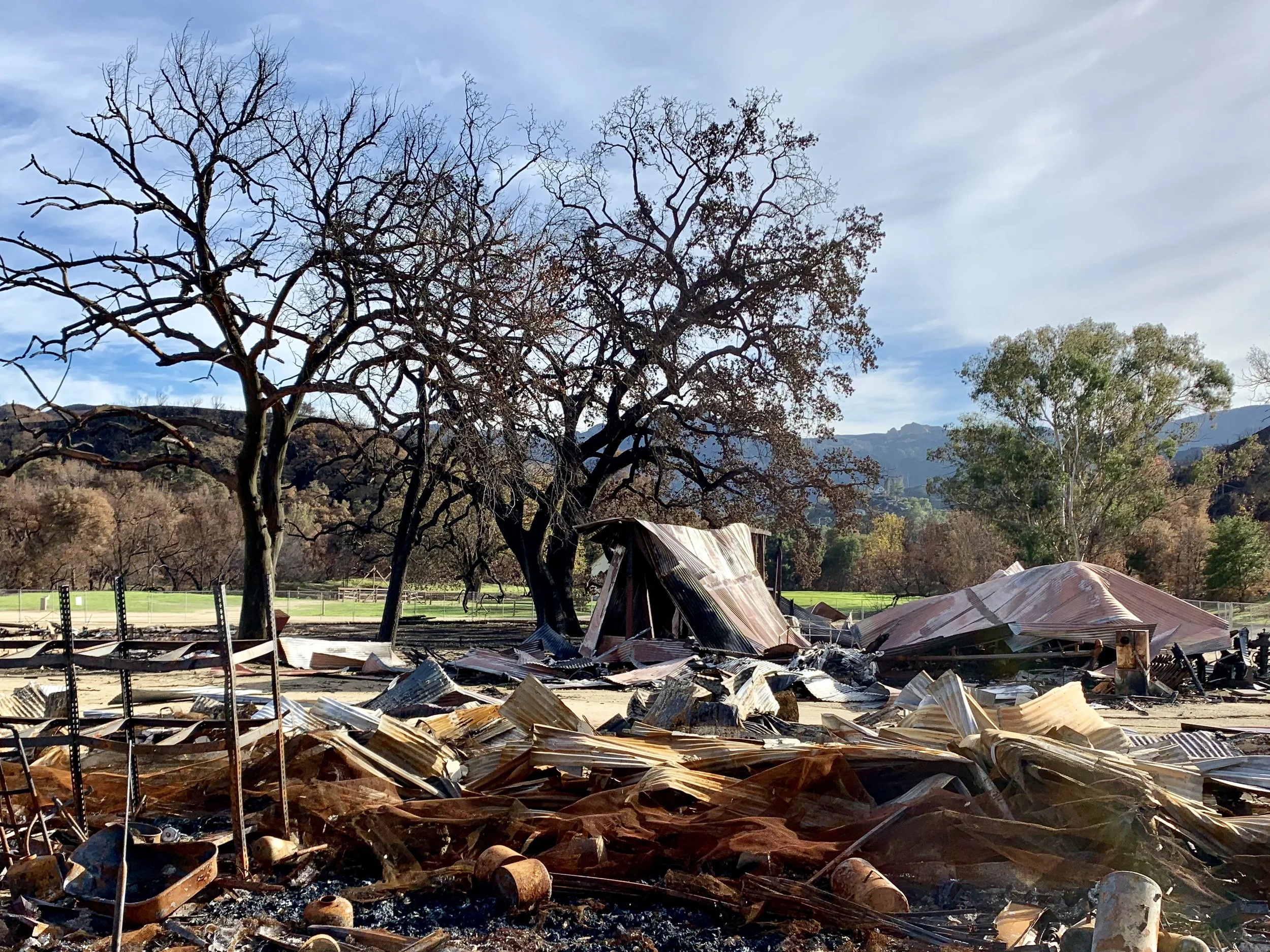
A saloon and hotel?
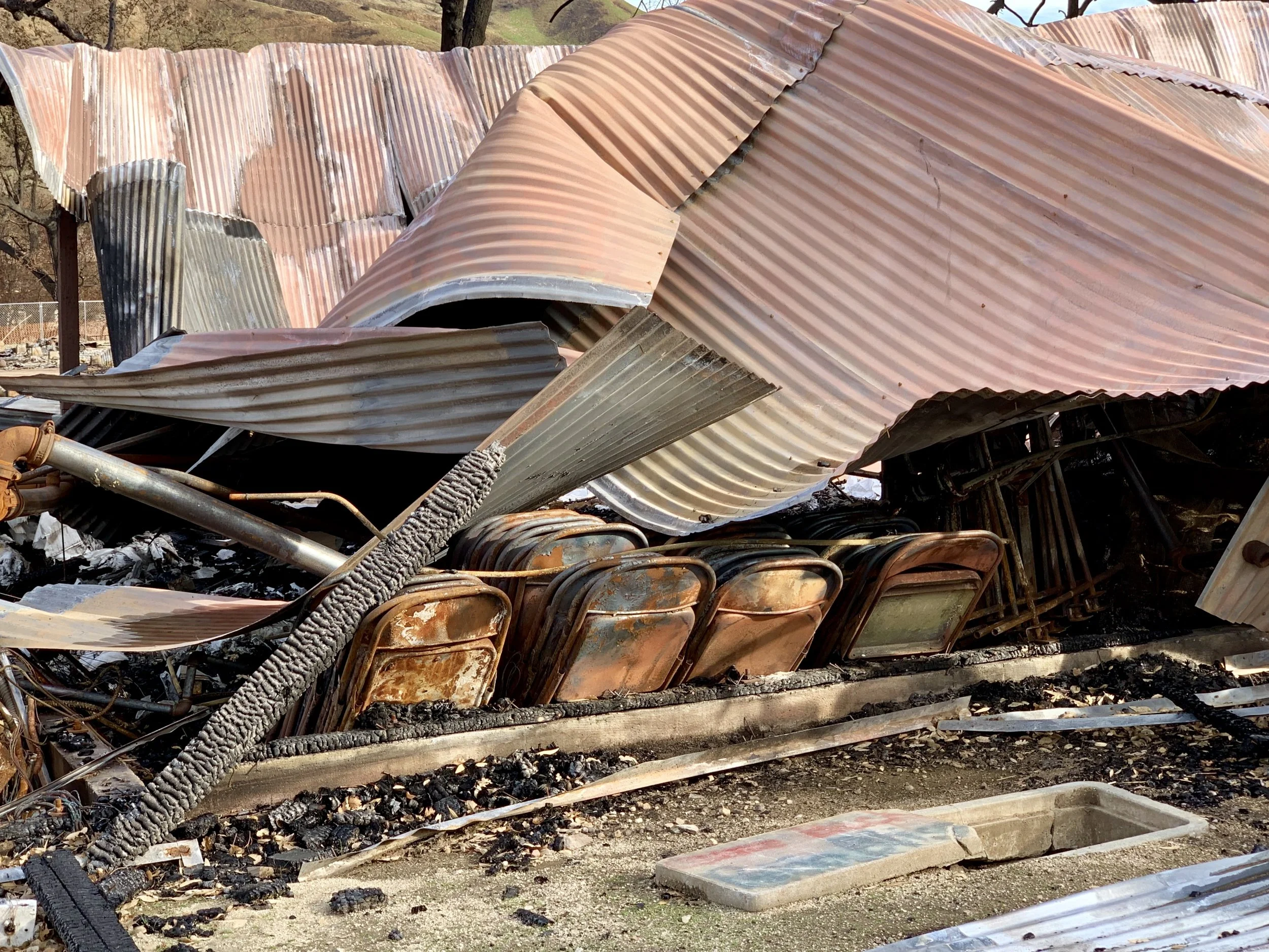
A storage room?
Fortunately, I had a chance to rectify my poor observations the next day when Debra drove me back to the Paramount Ranch, which - sadly - had burned to the ground in November of 2018. As we drove, I asked Debra if she knew of climate deniers living in the area. She said no; in fact, her view is that southern Californians are united around climate change - the fires of the past several years have diminished any doubts.
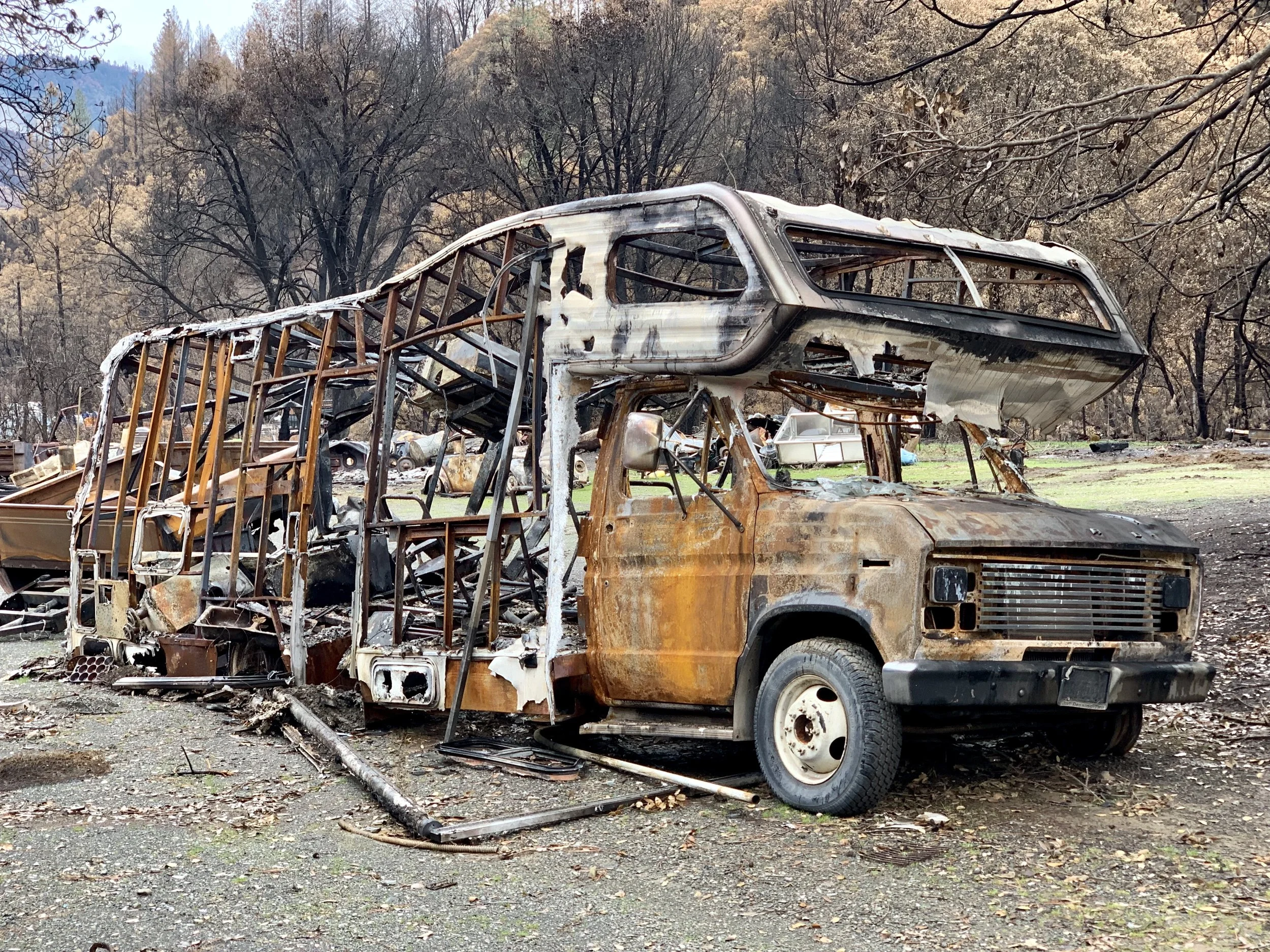
A large burnt out camper van sits by a highway near Delta, Ca. The Woolsey and the Delta fires took place in September and November, 2018, respectively.
Today I read a comment by Tom Di Liberto, a scientist who worked on a well publicized Ocean Warming Report. He was quoted as having said that he thought we wouldn't reduce GHG emissions meaningfully until 2040. His comment made me wonder.
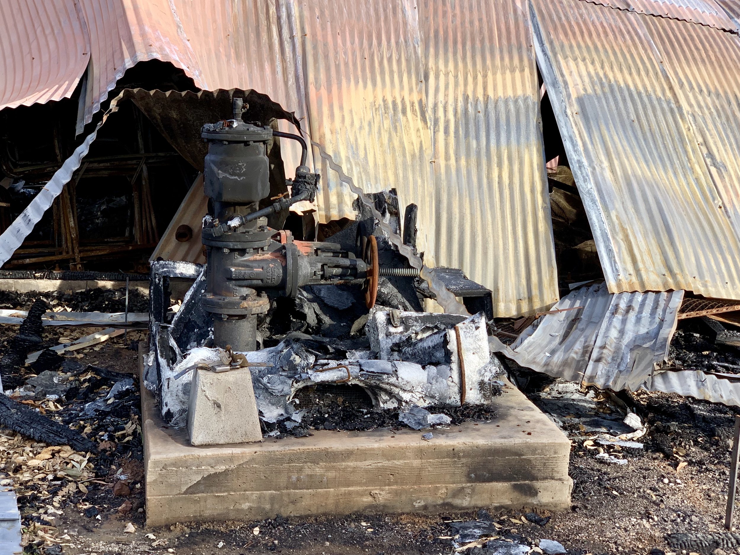
A water pump?
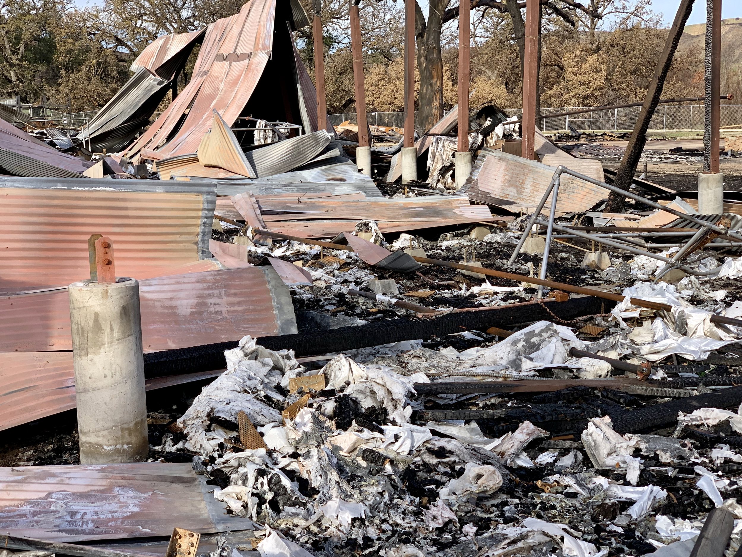
More debris.
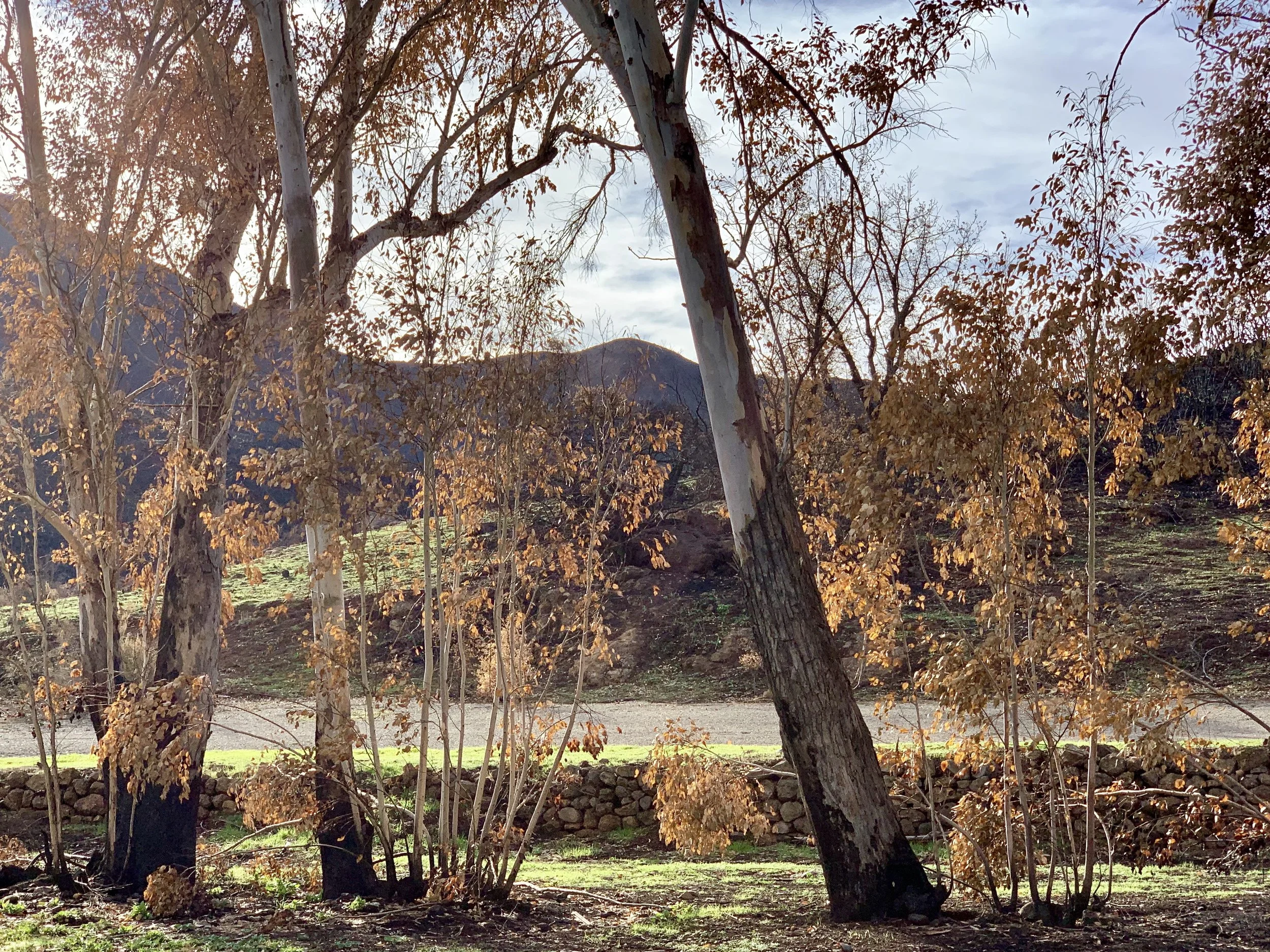
There's something beautiful about a fire area in recovery. Only 3 months after the fire, a hillside in the Santa Monica Mountains near Paramount Ranch makes a comeback.
What will our "pain point" be? Because climate change is as real as the sun, the shoe will drop on climate denial at some point, and we will finally unite in our understanding of what we are up against. But how many people will die first, how much degradation will we endure, how crippled will our economy have to become? Hopefully sooner, rather than later, Americans will say, "enough is enough", and put their shoulders to the wheel of change in a serious way, joining the many other countries attempting to transition their own economies. Some days that seems a long way off - especially as I cycle through the desert near the Salton Sea in January. But there's nowhere to hide. Check this out.
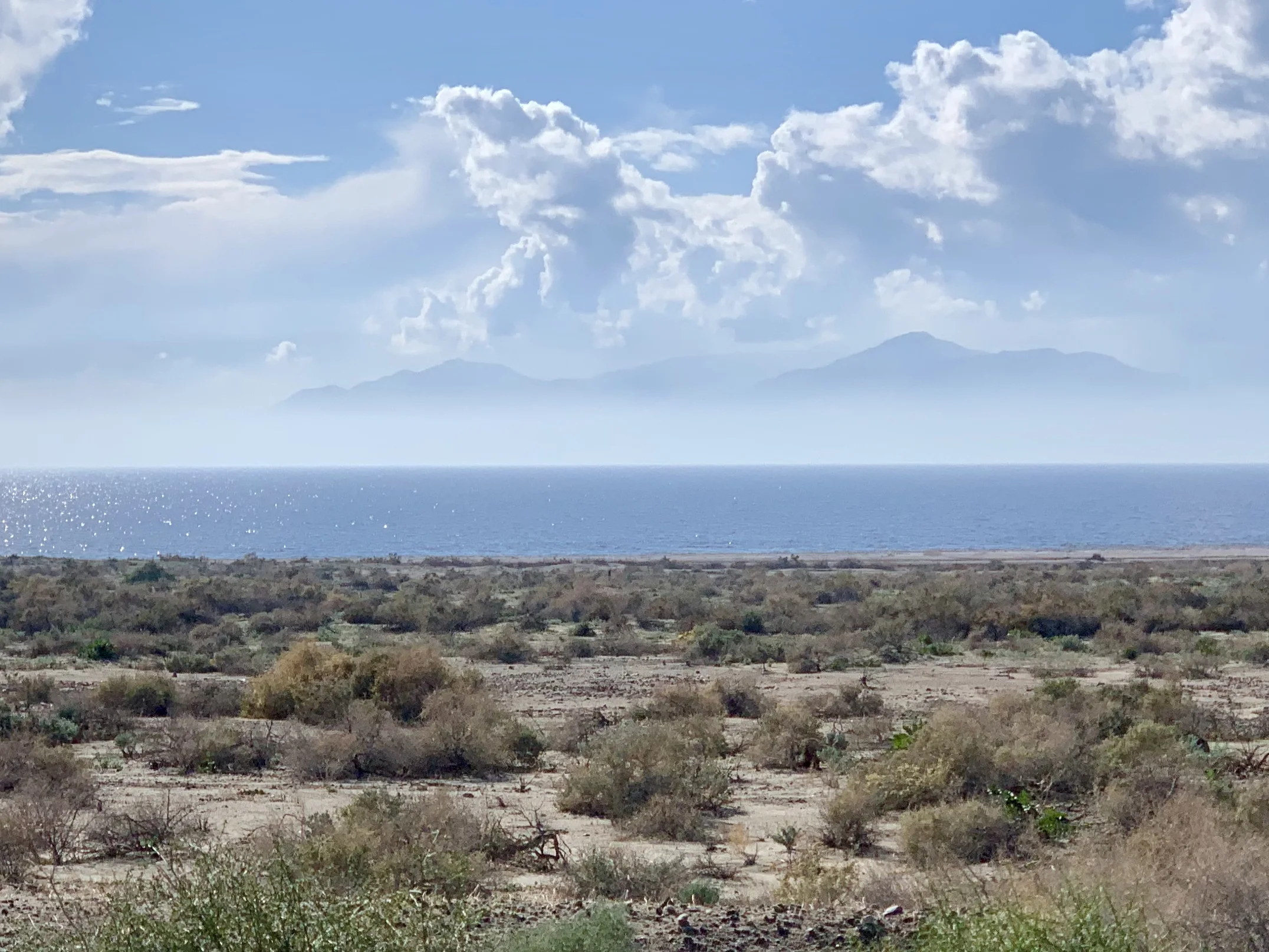
The northern and eastern shore of the Salton Sea is remarkably empty. The first 20 miles of the coast from the north shore are protected by at least three county parks. I was surprised and delighted to see this.
Some days there is progress. I've written in many previous posts about the Citizens Climate Lobby, but I have not yet mentioned that CCL has helped two carbon dividend bills become introduced in Congress. Here is the House Bill, and here is the Senate Bill. Please check them out. If you find these thoughtful bipartisan climate bills hopeful, let your Representative and Senator know you support them. We know that politicians respond to popular will, so we must make it clear to policy makers that we expect them to be effective leaders on climate.
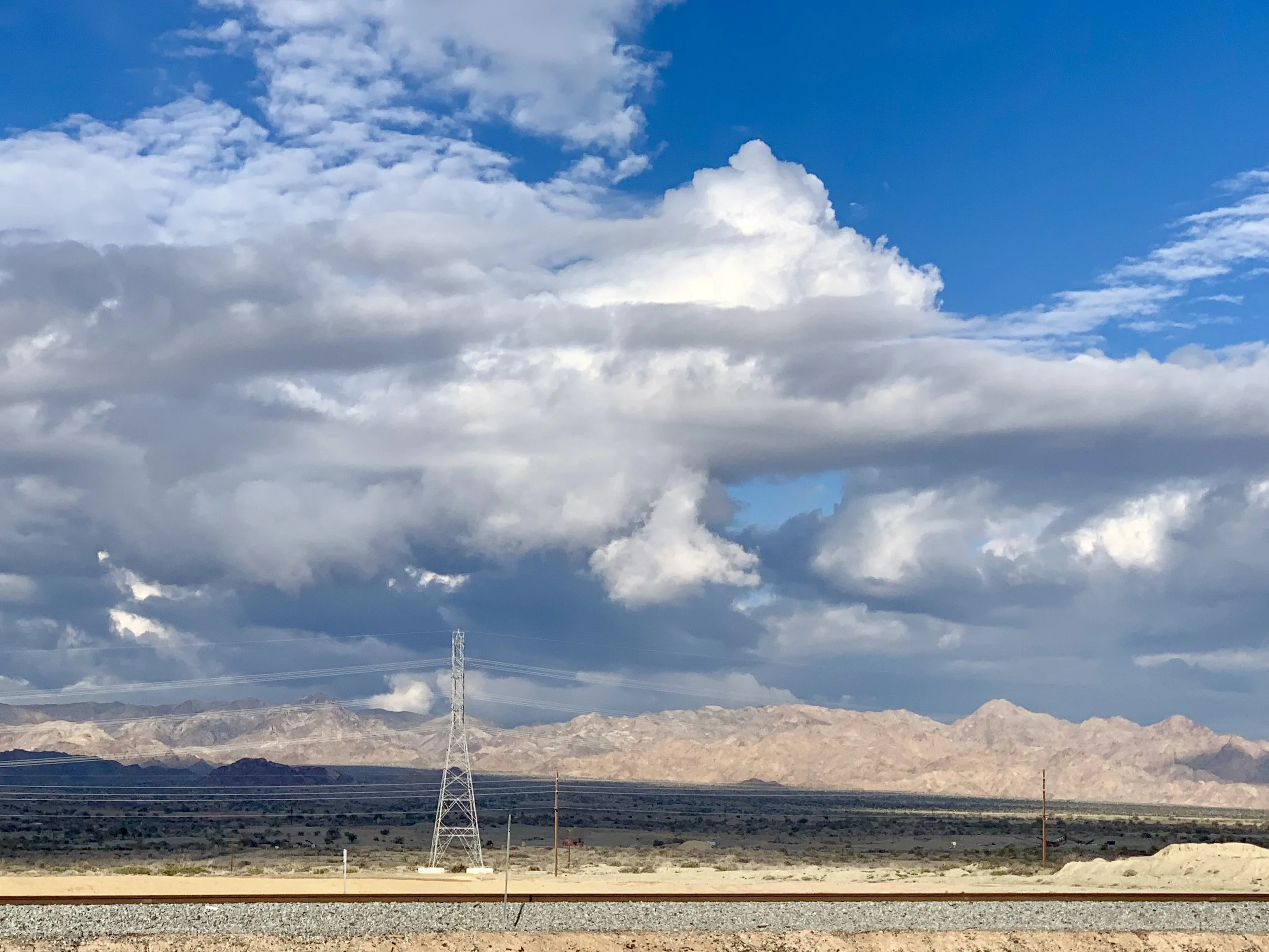
Looking east away from the Salton Sea toward Joshua Tree National Park. Someone told me that Joshua Tree poachers were in the Park because of limited staff during the government shutdown. If that's true, it's heartbreaking.
This is no small task, as we all know. The world's largest economy (ours) is dominated by policies favoring corporate interests and rich corporate-bought climate deniers who are outside mainstream thought, and insulated from extreme climate events. Imagine what this must feel like in smaller countries.
I have some adventurer friends, Ken and Fi Morton, who wrote the following in an email to me:
"Interestingly, we are in Ecuador right now where everyone acknowledges climate change as an obvious event, and not a divisive partisan issue, where private industry and gov't are investing in "clean" infrastructure like solar, and electric/LPG public transport. Also, sadly, is the realization that it, like most developing countries, they are powerless to slow or curb global climate change, as despite all efforts, the world's biggest economies will dictate how climate change plays out... which doesn't give one cause for optimism, currently."
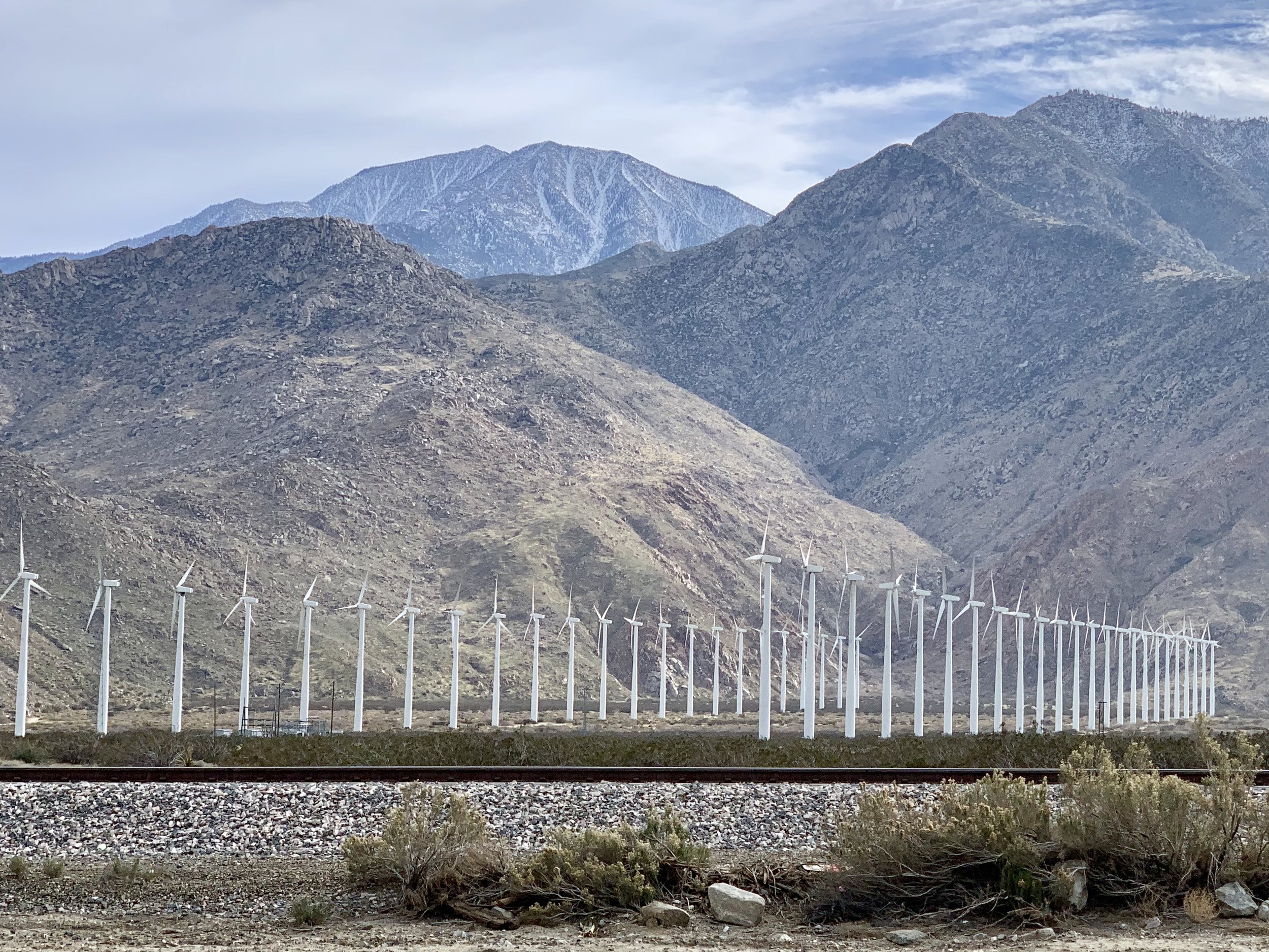
The pass from Banning to Palm Springs is quite windy and there are hundreds of wind turbines along the way. They can be attractive, and far less noisy than traditional oil wells.
There's so much to do. And I think the most important thing of all is not to capitulate to dispair or cynicism, no matter how large the obstacles seem. We've proved the resiliency of our species over and over. Yes, we may be entering the greatest challenge we've ever faced, because none before now has required no less than global economic transformation. Clearly this is no time for "me first, or us first" policies. Let's screw our collective heads back on straight and meet this historical moment with clarity and resolve.
For those of you who like the Garmin maps, here are the past four days of riding:
More to come.
All photos, unless credited or otherwise noted, are copyrighted property of the blog post author.